

How do we organize a community around the landscape, mobility networks and the public realm?
The Bluffs
Framework Plan
Westbank First Nation
2023 - 2025
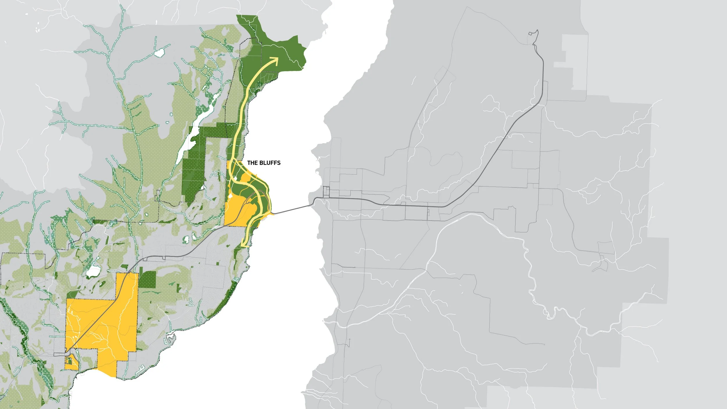
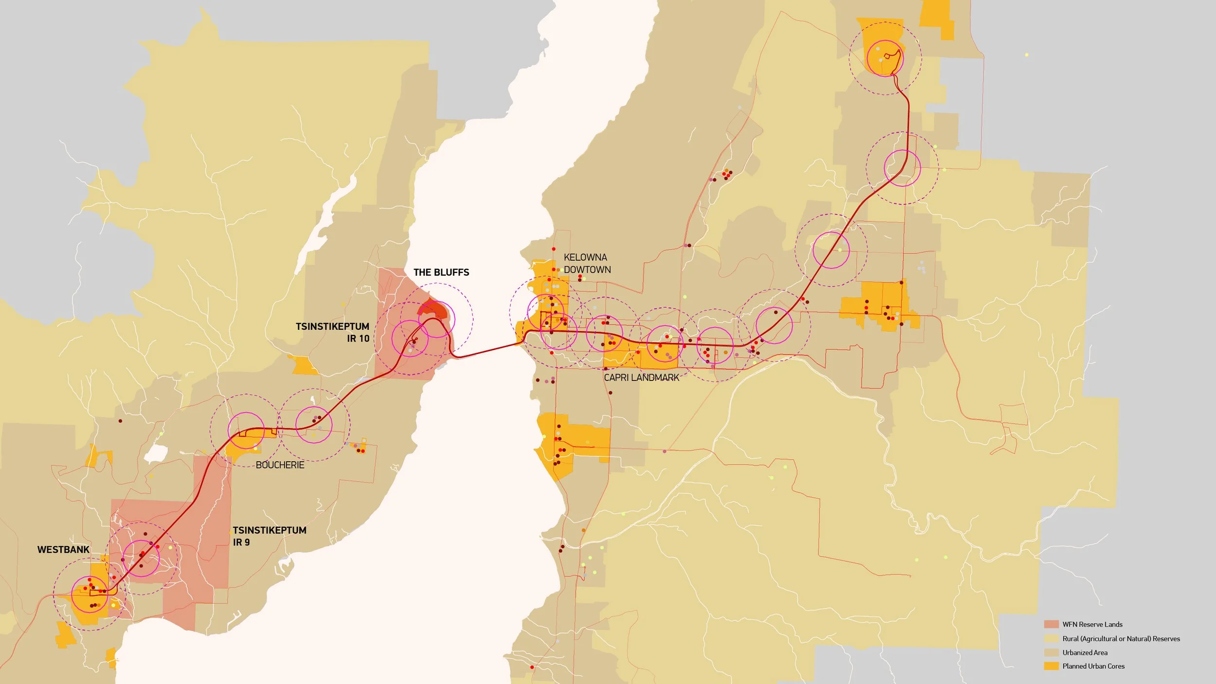
JIM is leading the design of a 16-ha development in Westbank First Nation and planning a larger 24-ha Neighbourhood Plan area called “The Bluffs”. By reframing a previous plan submission, JIM structured the project around a strong, sustainable agenda tied to the WDN Comprehensive Community Plan (CCP). JIM expanded the scope to provide more public park space, create ecological corridors across WFN lands, and address significant mobility issues. A proposed lakeside park restores natural wetlands around the lake, 85% of which has been lost in the Okanagan Valley. Working with MoTI and BC Transit, JIM introduced rapid public transit connections to Highway 97, the first of its kind in the region. Lastly, the team began investigating district energy opportunities that would serve the Bluffs and future developments in the area.
The Bluffs Performance Framework emphasizes multi-scalar interests and planning principles.
Building for the Future
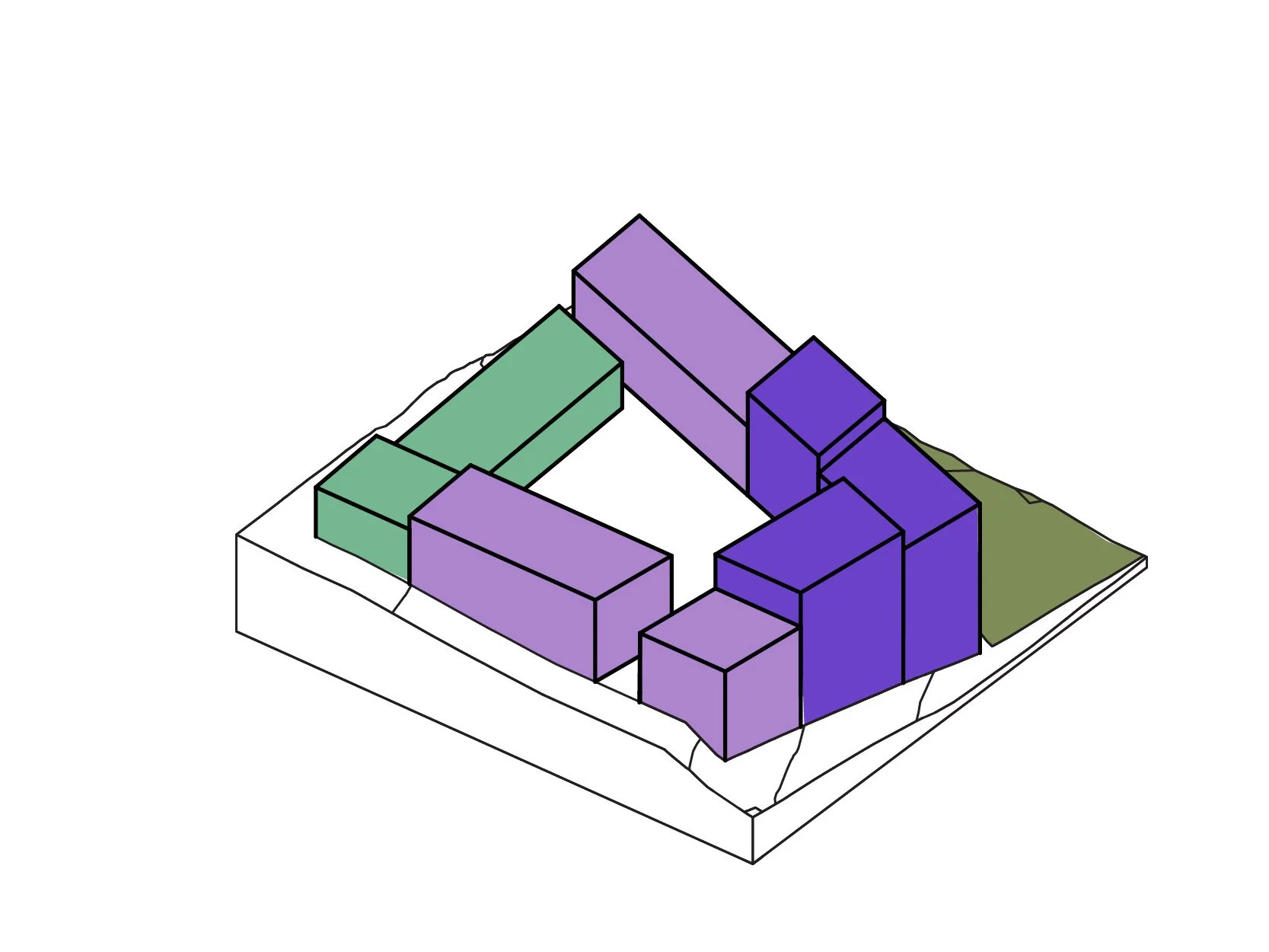
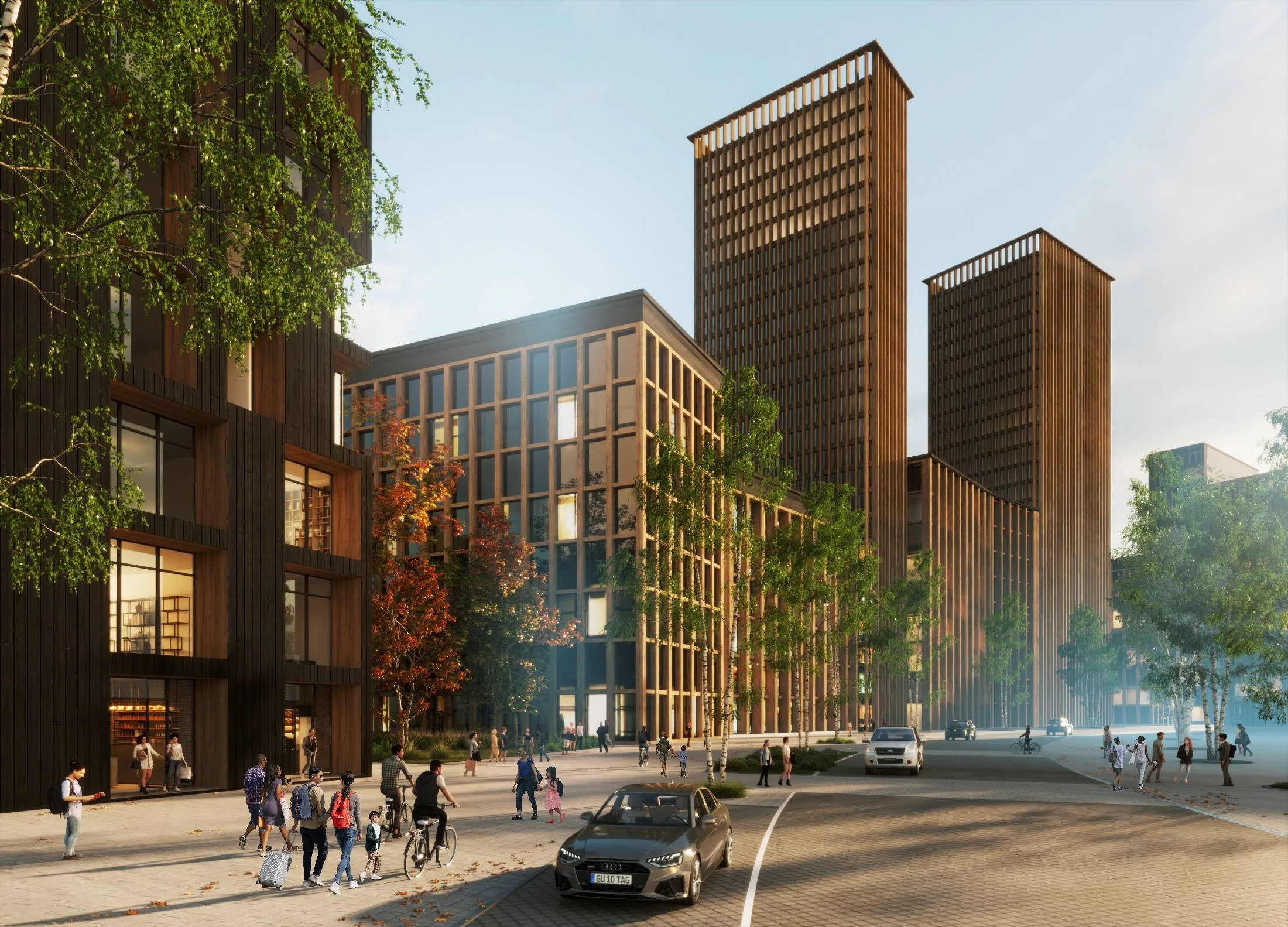
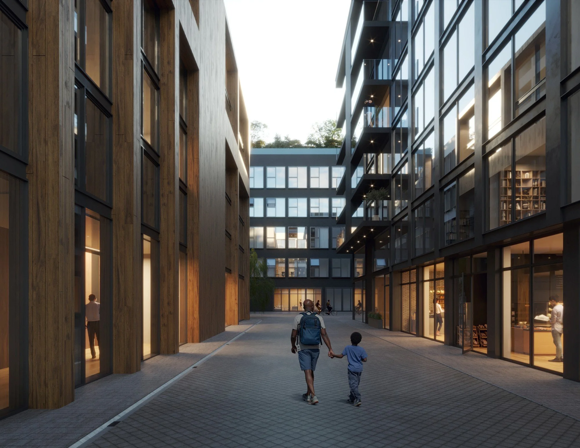
These infrastructural components support a creative retail and housing program with over 4,700 dwelling units in the development area alone. A housing mix of affordable and market-rate units with various tenure types would be further supported by amenities, including a market hall, mobility hubs, a recreation centre, and at least three childcare facilities. The housing itself, guided by the Design Standards, challenges the perception of high-density living by elevating quality through loose-fitting typologies, point-access cores, dual-aspect apartments, and ground-oriented units that take advantage of the steeply sloping topography. The planning process is still underway, with Member engagement ongoing and continuing into the fall. The intent is to complete the project in four phases by 2045.
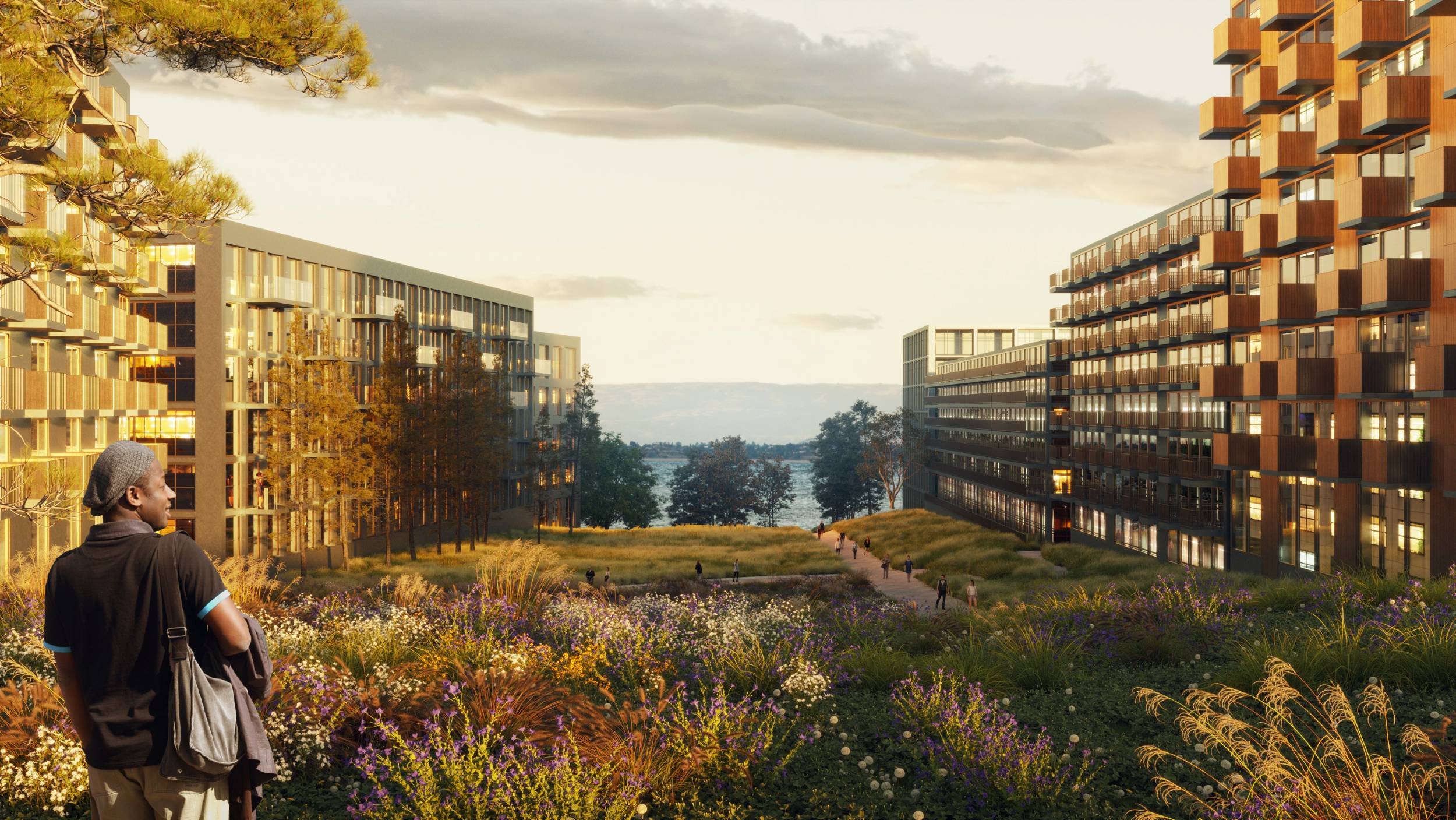
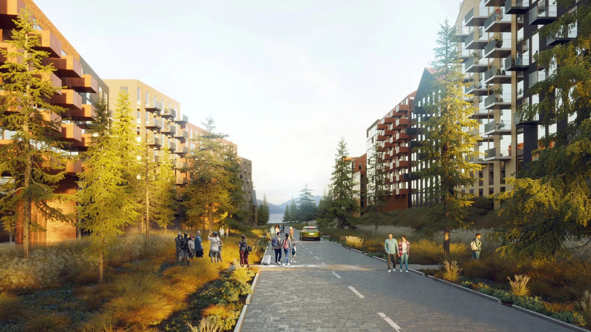
The Bluffs offers authentic Okanagan landscapes in managed urban settings.
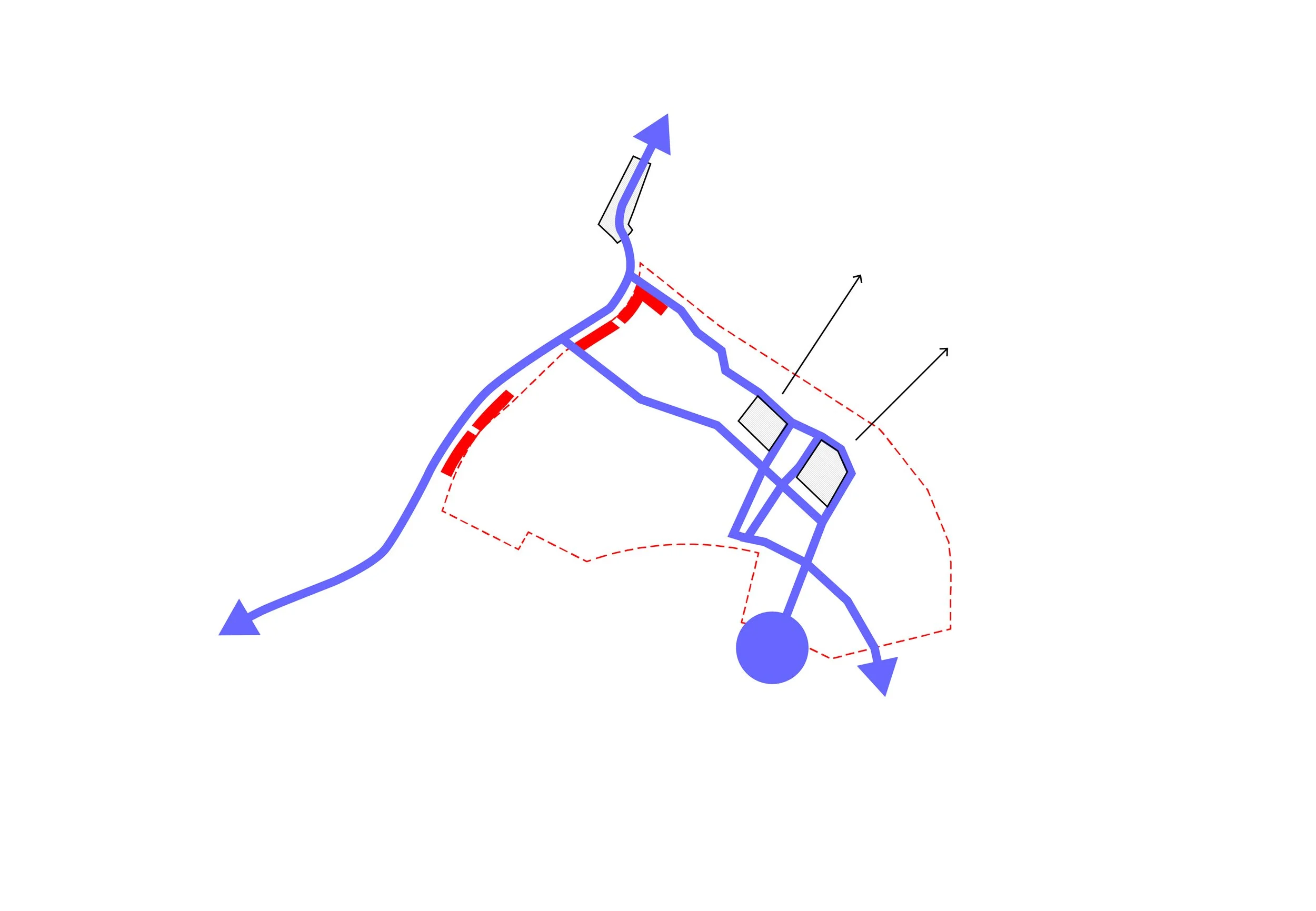
Regional Green Network
Regional Transportation Network
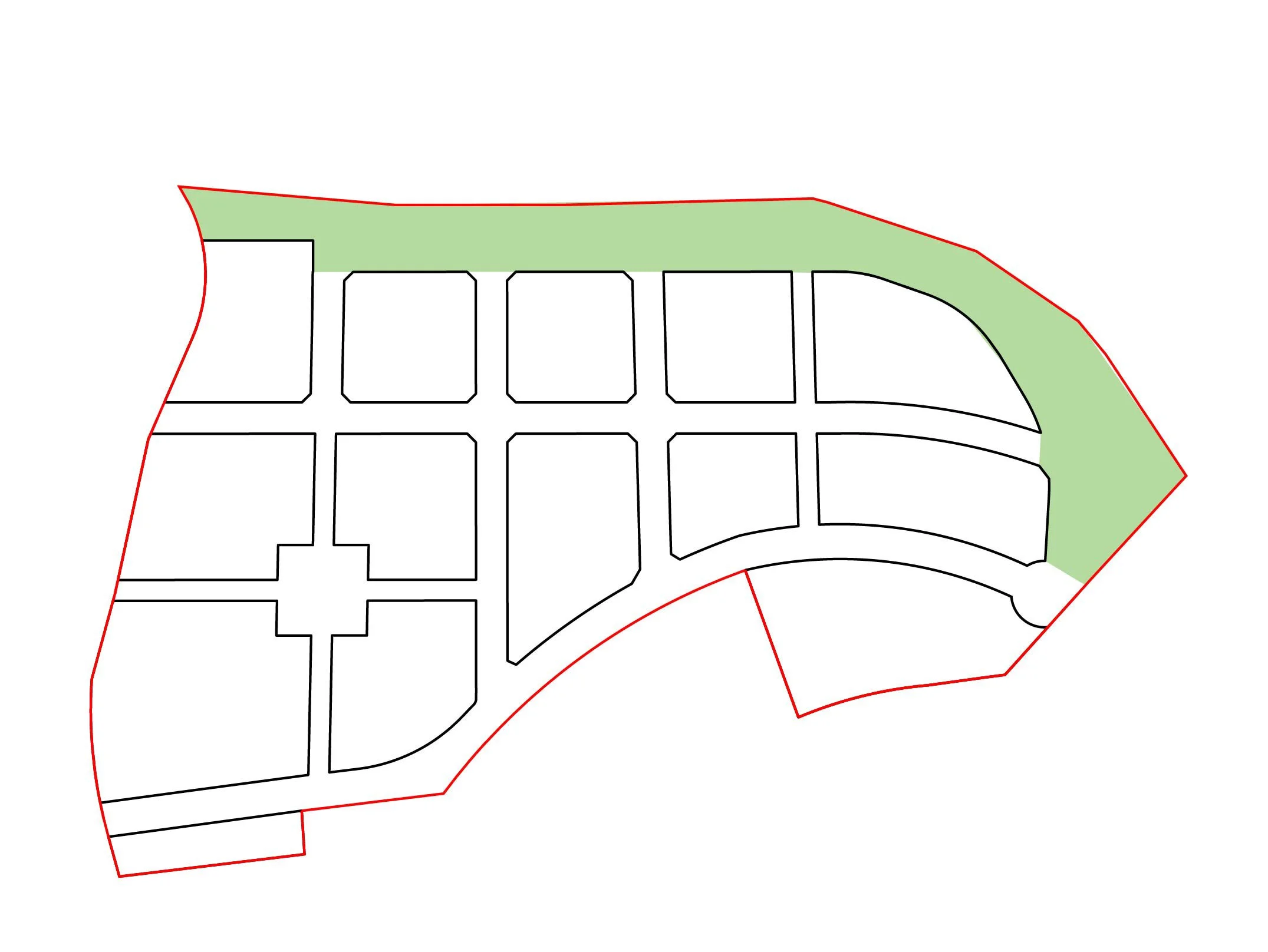
Base land plan
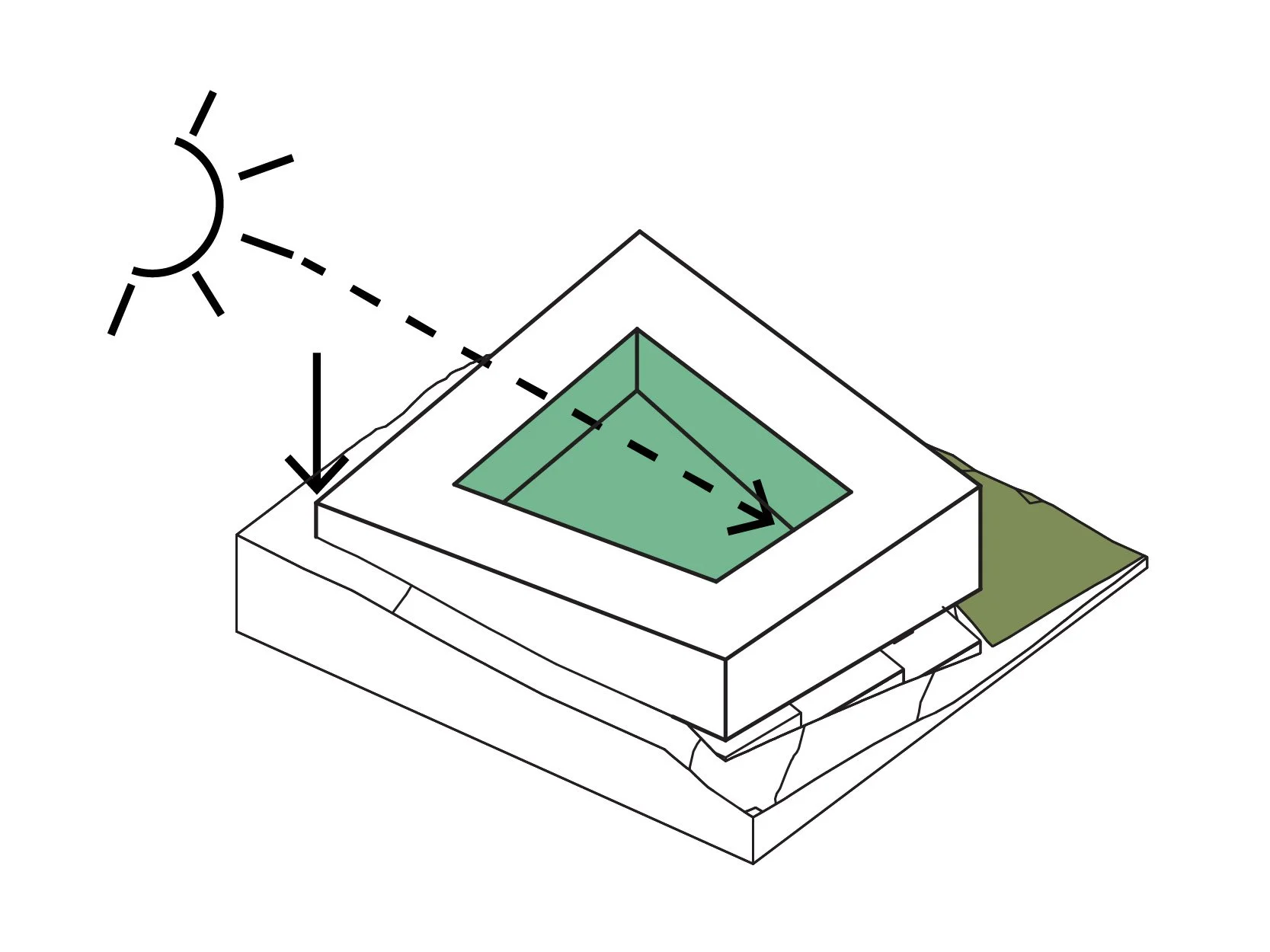
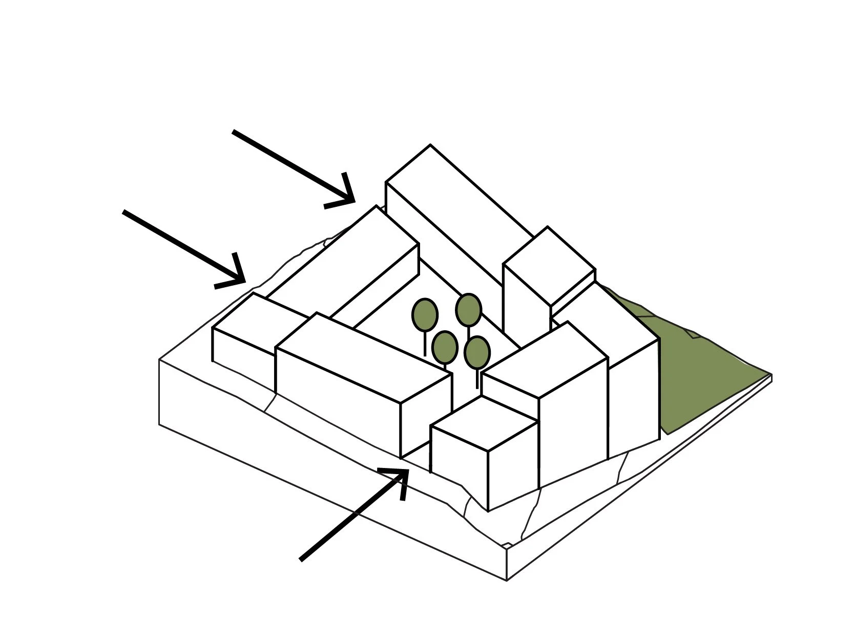
Prioritize views and experience
Shape new landscape and windows
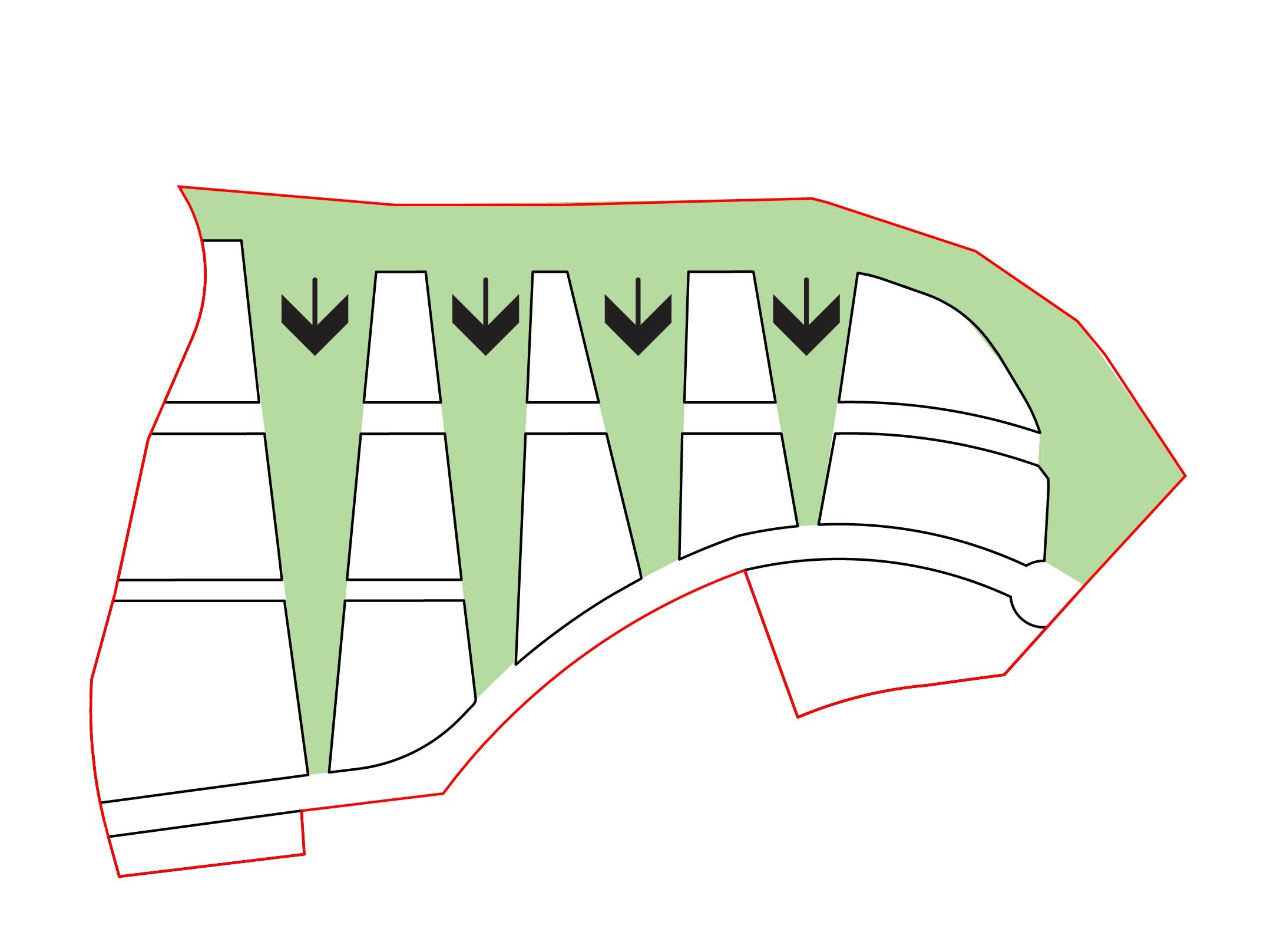
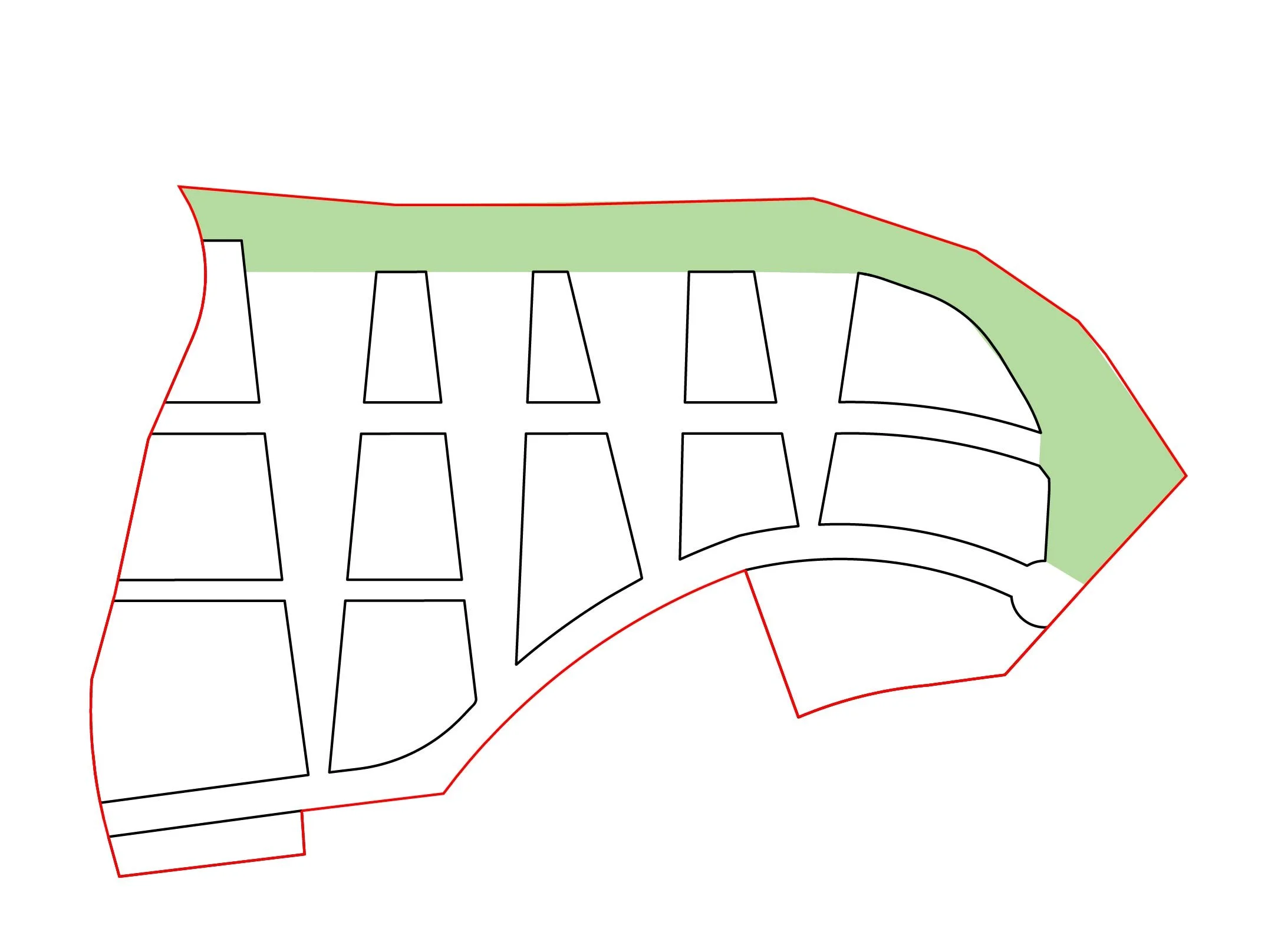
Enhance ecological links
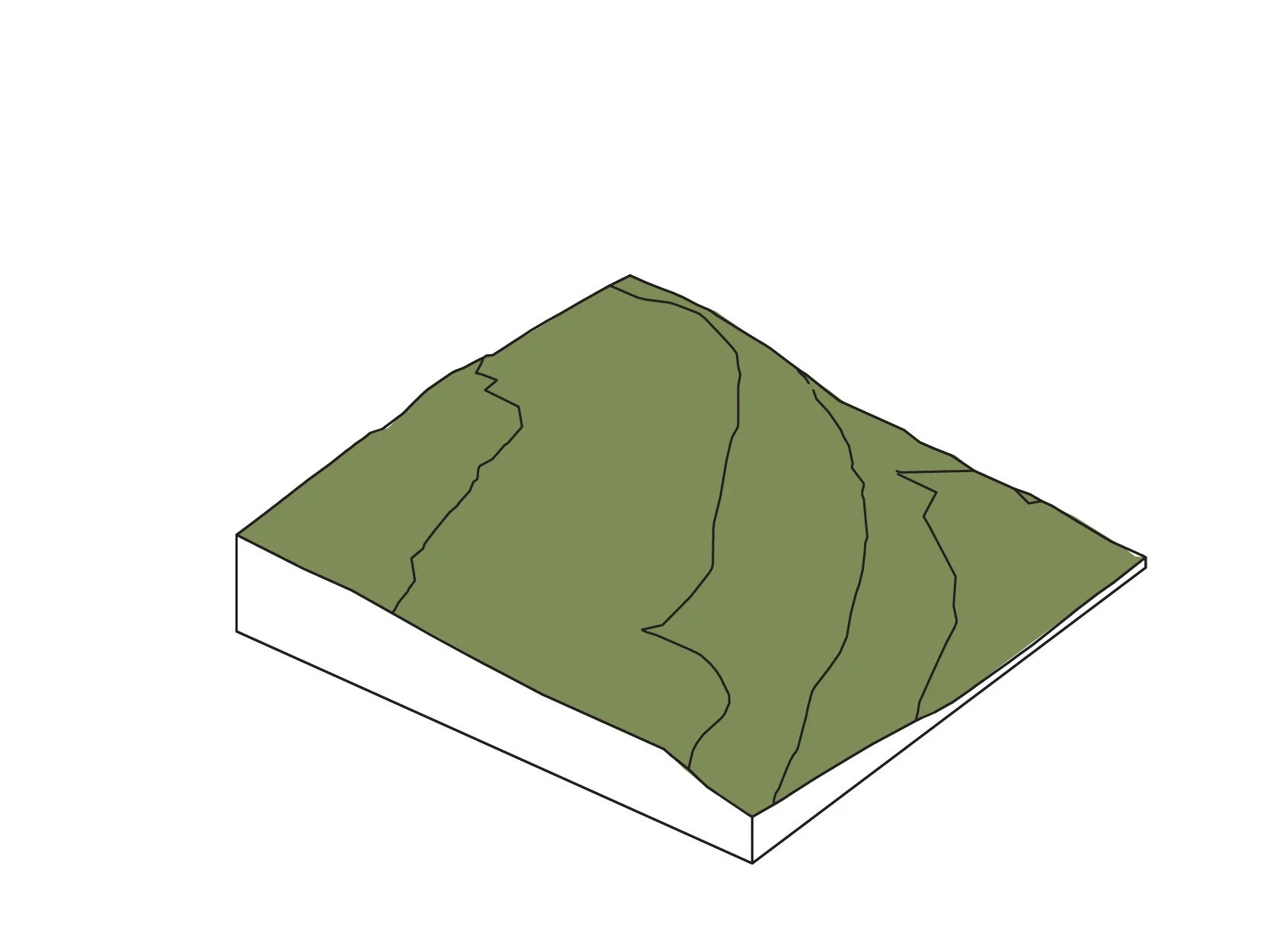
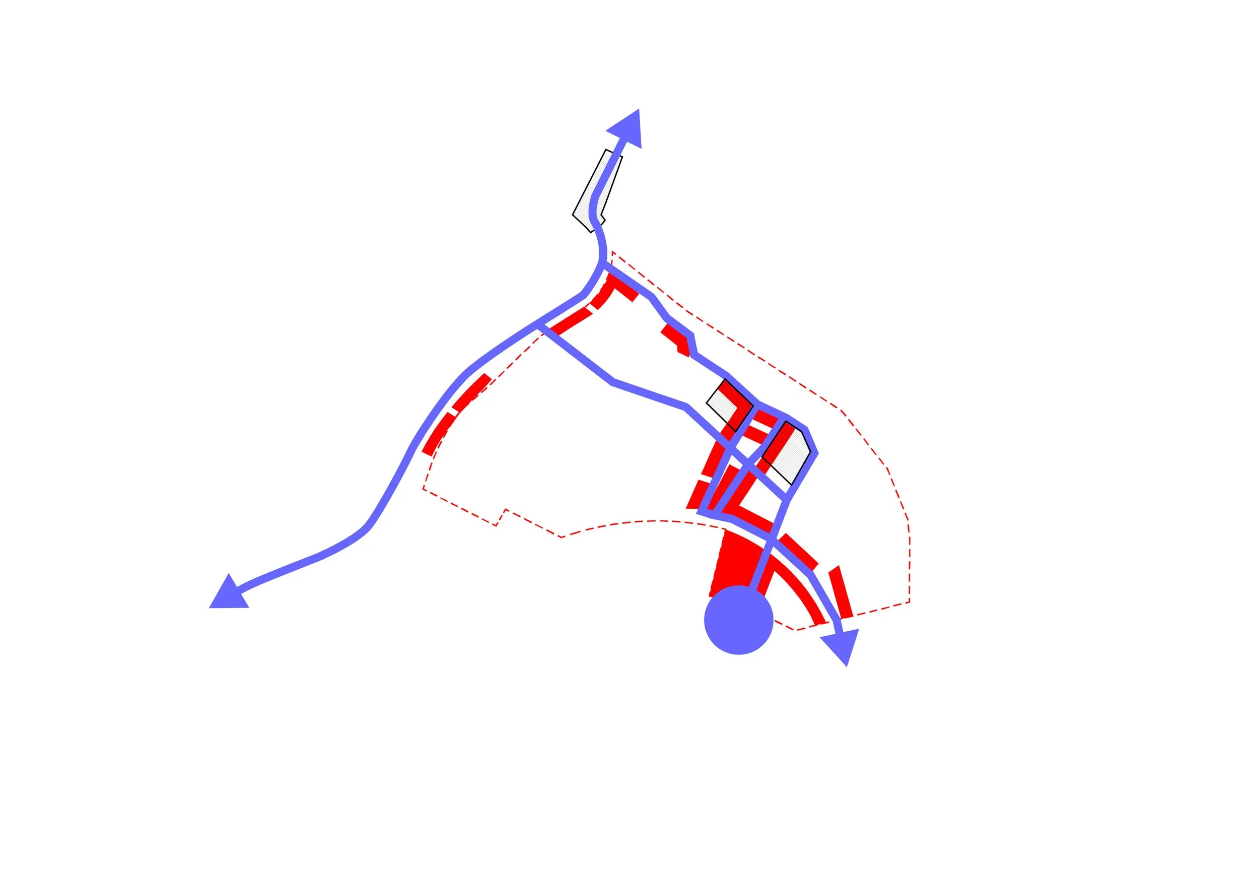
Existing Terrain

Establish limits
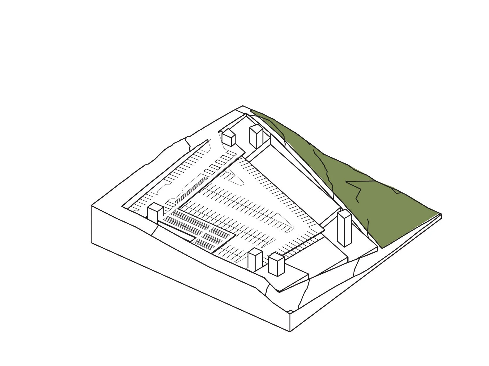
Excavate + construct parkade
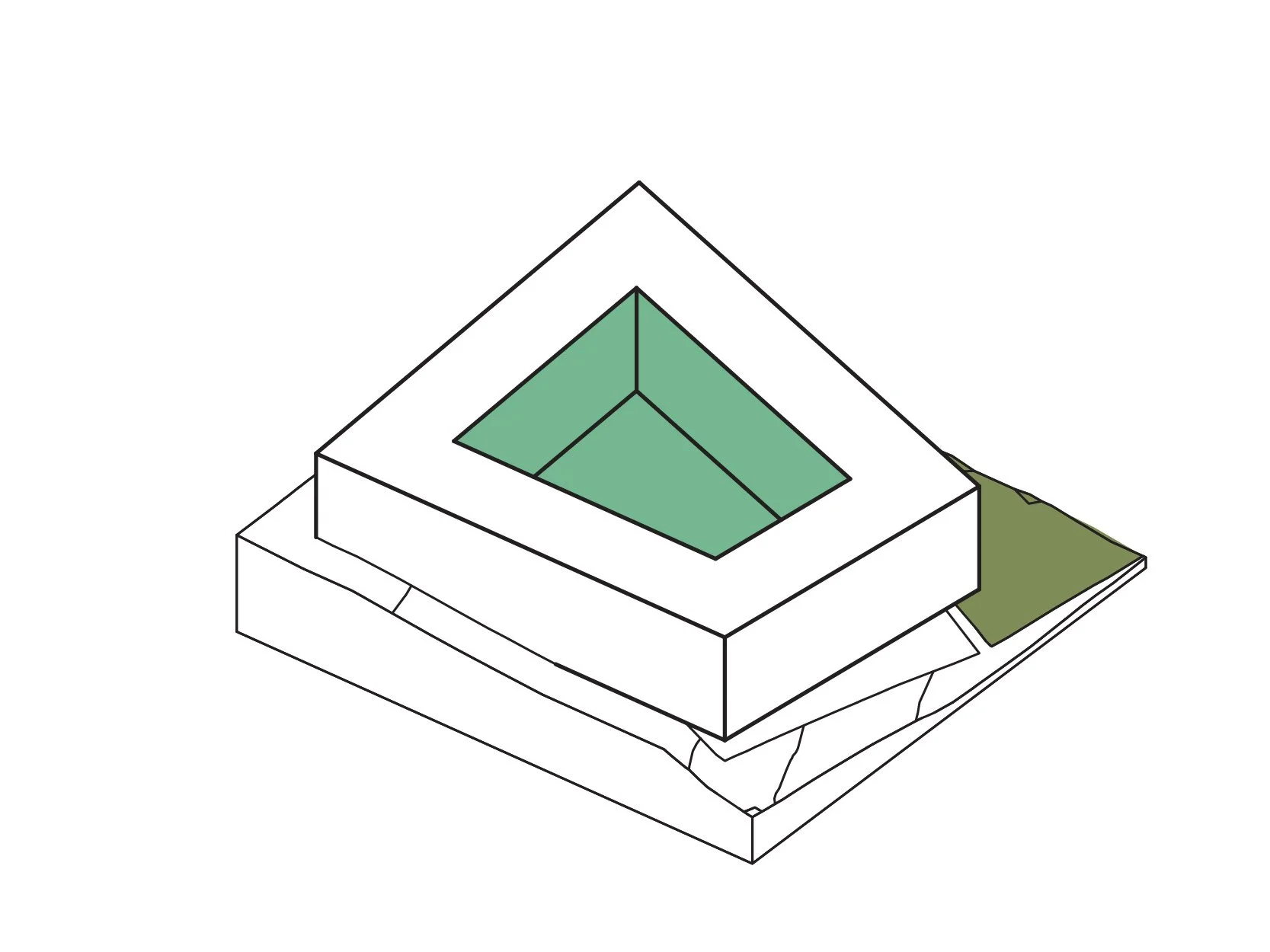
Establish primary massing
Adjust to environment
...and terrain
Perforate passages people
Connect to landscape
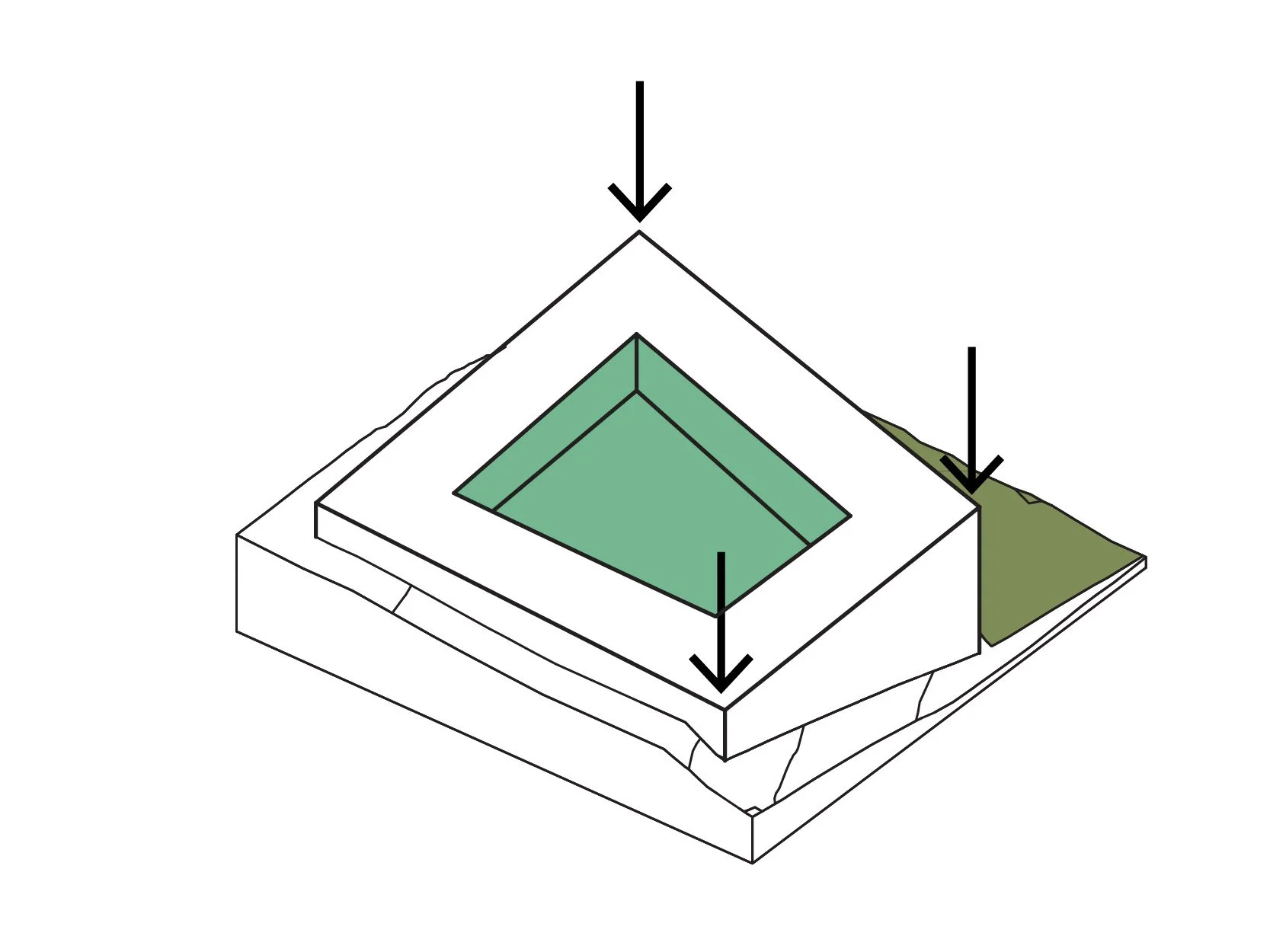
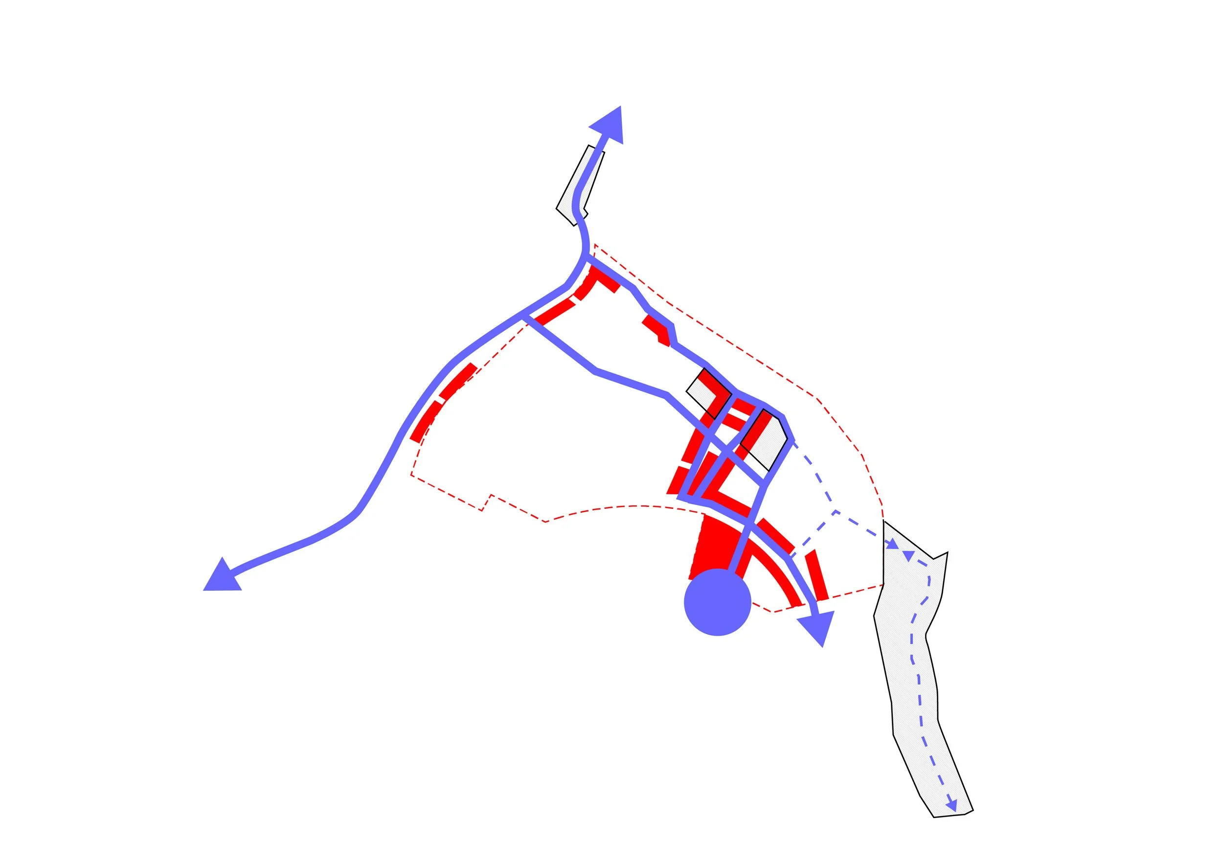
Responsible Density
To ensure a well-designed, high-performing public space, JIM revised the development's planning methodology. Rather than FAR and site coverage requirements, the plan consolidates open space into public parks and courtyards. The smaller lots are allowed 100% site coverage, with floor-height limitations to control solar access and scale.
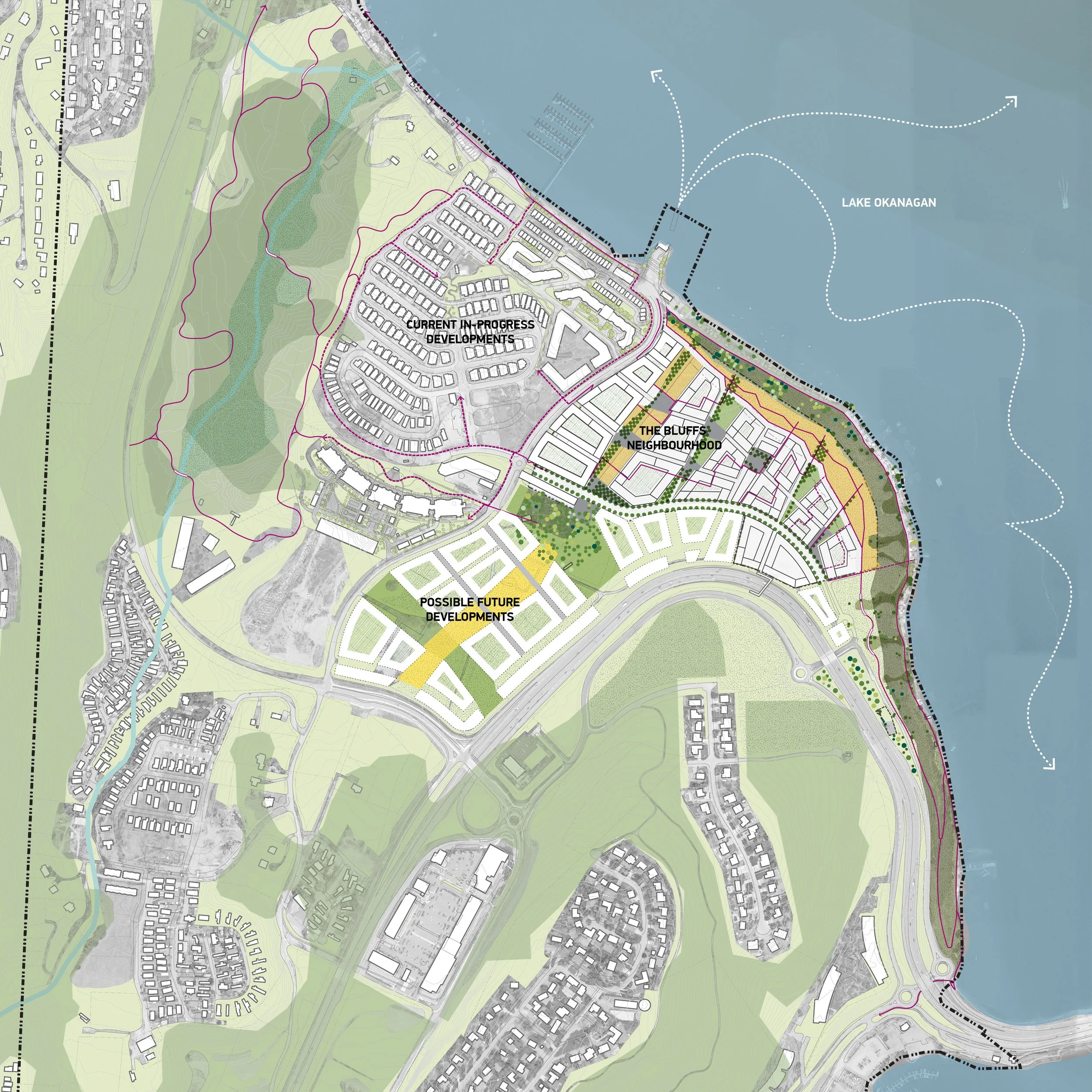
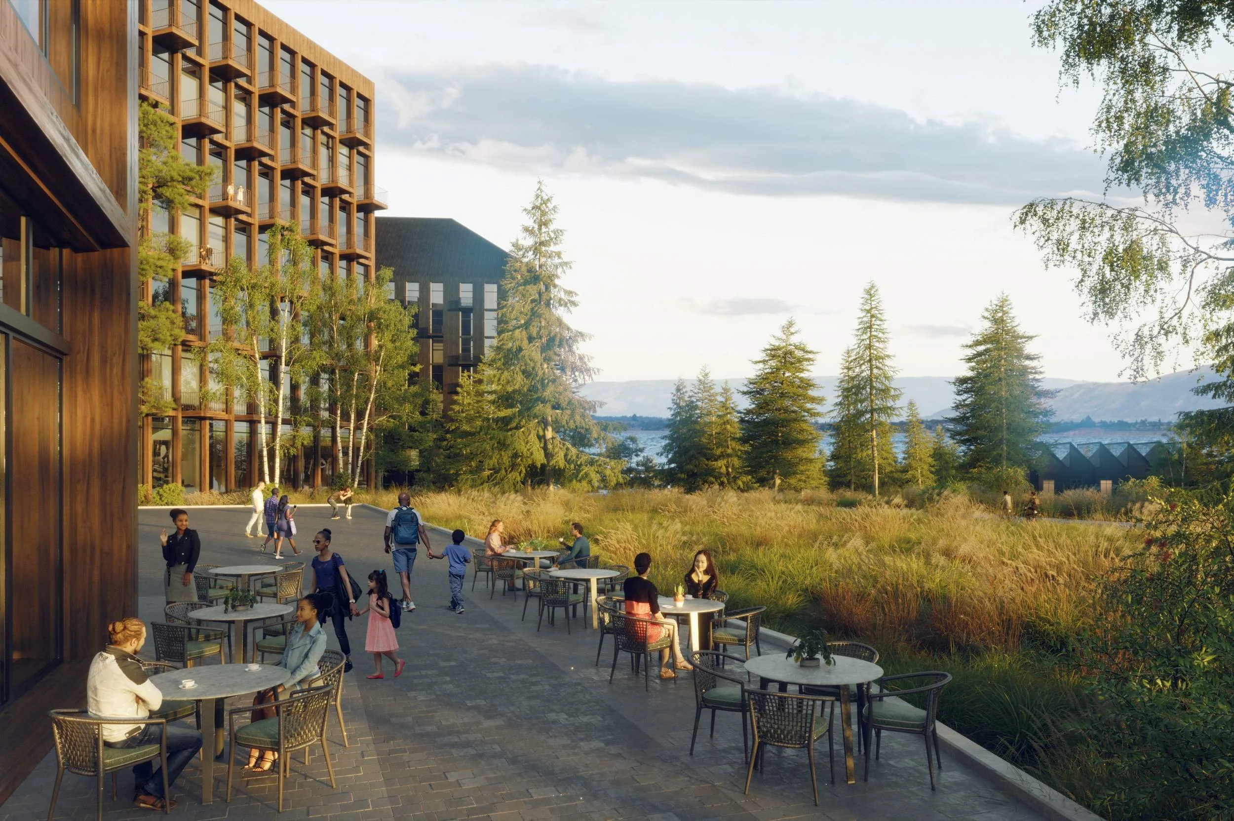
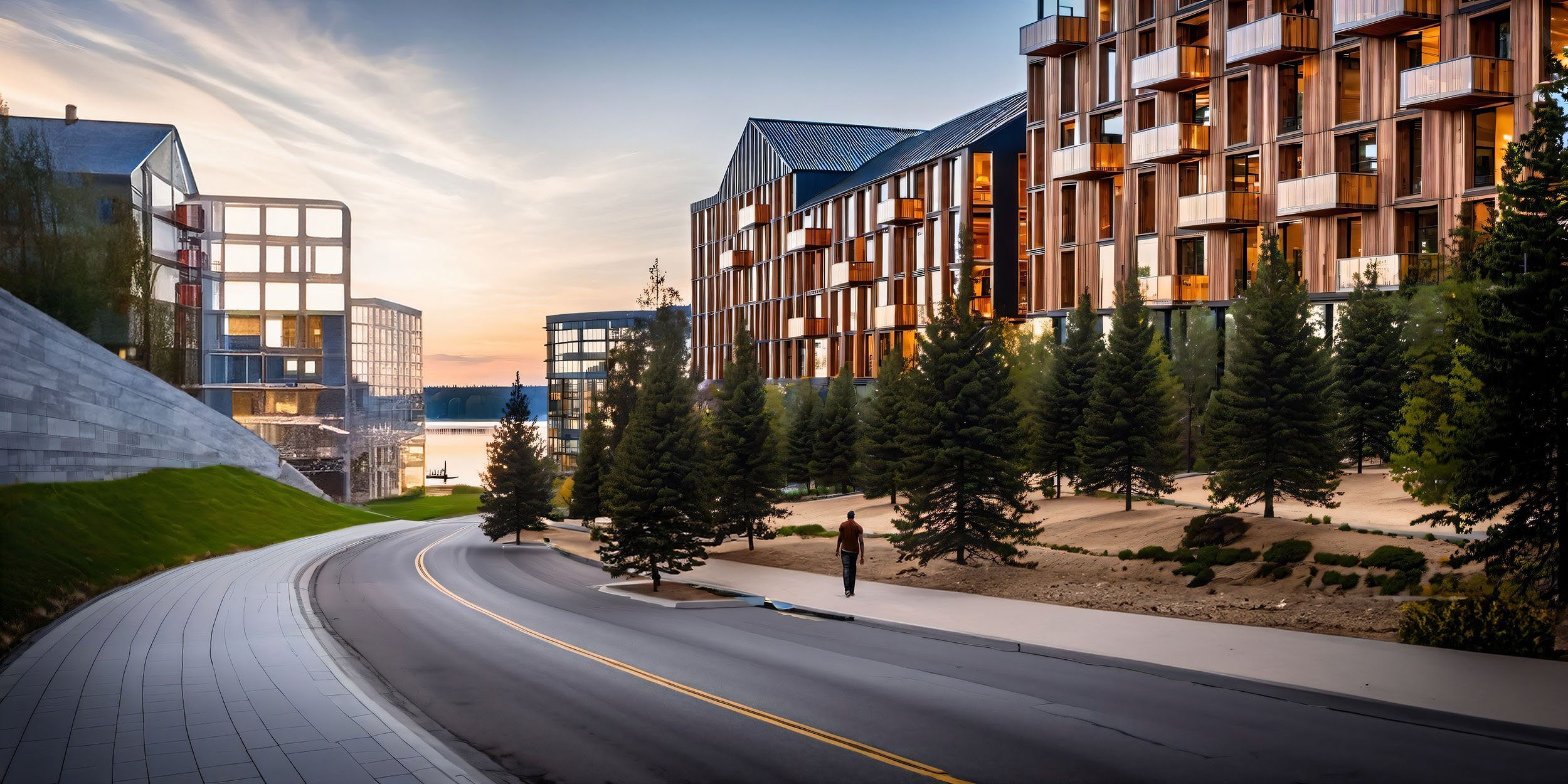
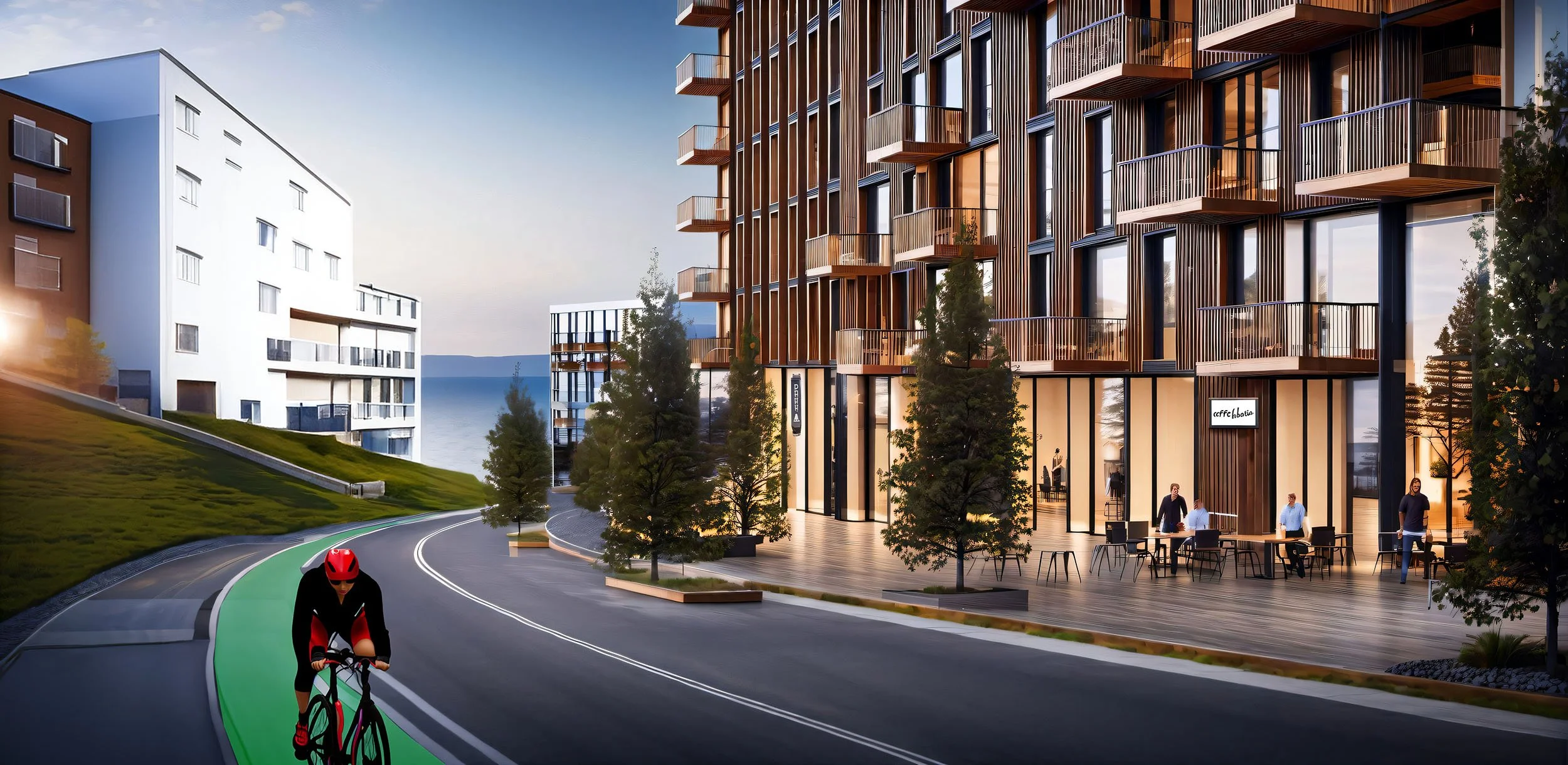
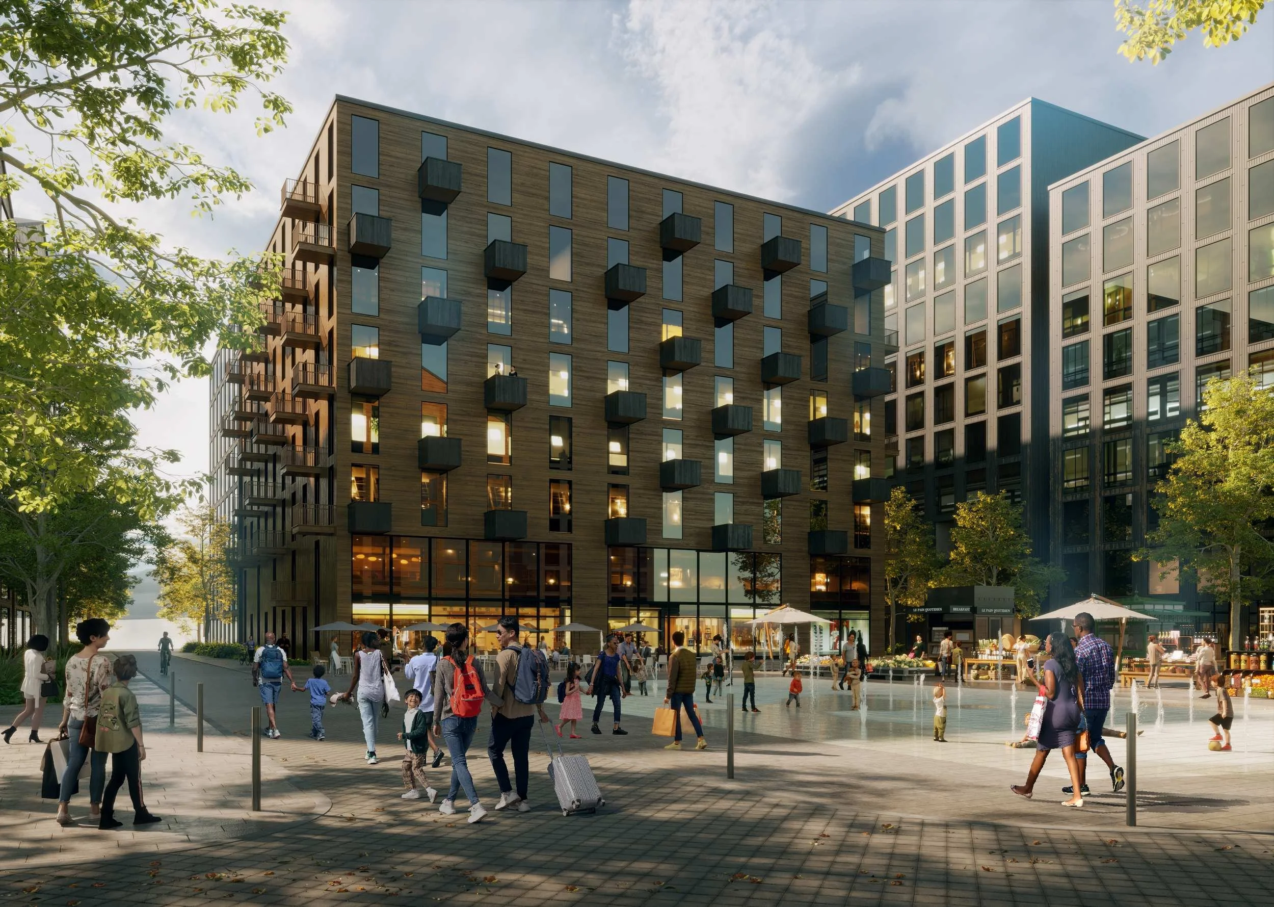
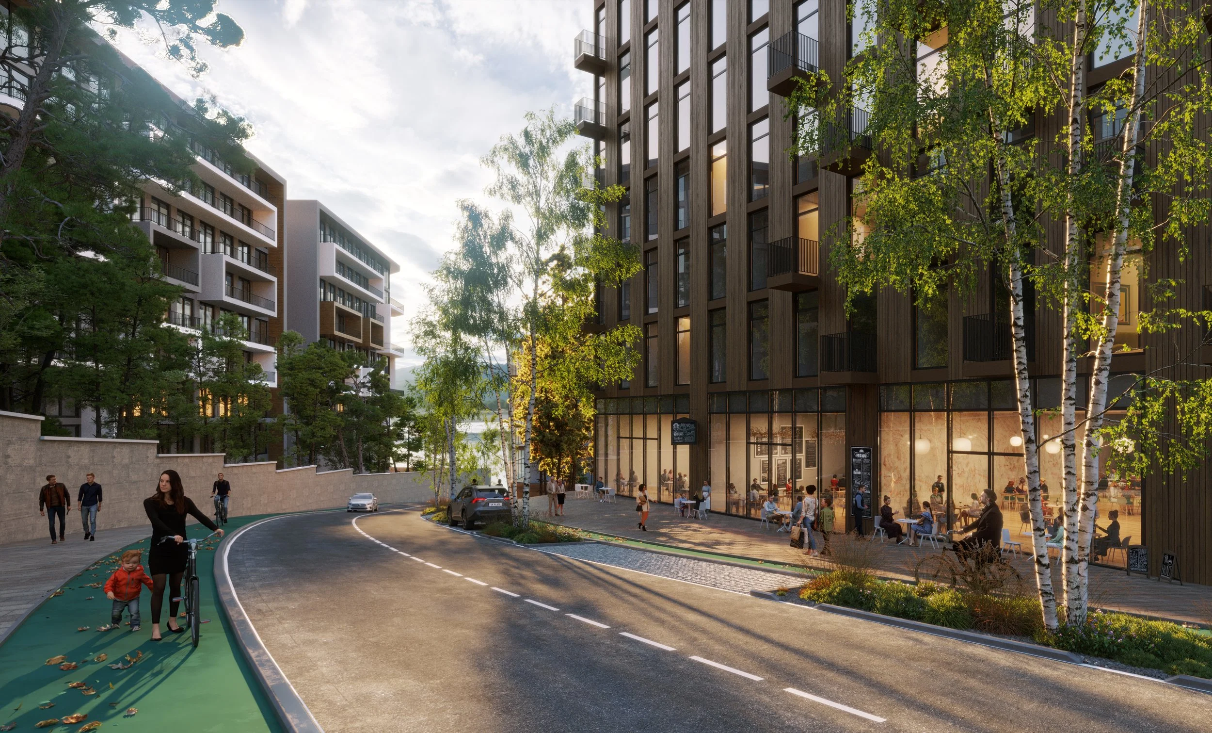
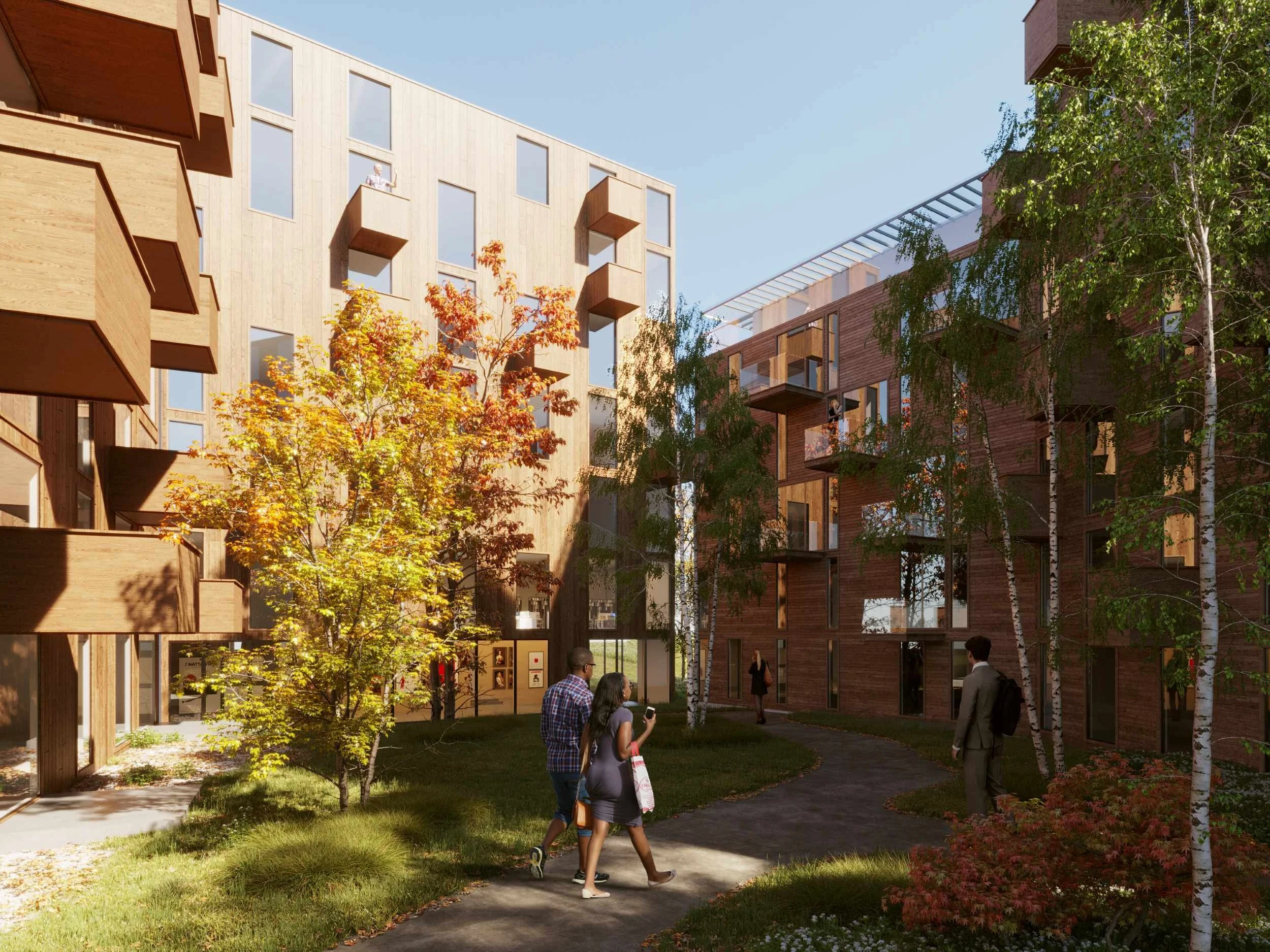
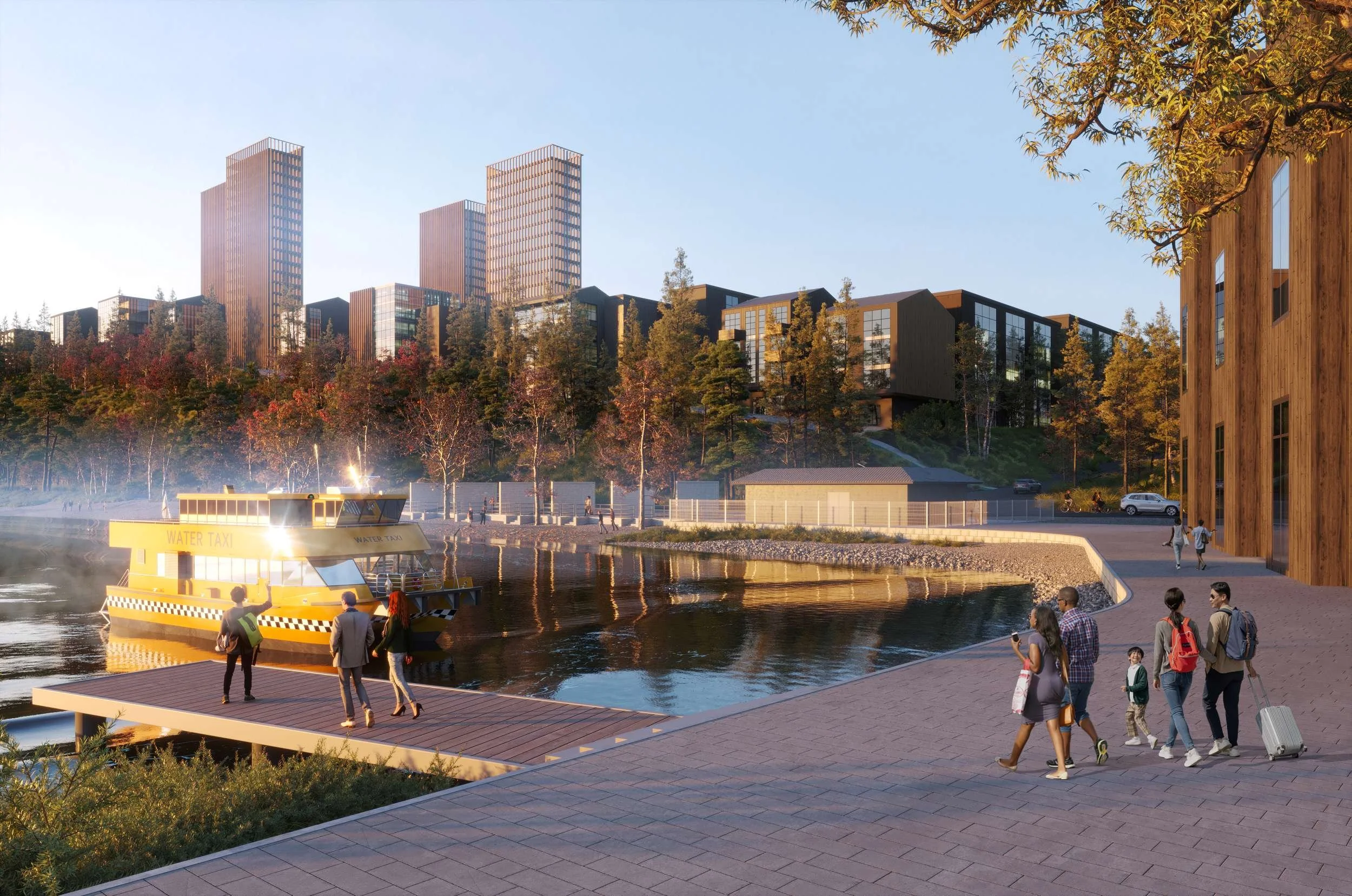
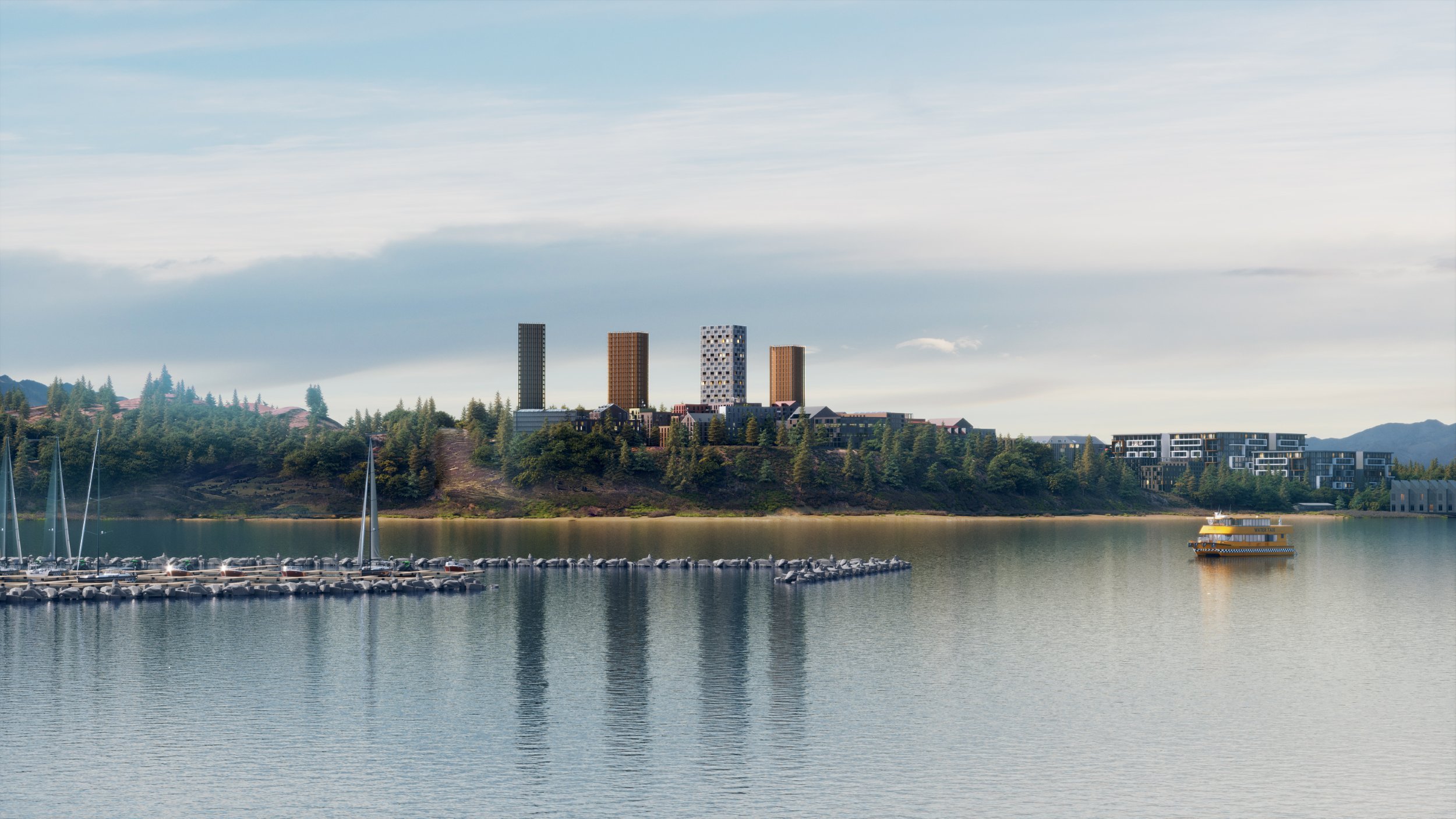
A new 16-hectare development with a comparable-sized park along the water on Westbank First Nation land, the Bluffs represents a new model for urban living in British Columbia—over four million square feet of mixed-use development, including a new community centre and park space. The dense buildings range from 3-story units to 28-story towers spread across the steeply sloping site. The buildings surround internal courts, while the dense blocks are separated by landscape corridors that connect the water to the forest. The development will include district energy and buildings designed using low-cost, passive technologies to achieve the highest sustainability standards while ensuring durability.
The Vision
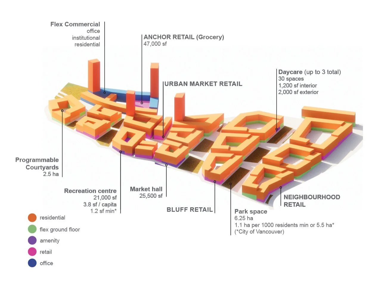
Proposed land uses in the Bluffs Neighbourhood
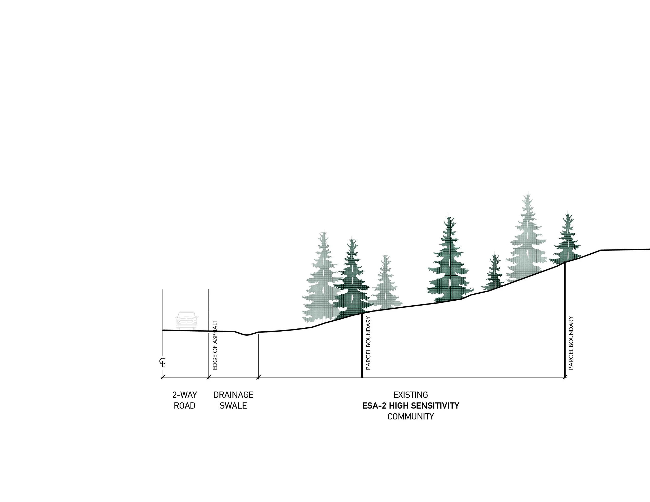
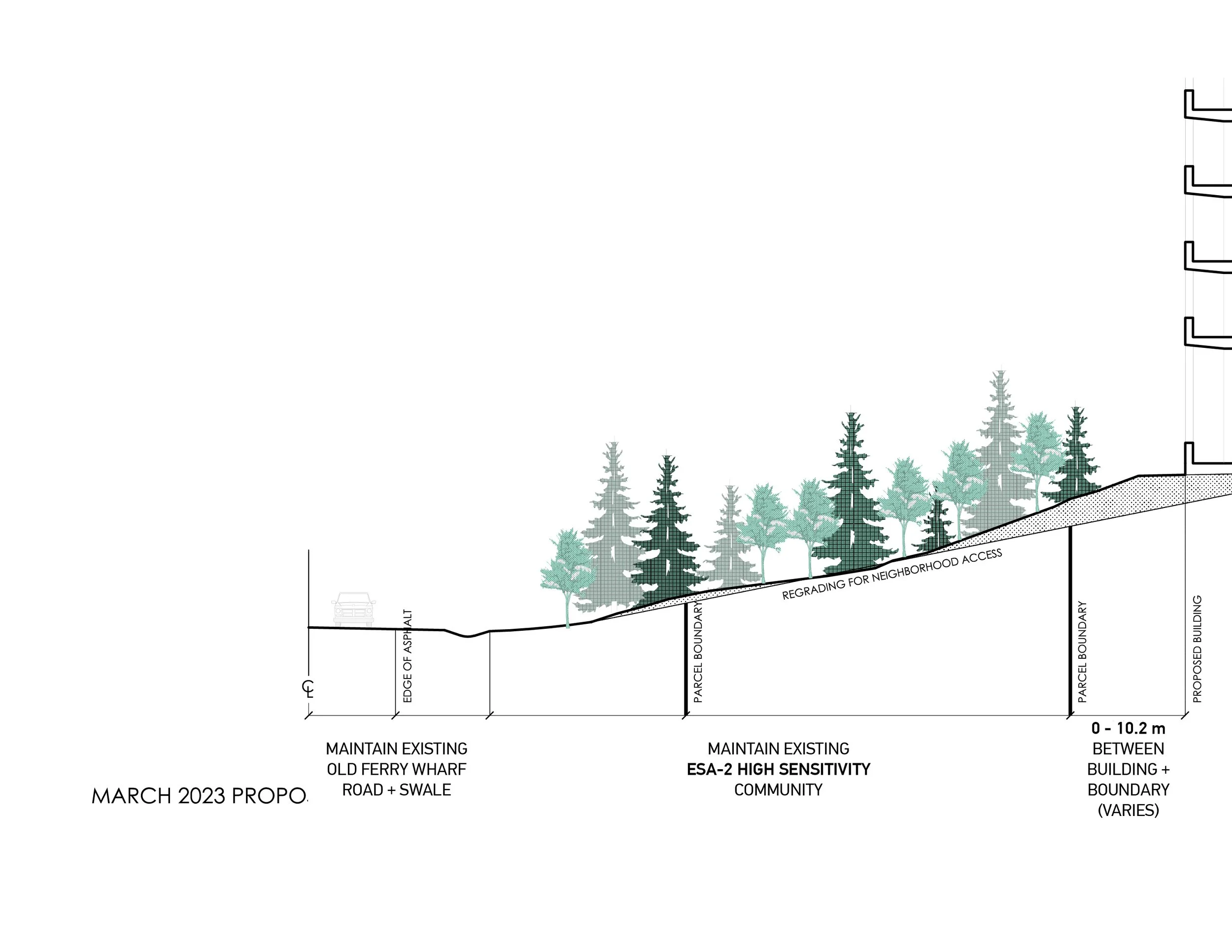
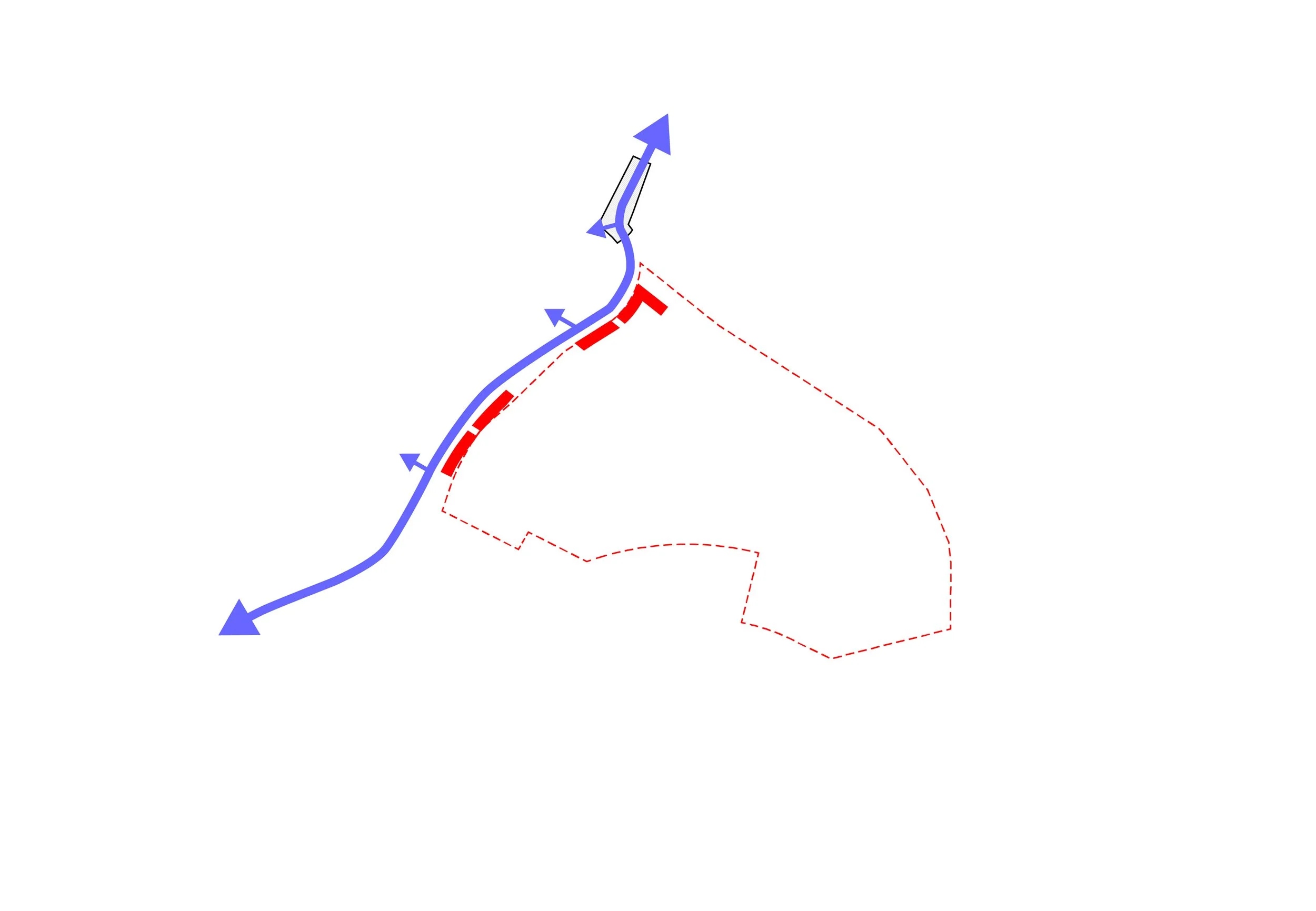
Old Ferry Warf road
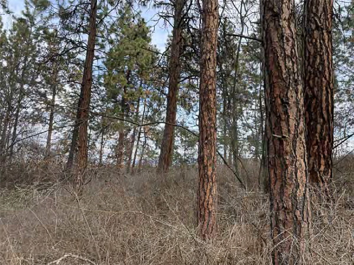
View within Polygon 10 (ESA-2 along Old Ferry Wharf Road) looking northeast
SCENARIO 1: landscape buffer Minimize impact on existing hillside and enhance as landscape buffer
SCENARIO 1: landscape buffer Minimize impact on existing hillside and enhance as landscape buffer
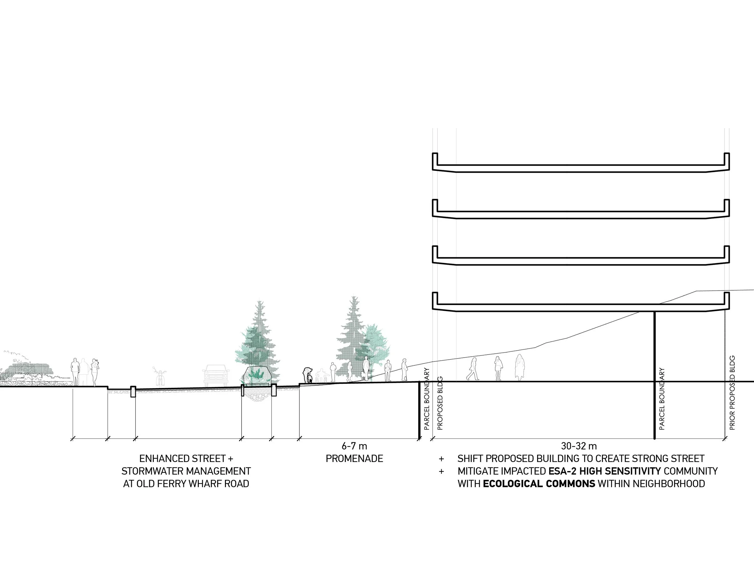
SCENARIO 2: Enhanced Street Add stormwater management and retail frontage promenade
SCENARIO 2: Enhanced Street Add stormwater management and retail frontage promenade
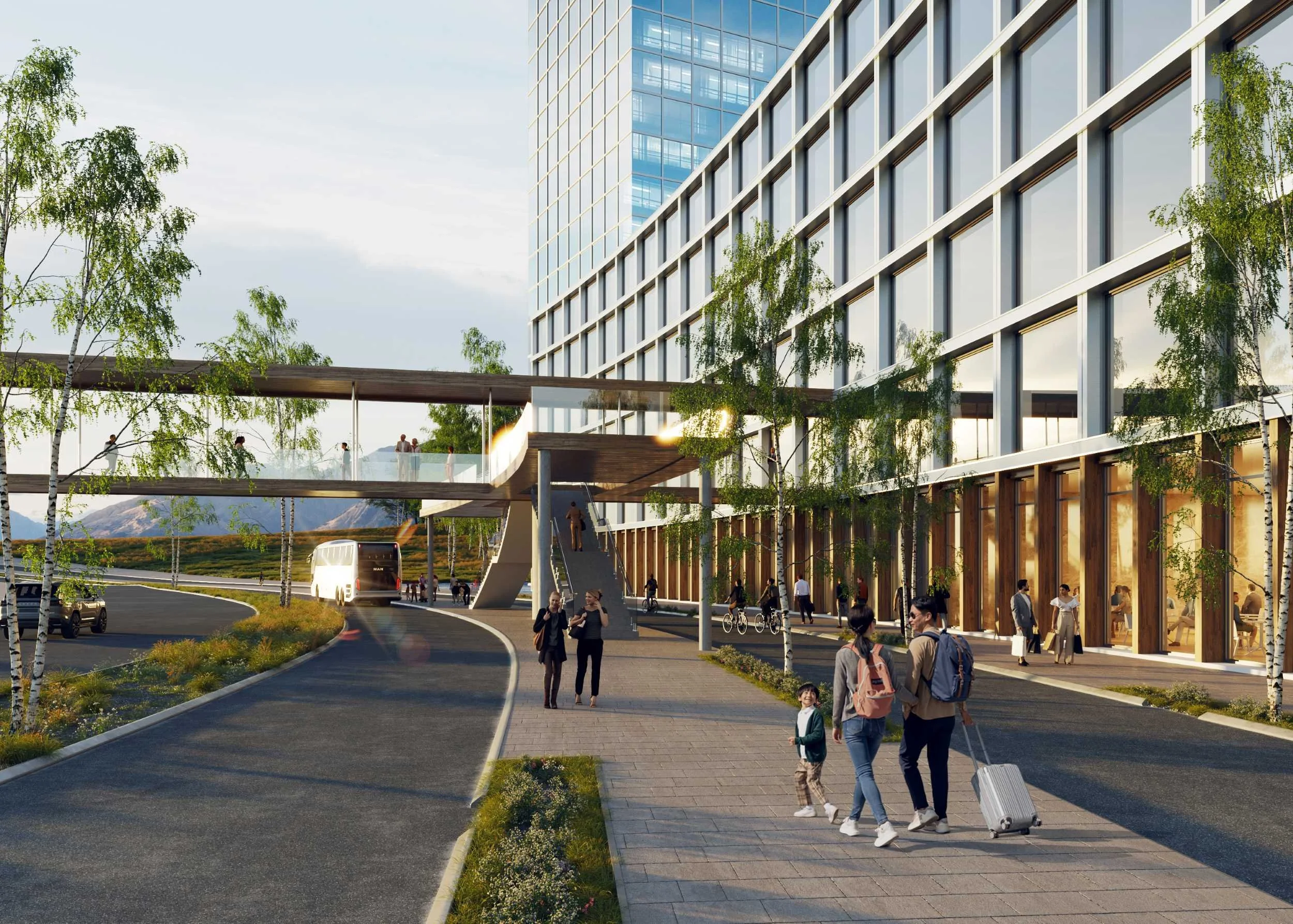
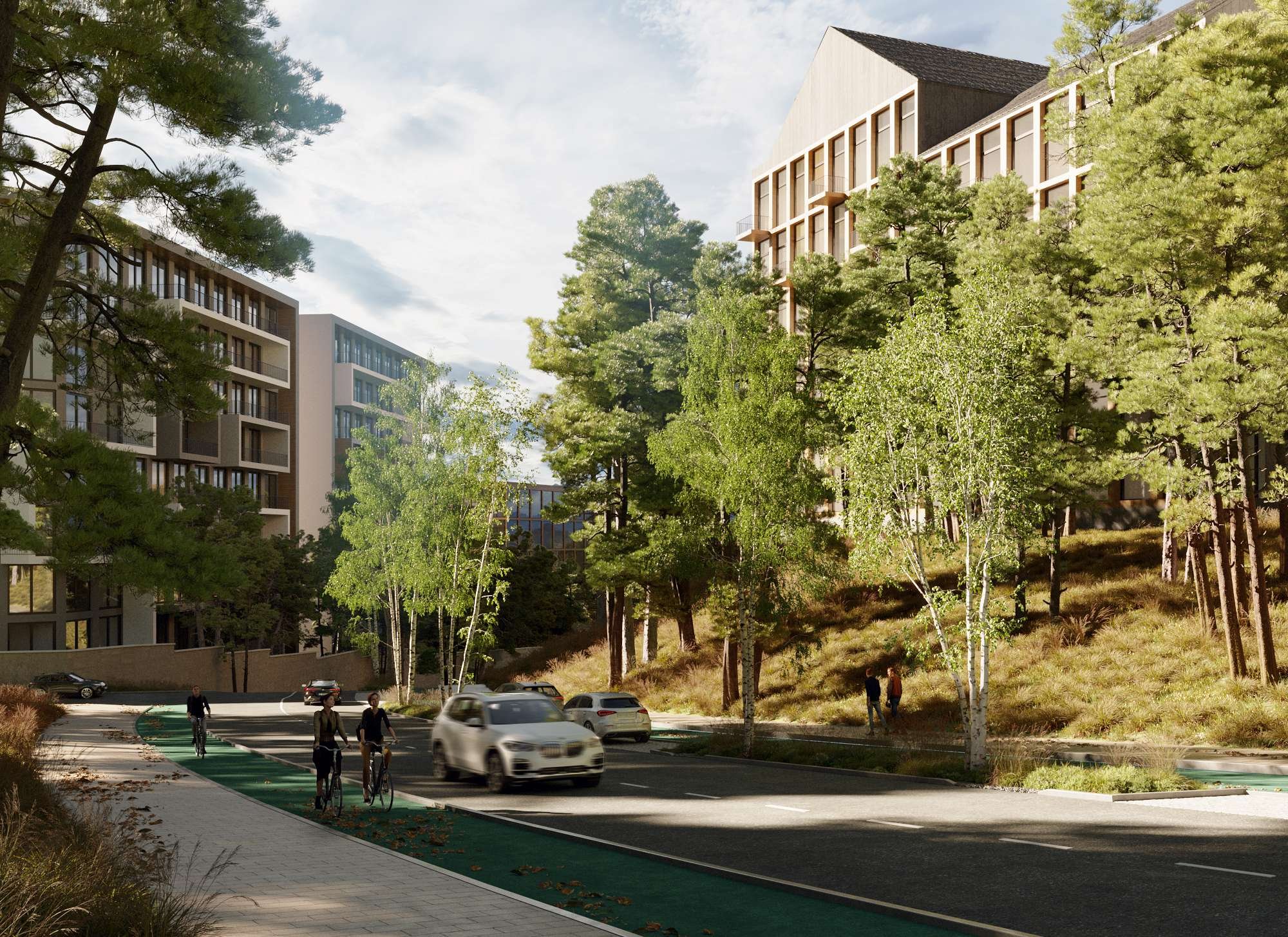
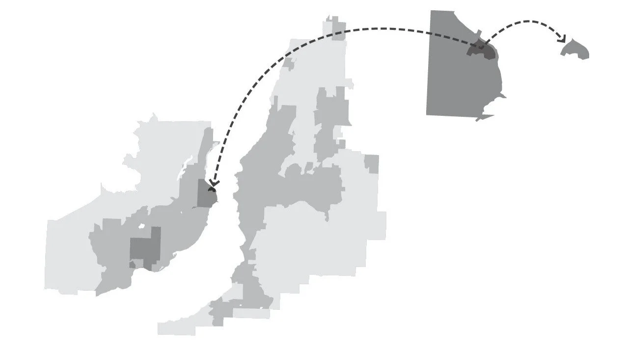
With increased density, JIM proposed several new transportation improvements, including a new express bus lane along the highway and a regional ferry. These public amenities reduce reliance on cars in the development and create a pedestrian-focused community.
Intimate streets shape active public and private experiences
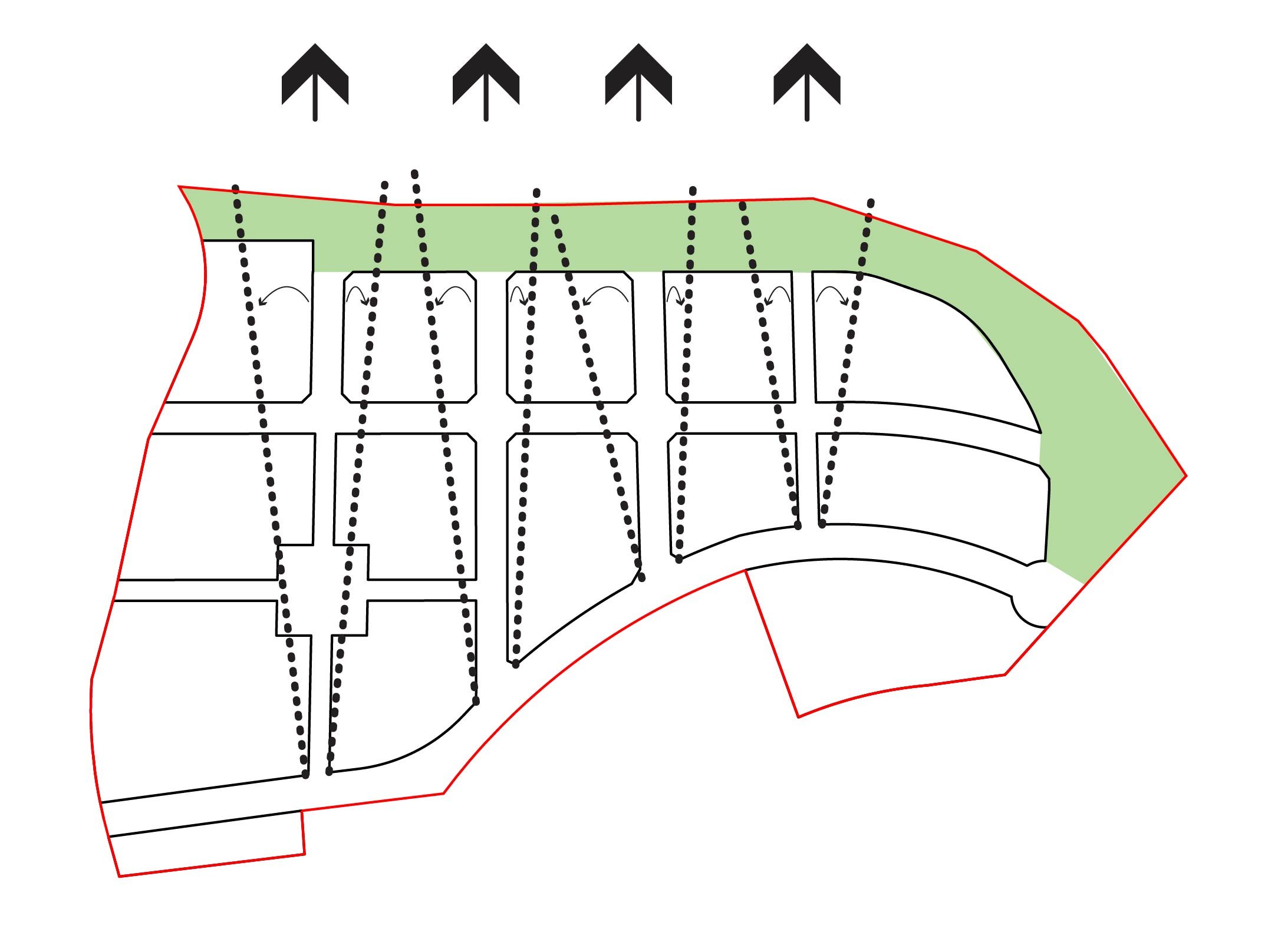
Betweenness
In a pedestrian-oriented, mixed-use neighbourhood, understanding how people move in a street network helps optimize retail positions. Betweenness examines the weighted values of destinations around the site and their impact on people’s movement. Placing retail along these movement paths allows them to reach a larger customer base. For The Bluffs, these patterns will shift as the development transitions from a vehicular-dependent to a transit-oriented site and as amenities are added.
With Phase 1 the initial retail offerings along Old Ferry Wharf Road will serve people as the move to and from the lakeshore and the adjacent developments.
As part of Phase 3 a new transit center, plus new destinations atop the Bluff embankment, will shift pedestrian flows through the development.
Attention will focus on building the primary retail components around these lines of pedestrian movement
Potential development of the foreshore’s non-Community Lands for visitors will add an additional destination to draw visitors and residents alike.
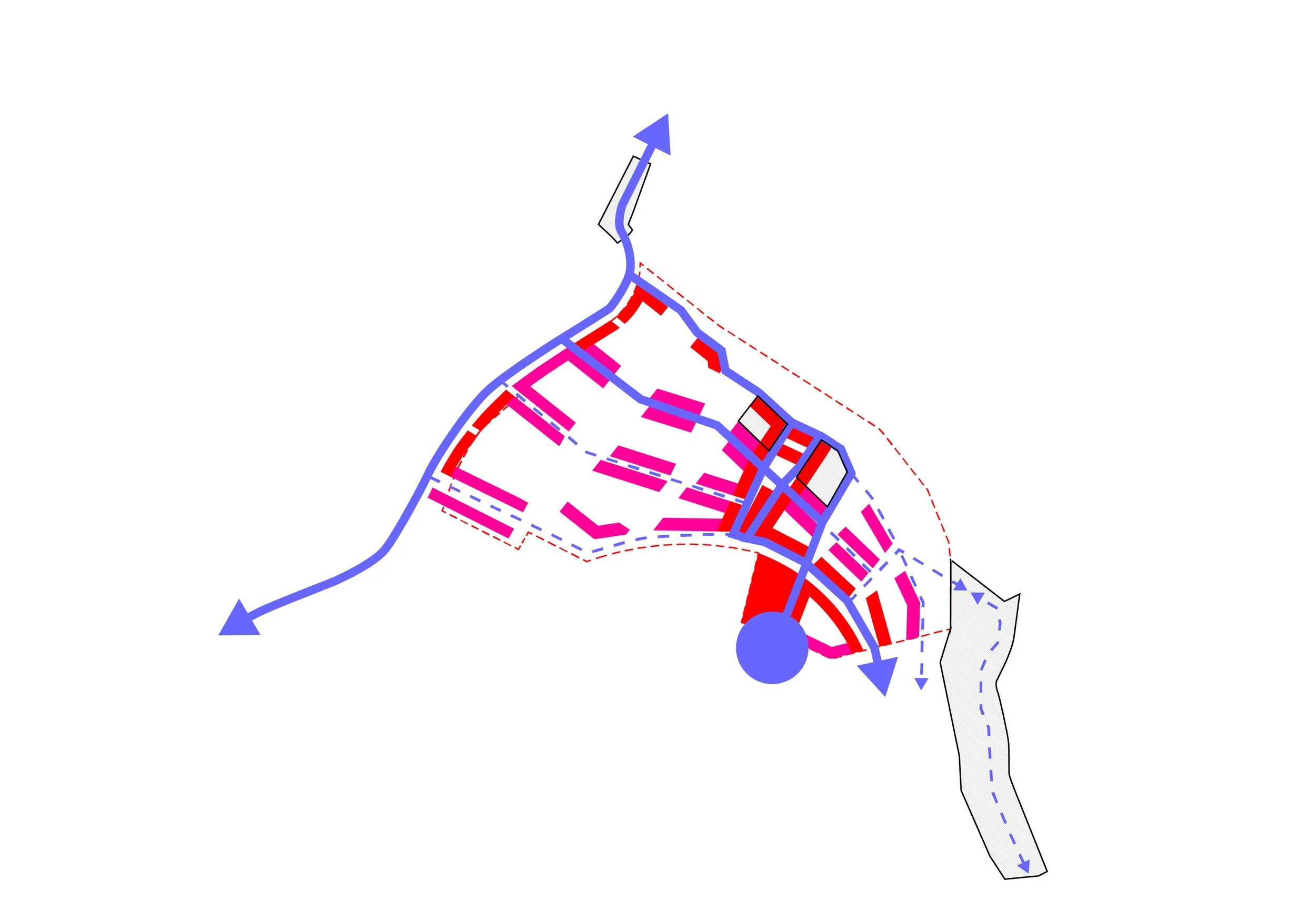
Success entices new retail opportunities as ground floor residential units are intended to be flexible and support growth.
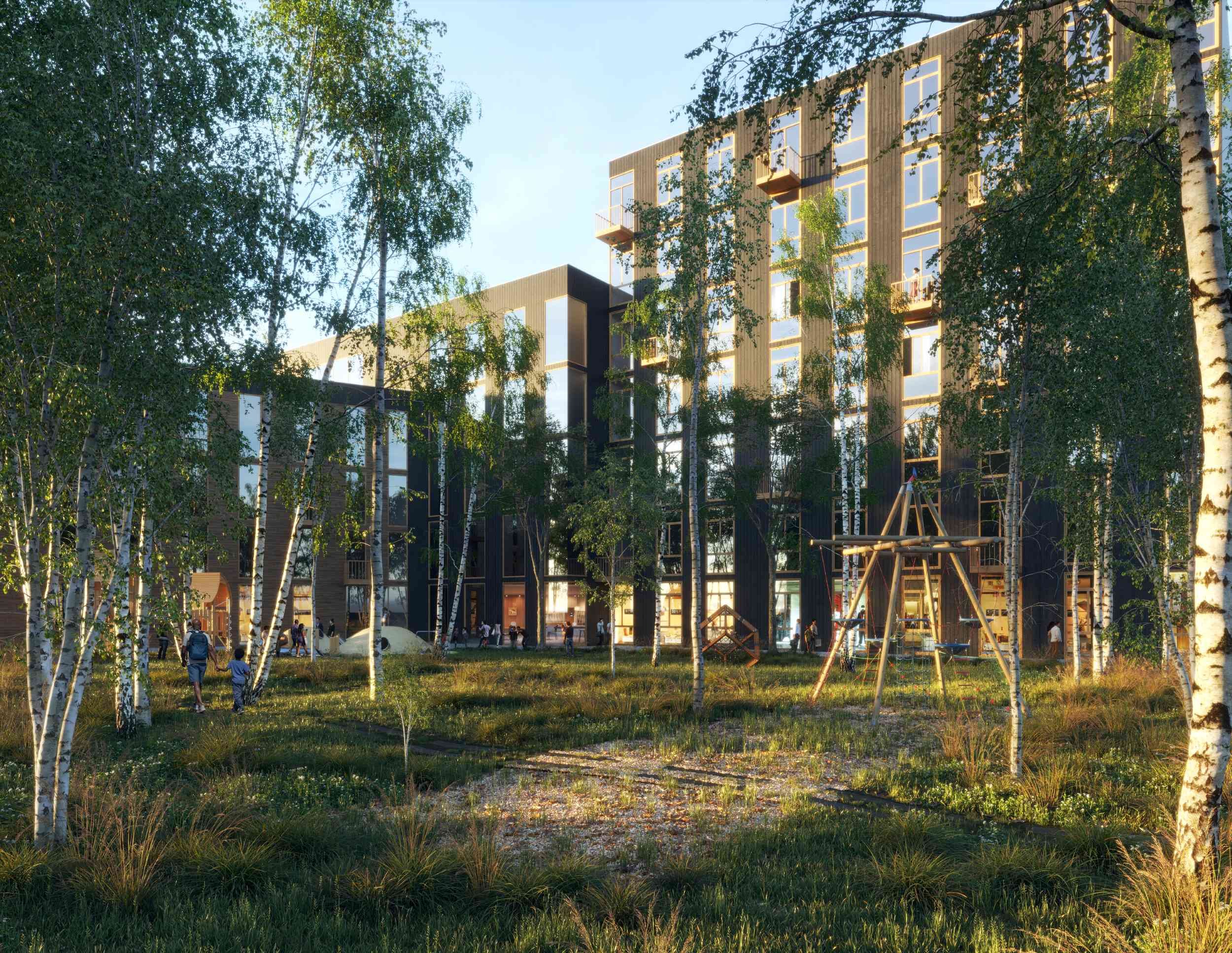
Courtyards offer pockets of wild Okanagan landscapes in managed settings at the Bluffs Neighbourhood.
Restoring Wetlands
JIM initially provided consultation to integrate a more sustainable approach into a prior development plan. As the project developed, JIM expanded the scope to address a need for more public park space around the site and the inconsistent relationships between the separate developments in the area. The proposed lakeside park would restore the natural wetlands around the lake, 85% of which have been lost in the Okanagan Valley. JIM also designed proposals for rapid public transportation connections and began investigations for district energy opportunities.
-
JIM
James Huemoeller
-
Landscape Design
OTHER LANDS STUDIO
-
Engagement, Planning and Civil Engineer
Aplin Martin
-
Geotechnical
Interior Testing Services Lts
-
Environmental
Ecospace Environmental Consultants Ltd.
-
Transportation
HDR
-
Archaeologist
Ursus Heritage Consulting
-
Surveyor
Ferguson Land Surveying & Geomatics Ltd.