

How do we organize a community around the landscape, mobility networks and the public realm?
The Bluffs
Framework Plan
Westbank First Nation
2023 - 2025
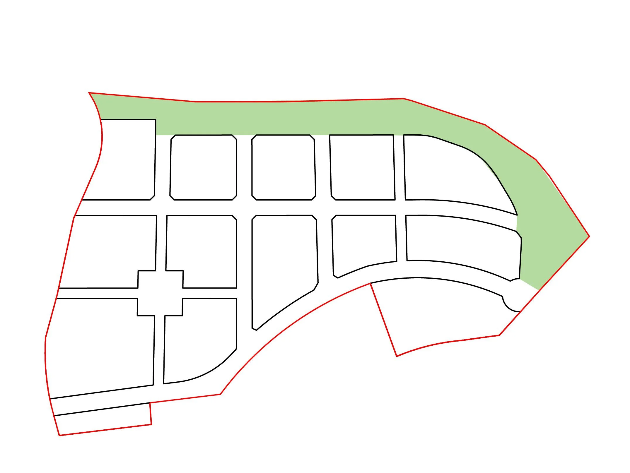
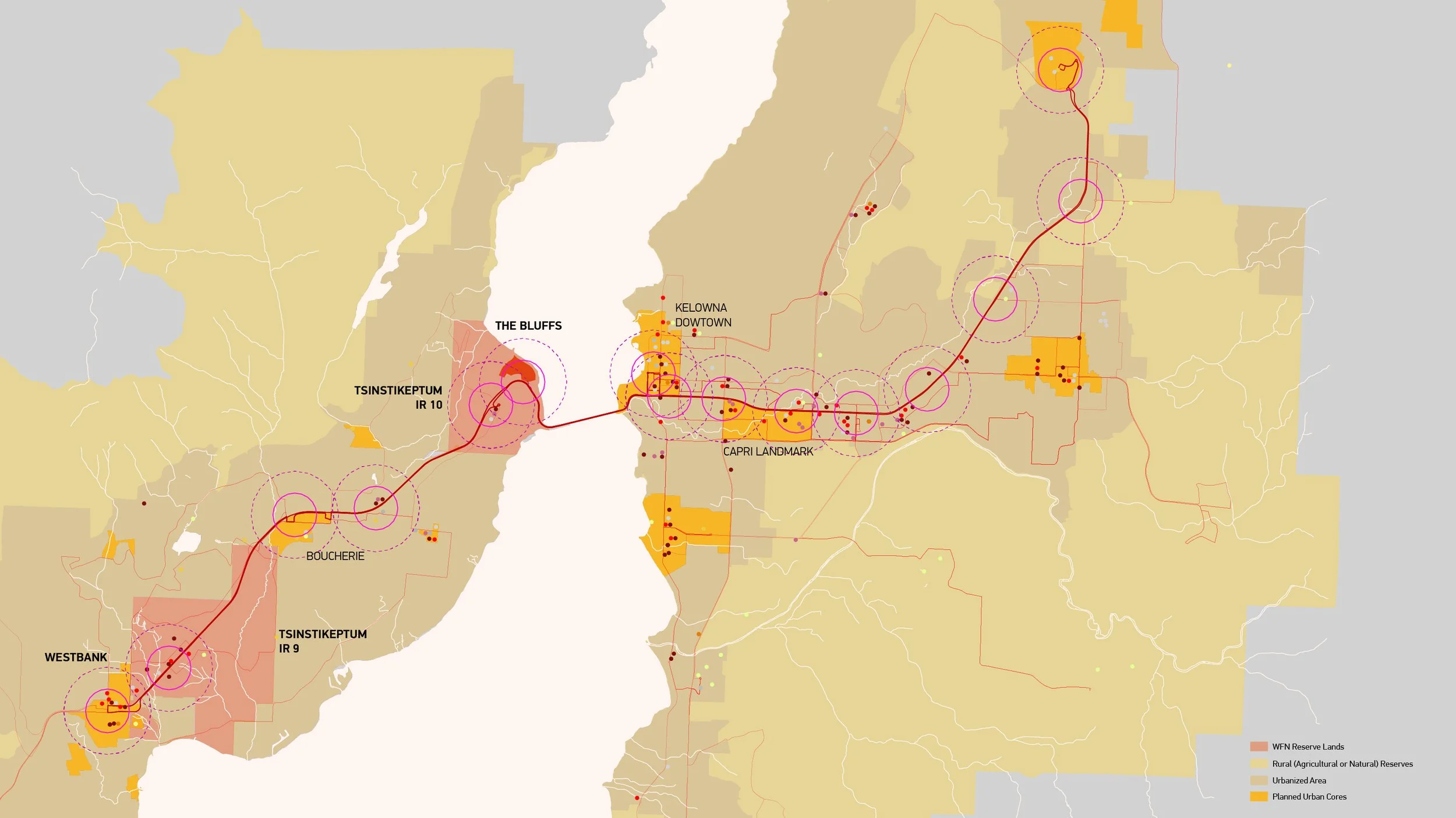
JIM is leading the design of a 16-ha development in Westbank First Nation and planning a larger 24-ha Neighbourhood Plan area called “The Bluffs”. The Bluffs Neighbourhood Plan is a comprehensive land-use planning document prepared for Westbank First Nation on behalf of WB Bluffs Developments. The document aims to guide future land development through rezoning, subdivision, and development permit processes, using land use planning and urban design guidance. The Bluffs Plan informs why and how the site will be developed. It also emphasizes the importance of the land and its potential to benefit the Westbank First Nation community by bolstering housing, the economy, and quality of life.
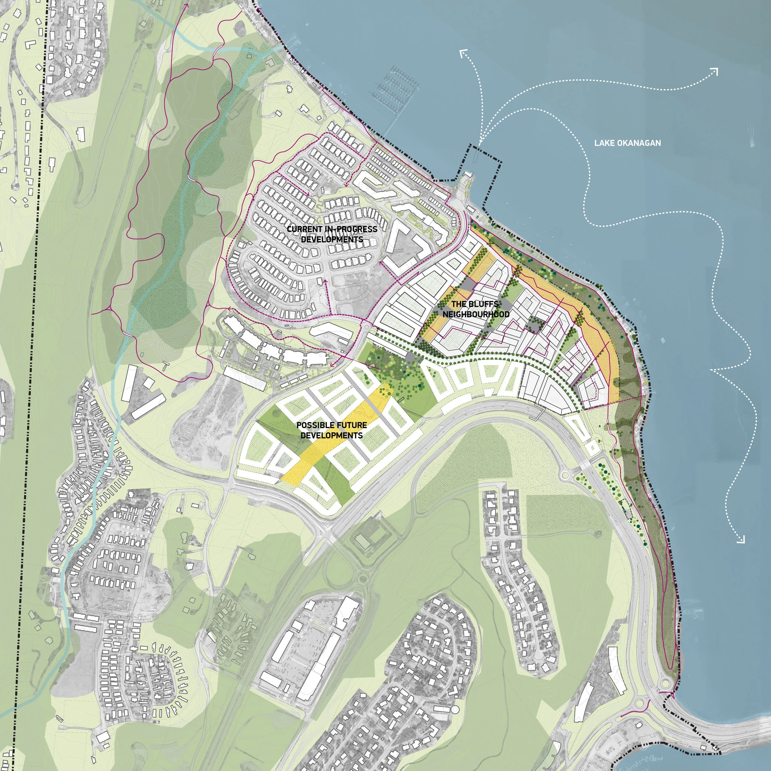
Situated in the WFN Tsinstikeptum IR 10 (IR 10), The Bluffs is a significant land asset amongst the collective community. To realize the full development potential of the site, the team aimed to make thoughtful land-use and urban design and planning decisions by considering prior studies and analyzing contextual factors, including the environmental, cultural, and economic impacts of the envisioned development. Emphasizing alignment with WFN values, the team’s integrated urban design approach respects and acknowledges Westbank's history and traditions. We think the resulting site design – including density, character, layout, typology, and amenities – reflects a thorough analysis consistent with WFN planning policies and goals.
IR 10 is a low-density community with mostly single-family homes and highway-based commercial uses. Over the last fifteen years, the area around The Bluffs, specifically in NP 10-7, has seen intense development, with each subsequent project being denser than the last. Though there is still little commercial development, and the developments are largely centred on the car, they align with the current zoning that calls for a denser IR 10.
Given the location of IR 10, further densification seems warranted. Some of the most notable landmarks in IR 10 include the adjacent Okanagan Lake and Okanagan Lake Shopping Centre, southwest along Highway 97. IR 10’s proximity to the William R. Bennett Bridge makes downtown Kelowna easily accessible, just as West Kelowna is working to create a strong urban core. The immediate area is also well-known for its agricultural reserve lands, including several wineries.
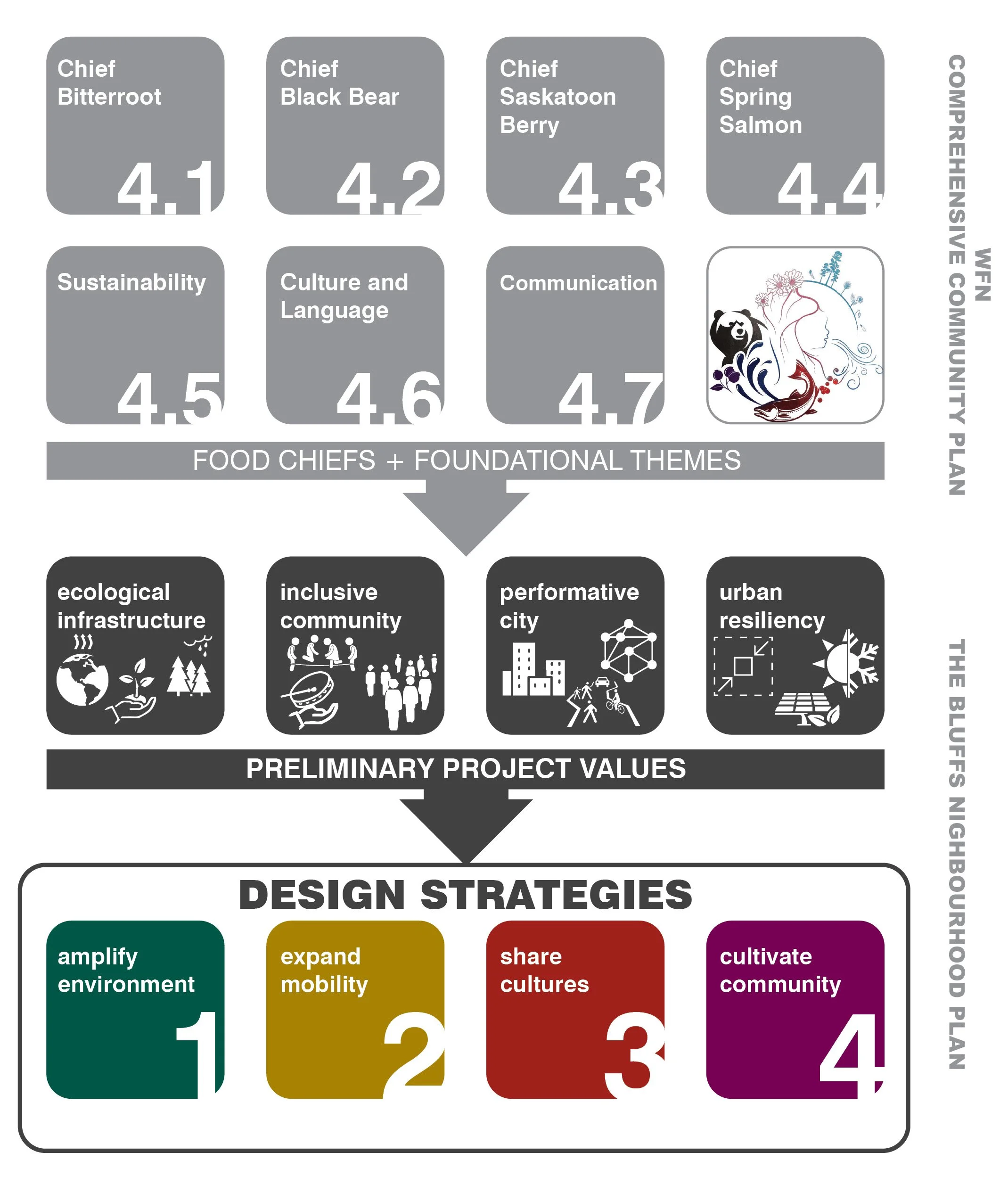
The Transition from Community Vision to Actionable Strategies
Community Themes to Tangible Outcomes
Planning for the project began with a review of the WFN’s Comprehensive Community Plan, focusing on Food Chiefs and themes. From that resource, the team built a series of Project Values that adapt and incorporate them into the specificities of the Neighbourhood Plan. The development of the four Project Value categories was an iterative process that became more refined as the project team gained more insight into the project specifics and its intersection with the CCP. Once we framed the project, we then specified formal strategies for actualizing those values. In this case, we defined four organizing Design Strategies.
The Bluffs Neighbourhood Plan was grounded in the vision of the Comprehensive Community Plan and aimed to support WFN’s development of IR 9 and IR 10 as interconnected communities. Though the Plan had specific land boundaries, its ambition extended beyond them to ensure that every planning decision enhances the broader WFN and West Kelowna communities.
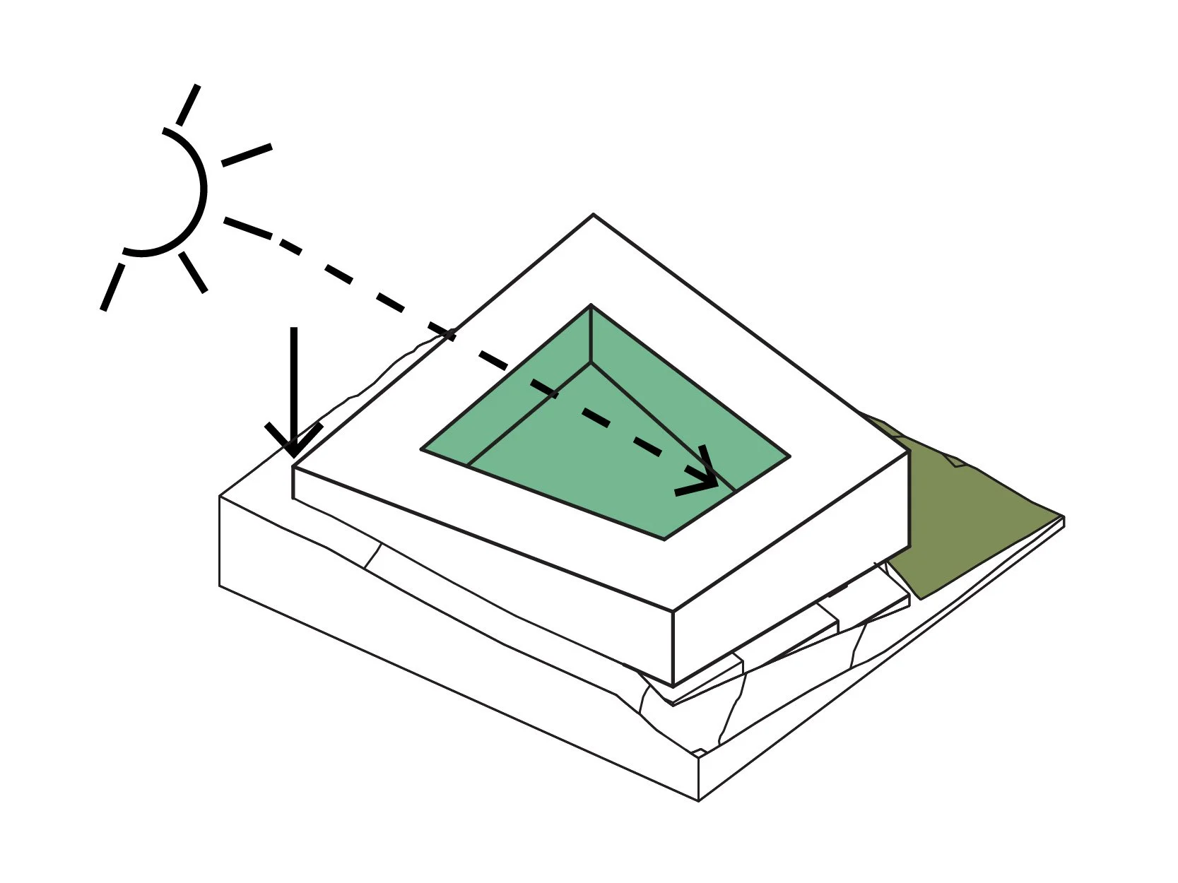
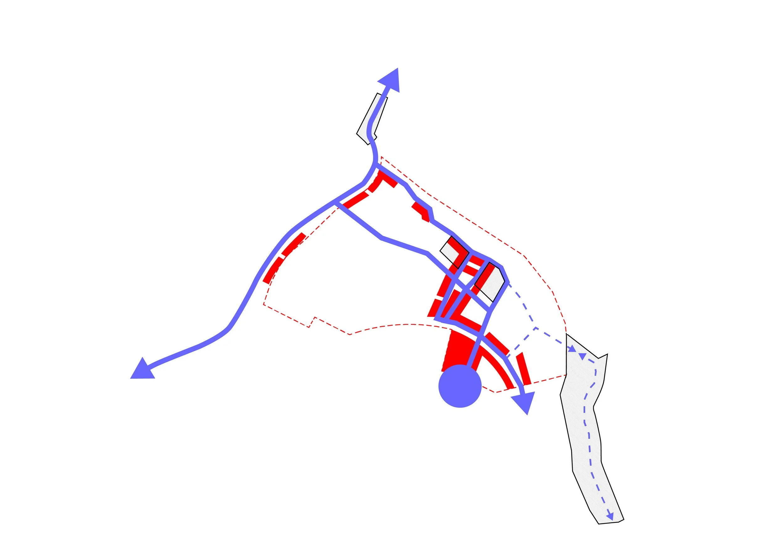
This interconnectivity emerges through the four Design Strategies, each addressing a specific plan component. The four strategies build on each other, starting with the landscape. The landscape is the point of departure for the plan, centred on the escarpment and the lake, and building ecological connections across the site. Maintaining or improving the site's ecological performance is a critical value that will shape the project’s identity and character.
Once a foundation was set, the plan looked at the transportation network, the enabling device. The values outlined for the plan could be reached without a clear vision of how transit will operate to and from the area and through the site. The design for a pedestrian-oriented project further reinforces the importance of transportation.
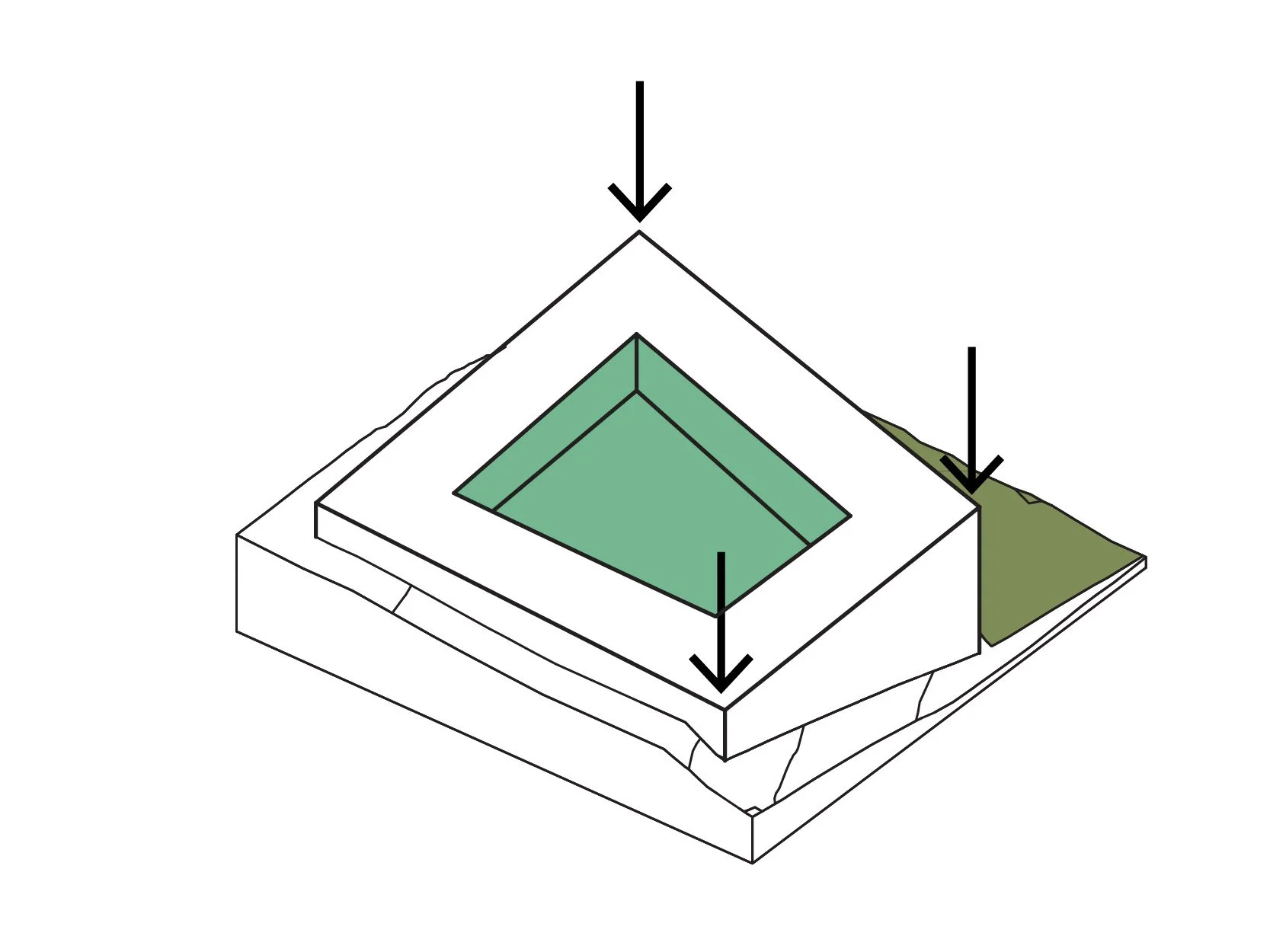
With access to the site, the plan then looked at ways to foster urban vitality. Just as the plan places a high value on ecological performance, it also demands that it provide WFN with an economic and cultural centre for the IR 10 that can provide jobs and reinforce WFN traditions into the future.
Only after these pieces are in place does the plan finally look at the community that will ultimately call The Bluffs home. Great neighbourhoods in great cities of the world all offer access to both natural and urban amenities. New York has Central Park, Vancouver has Stanley Park, and even Hong Kong, one of the world's most densely populated cities, depends on surrounding natural reserves to make it livable.
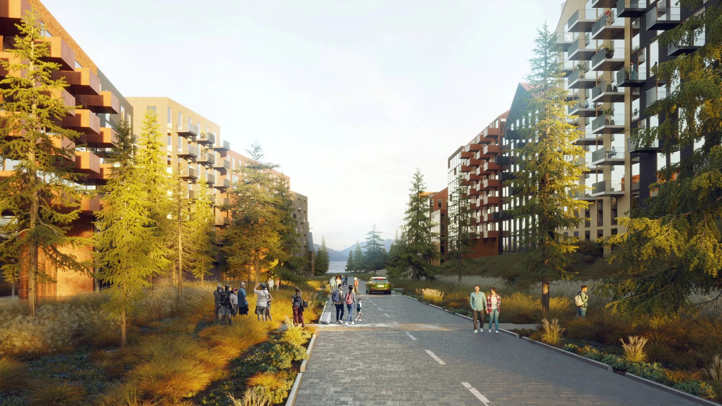
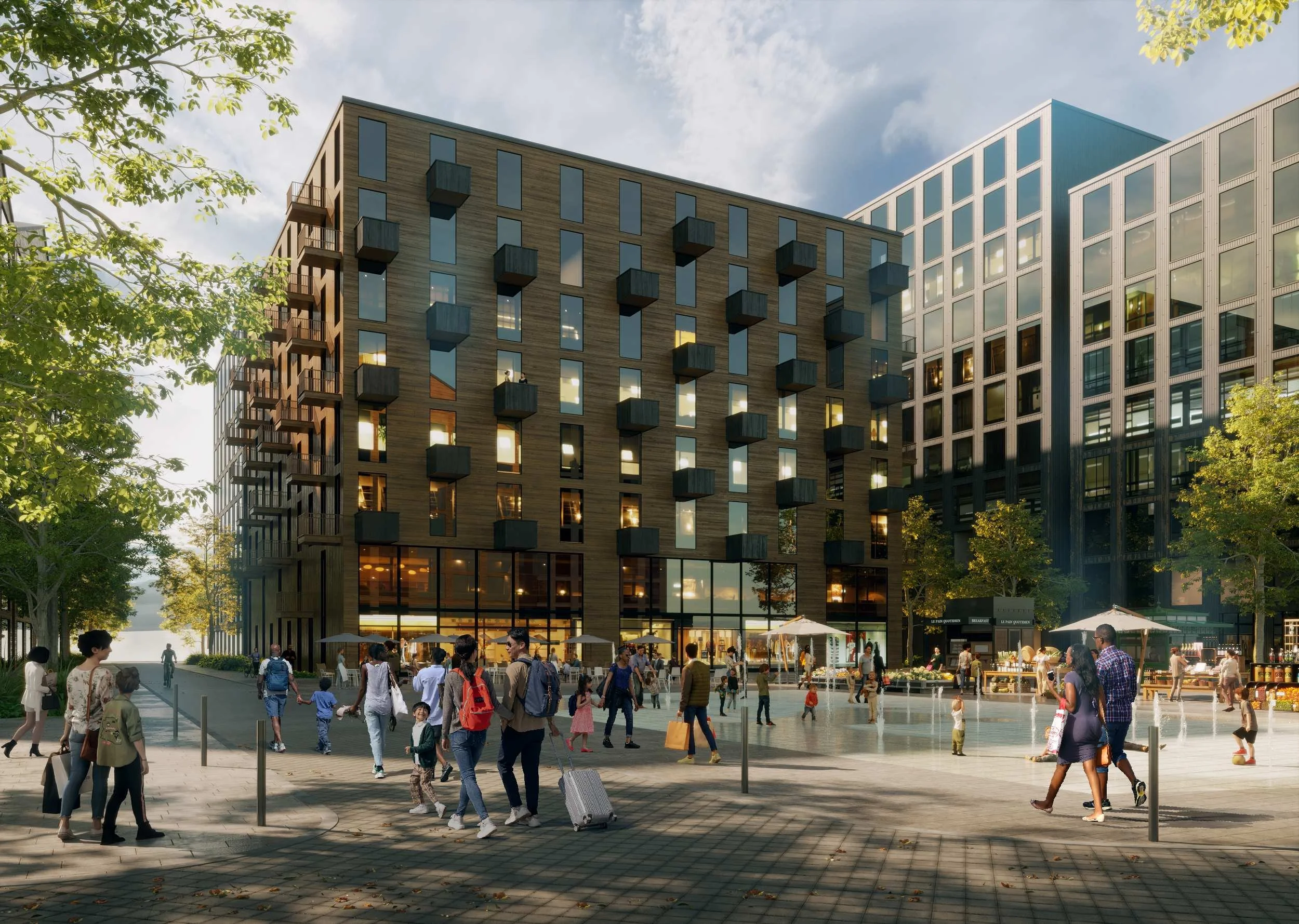
Only after those connections are made can the plan turn to make world-class housing that sets a new standard for 21st-century living. For too long, single-family housing has been the focus of North American housing. Denser housing typologies have been seen as substandard options, accepted because of lower prices or better access to amenities. The Bluffs aims to provide highly adaptable, high-quality housing with access to natural ventilation, daylighting and views across the Central Okanagan landscape.
Furthermore, the plan lays out a pathway to ensure that the options provide housing to the entire cross-section of society, across the continuum, recognizing that people of all types need to be welcome to make a place like The Bluffs successful.
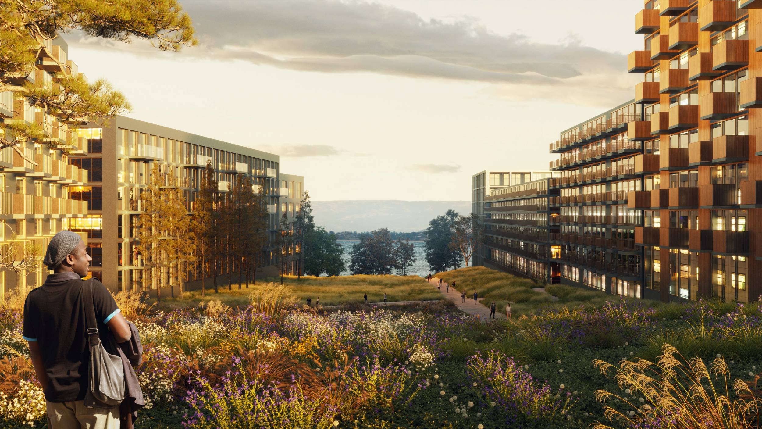
The Bluffs offers authentic Okanagan landscapes in managed urban settings.
The Framework
It was important that we recognized the plan as a framework, rather than a “master plan.” Implementation will occur over the years, and the project’s life will last much longer. No single plan can anticipate the changes our global societies and the Central Okanagan will face in that time. So, it is critical that the plan stay flexible to adapt to future uncertainty. Thus, the plan was more of a guide, with clear directions, than definitive choreography.
That said, it was also important that the plan provided a clear outcome based on a well-articulated vision. Even as the means to achieve the vision may change, the intention will not. Framework plans are not new. The risk with framework plans is that the vision is so poorly defined that the outcome fails to achieve the values behind the project. Therefore, we made sure the Plan presented a tangible vision for The Bluffs. Visual imagery, diagrams, and other drawings aim to convey a definitive design intent while acknowledging our volatile world
The Framework
AMPLYING THE ENVIRONMENT
On the WFN lands of IR 10, the natural and built environments can work harmoniously to create resilient, high-performance landscape systems, spaces, and cities through diligent, thoughtful stewardship of human and more-than-human resources. The value of reconciling the past with contemporary pressures lies in the chances to anticipate and advance resilient and equitable futures through responsive and adaptive planning and ecological design.
We aimed to consider both the spatial needs of the new human inhabitants and the requirements of local wildlife, ensuring safe passage and shelter for local animals. In doing so, we can maximize the potential of the Bluffs development to thrive, as it offers increased diversity in spatial and microclimatic conditions. Ultimately, we aspire to achieve the harmonious coexistence of plants and animals and to foster a relationship built on mutual respect and reciprocity.
So, the Bluffs Neighbourhood Plan sets out a series of design strategies to engage both the traditional, living histories of the Okanagan Valley and the various specific policy and cultural frameworks guiding current and future development in IR 10 and West Kelowna.
From an environmental perspective, the Bluffs Plan considers the spatial needs of new inhabitants, the site's specific geotechnical and hydrological constraints, and the requirements of local wildlife, ensuring safe passage and shelter for area animals to maximize the diversity of spatial and microclimatic conditions. Ultimately, we aspire to achieve the harmonious coexistence of human and non-human inhabitants and to foster relationships built on mutual respect and reciprocity among these groups.
DESIGN APPROACH 1
Steward Sensitive Ecologies
The Central Okanagan basin of British Columbia is an area of great ecological significance within both the Province of BC and Canada as a whole. It is an area of high biodiversity value, with many rare and endangered plant and animal species, ecological communities, and sensitive ecosystems. The new Bluffs landscape promotes strategies to enhance these special communities and enhance ecological productivity in and around the neighbourhood.
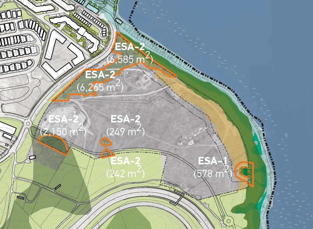
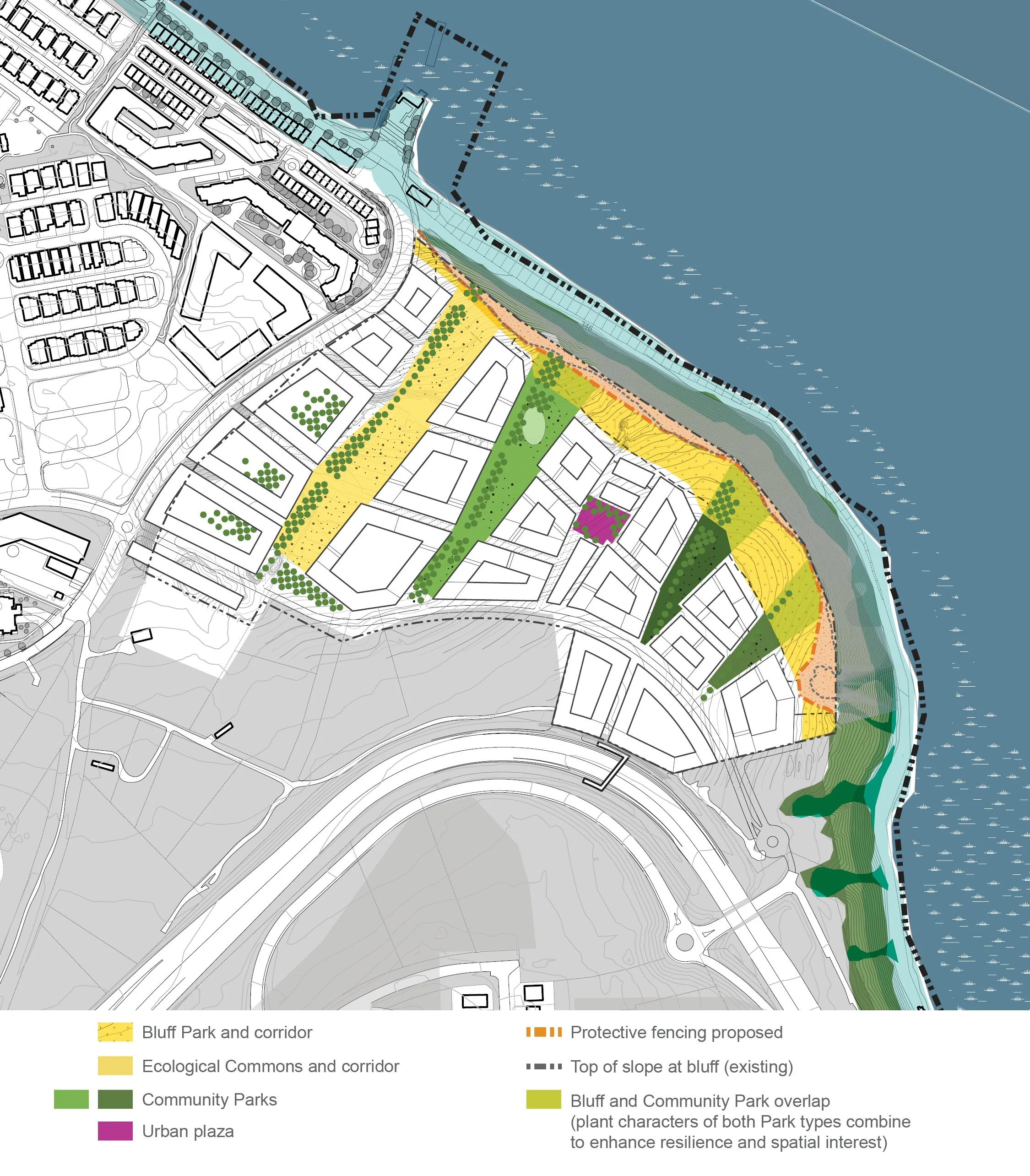
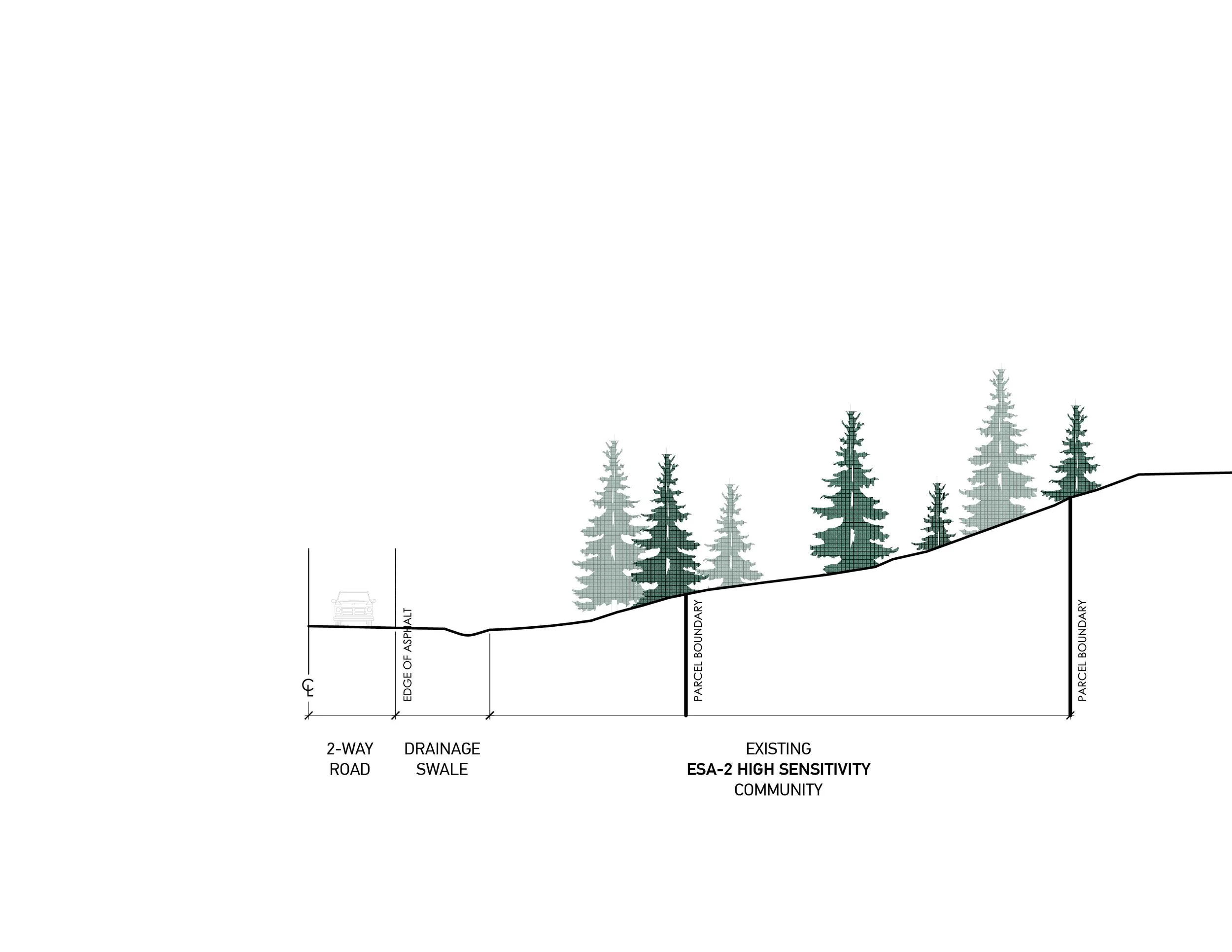
1. Avoid, retain, protect (ESA-1) Proposed development activities (clearing, grading, etc.) associated with the Bluffs Plan avoid the most sensitive areas of Very High (ESA-1) environmental value. This area is to be preserved and protected during all phases of implementation, with fencing to establish a 10 m buffer and, as part of the possible linear bluff park, additional buffer planting where feasible.

2. Impacted areas (ESA-3 and -4) Areas of “Moderate” value are most impacted by the proposed development layouts. Planning, design, construction, and/or operation of work for the Bluffs Neighbourhood Plan aims to minimize potential adverse effects on sensitive habitats, including adjusting construction sequences or timing and using construction or operational methods that minimize changes to habitat attributes and functions.
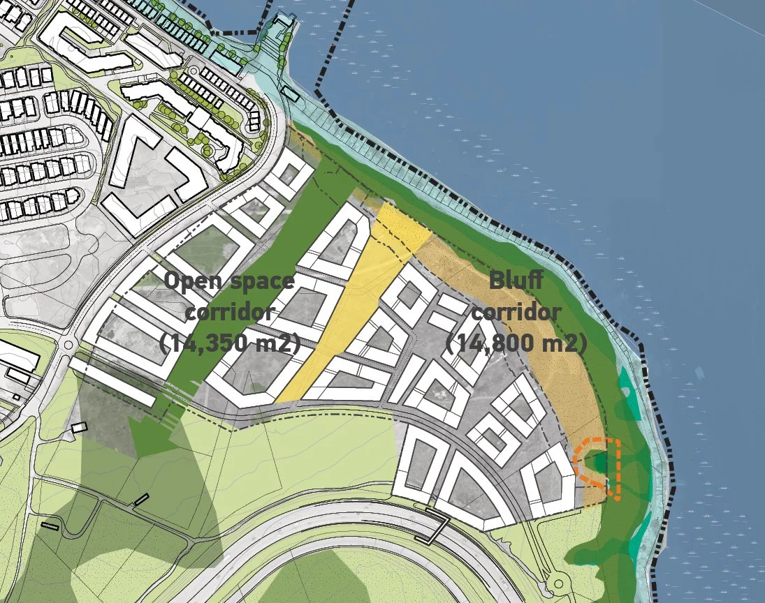
3. Compensate (ESA-2) Where avoidance and mitigation techniques are not adequate to maintain habitats or ecosystems affected by the development, especially at remnant ESA-2 areas, the Bluffs will replace natural habitat and features or increase the productivity or function of existing habitat or ecosystems, particularly at the major Ecological Commons and Open Space Corridor.
DESIGN APPROACH 2
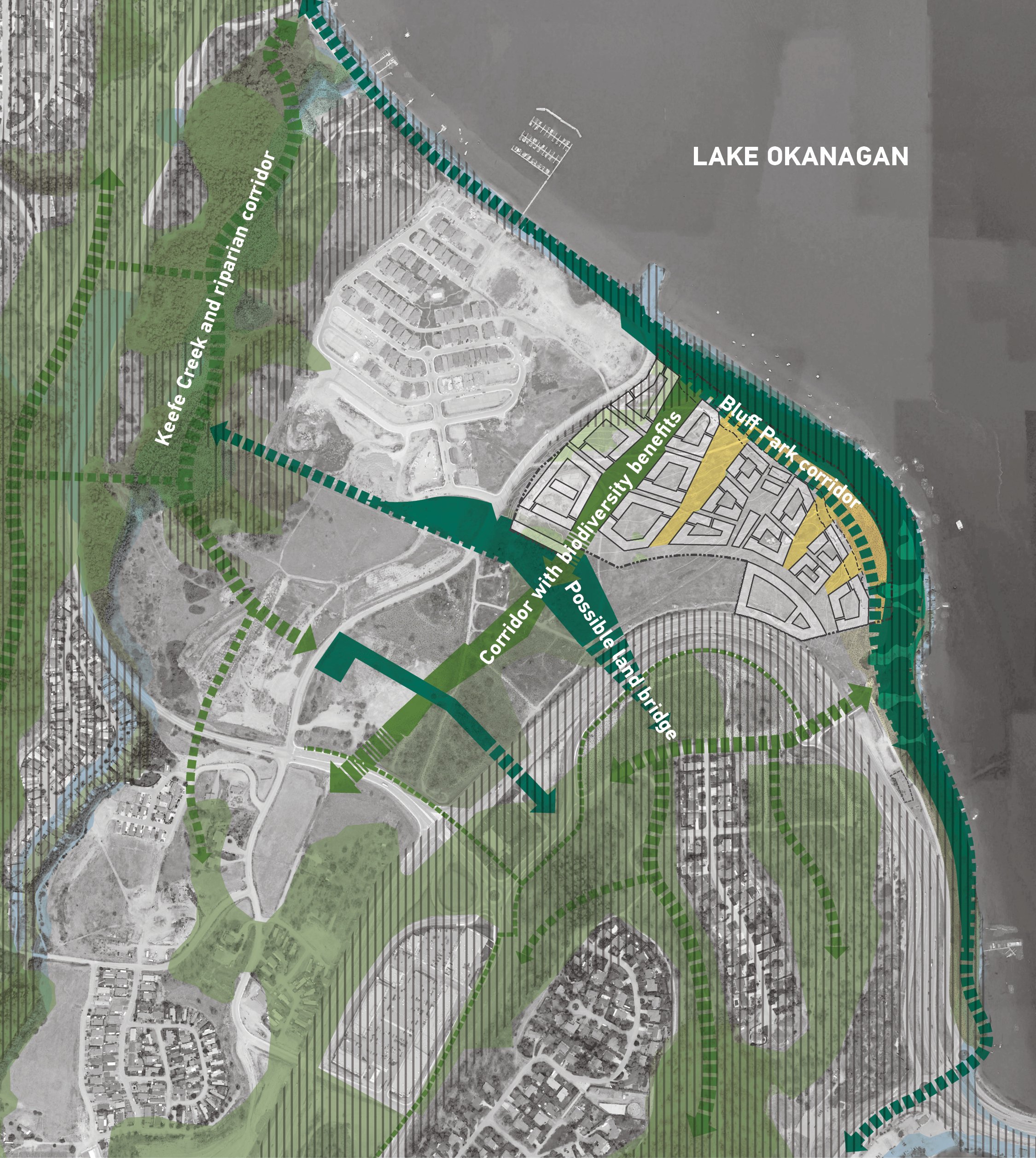
Connect & Create Corridors for Multi-Species Connectivity
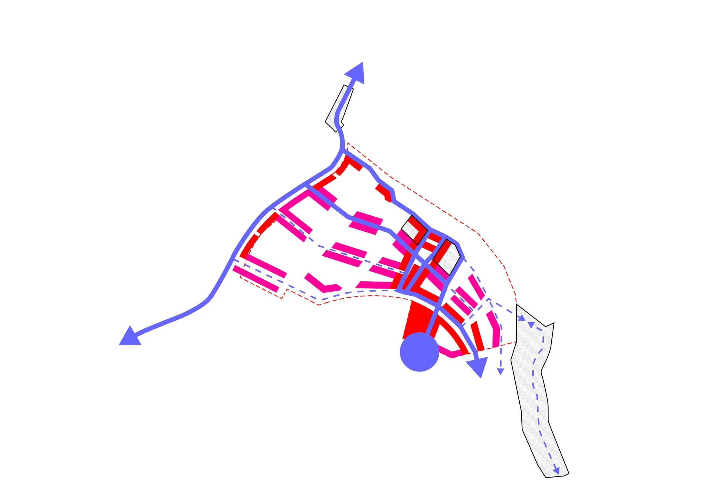
The Bluffs Plan understands connectivity across time, space, and species. Habitat and ecosystem links will primarily be supported by land stewardship, habitat balance, and ecological design components of Design Approach 1. So, while adjacent urban development and infrastructure have fragmented natural habitats, the Bluffs Plan proposes replacing and enhancing existing communities with rich, diverse landscape types and experiences.
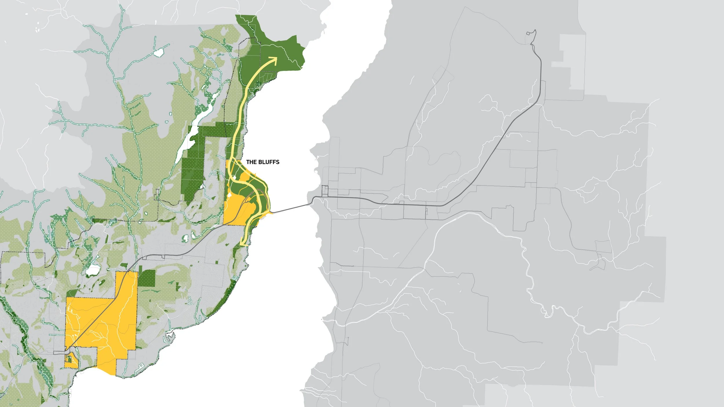
The Regional Green Network
DESIGN APPROACH 3
Increase Biodiverse Communities
Given the centrality of water to syilx culture and the region's dry climate, water will play a crucial role in the Bluffs’ current planning and future management. To maximize biodiversity, the neighbourhood will aim to construct new urban wetlands and meadows to expand the range of plant types and landscape experiences, and to shape new spaces for a range of human and non-human visitors.
The site lies within the dry Ponderosa Pine zone, just below the larger, dry Interior Douglas Fir zone that characterizes the low to mid-elevations of the Southern Interior. This zone consists of a mosaic of grassland, forests, and wetlands in the valleys of the Southern Interior. The young Ponderosa pine (Pinus ponderosa) woodland ecosystem is Blue-Listed in British Columbia, as “an ecosystem of special concern.” It’s a small but important stepping-stone for wildlife movement in an otherwise highly fragmented landscape.
To support ecological strategies for the Bluffs, the Ecological Commons acts as a primary landscape “window” to the lake and compensates for the loss of the Ponderosa pine woodland by linking the bluff with edge forests beyond NP 10-4, facilitating wildlife movement and providing refuge for birds and small mammals. In the Ecological Commons, these and other regional native plants will bring broader Okanagan landscapes into primary Neighbourhood public spaces. Native plants selected with attention to local biogeoclimatic and cultural values will, wherever possible, create productive habitats for wildlife and vibrant experiences for humans.
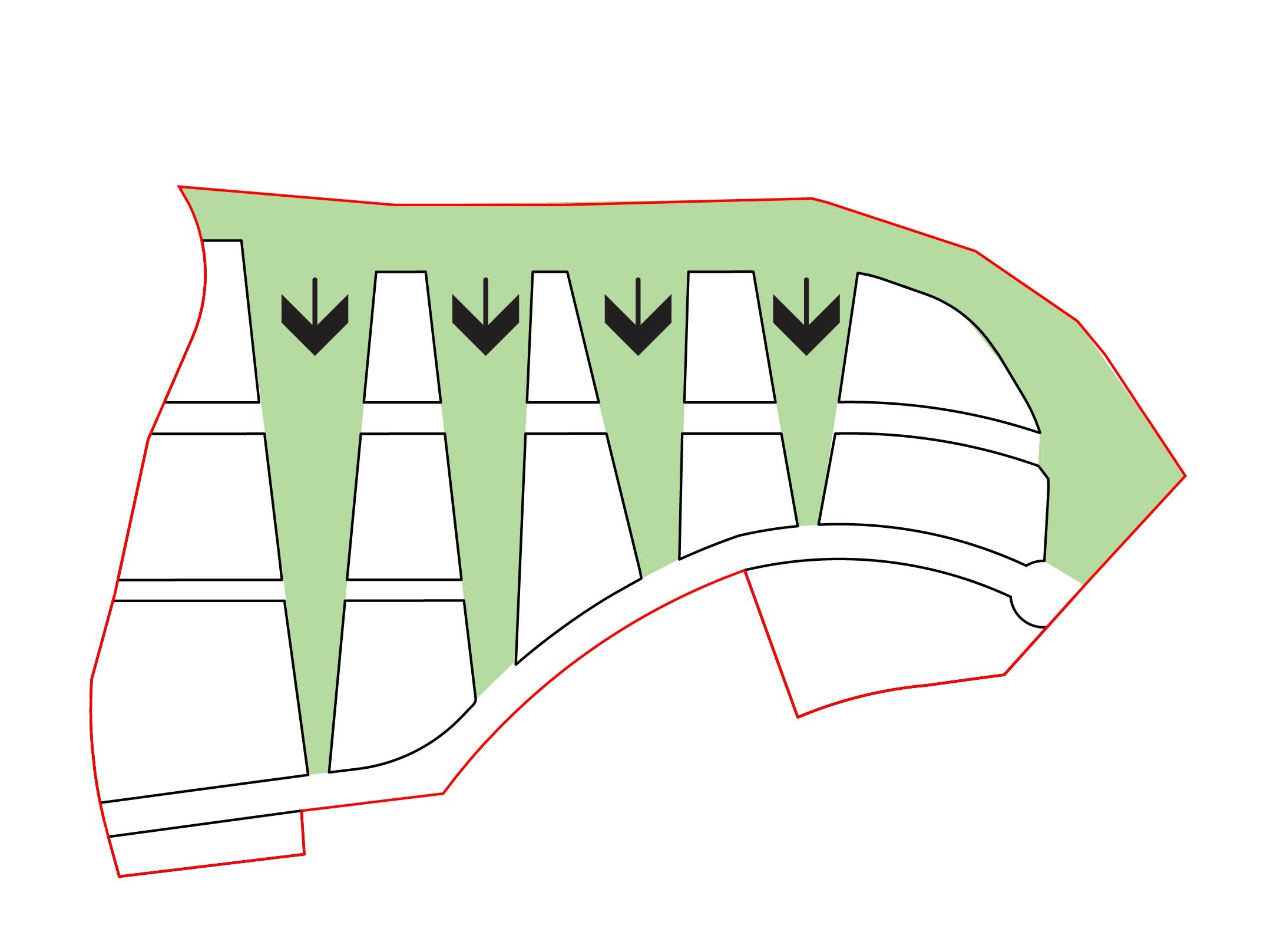
The several hydrogeological constraints of the Bluffs terrain, such as its steep slopes, low infiltration capacity, and reduced nutrient-holding capacity, offer opportunities to curate and restore a hyper-local ecological community. The Plan modelled its water strategy on natural regional water landscapes and management strategies, such as wetlands, wet meadows, rain gardens, and bioswales. This notion depends on translation into a network of water infrastructure, with streets collecting and moving stormwater to public space nodes and sub-grade storage locations.
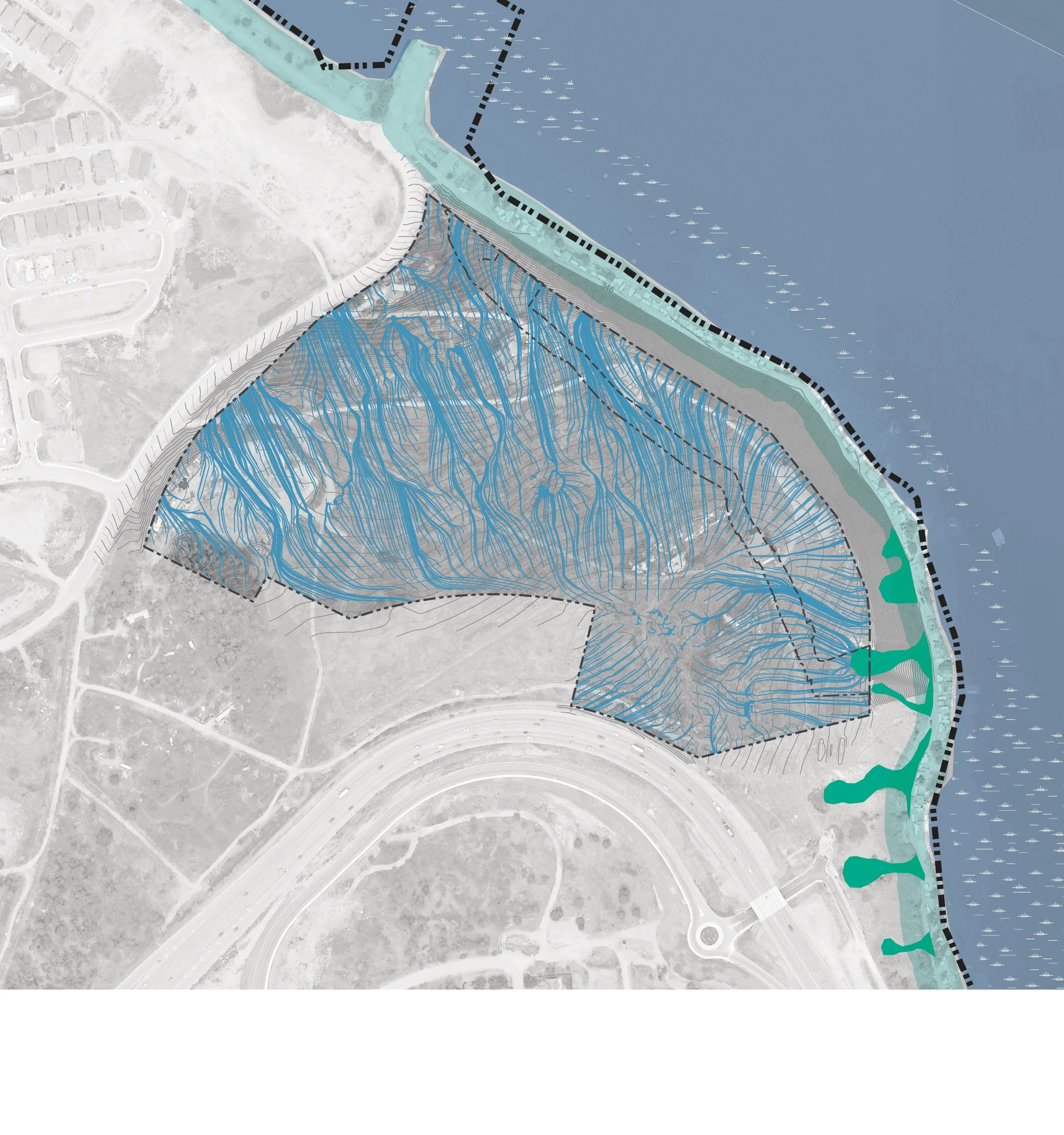
Existing Drainage
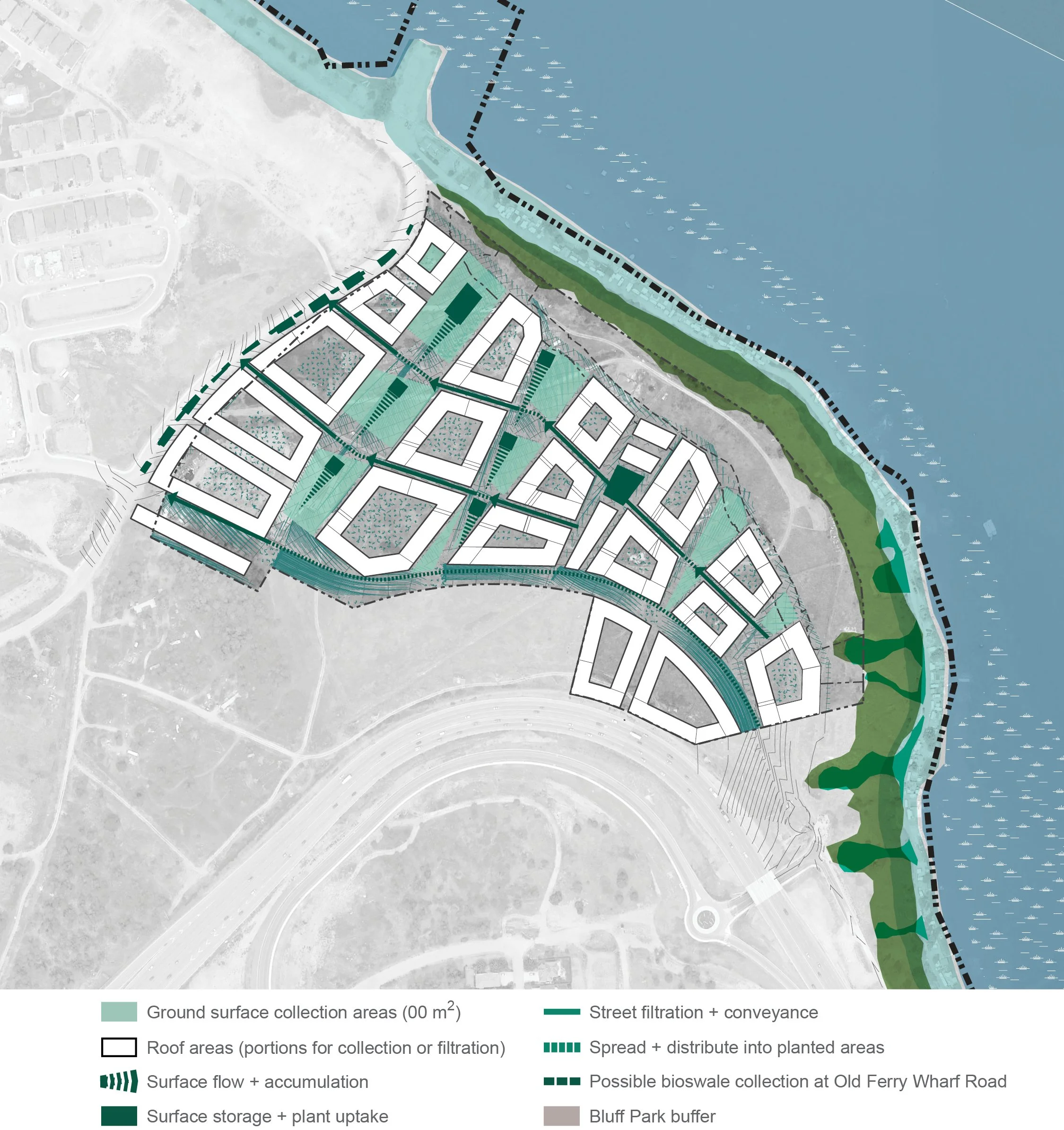
Proposed Drainage
DESIGN APPROACH 4
Introduce Wild Urban Landscapes
In our increasingly connected, globally oriented world, and in response to the uncertainty of climate change, cities are seeking landscape strategies that increase durability, reduce maintenance costs, and offer adaptability and flexibility. Unfortunately, too often this creates a sort of “sameness” and “flatness” in much of our urban experience. The North American turfgrass lawn, and its migration into and ubiquity within the medians and parking verges of our cities, exemplifies this situation.
On the other hand, the interacting forces of urbanization, globalization, and climate change have also led to novel plant associations that can be understood as the de facto native vegetation of the city. Such plants reflect the city’s socioeconomic history and anticipate its future trajectory. In most modern cities, native vegetation that originally occupied the site is long gone. Urban, recreational, and grazing pressures, along with invasive plant species, have caused the loss of many important habitats for at-risk species in the Central Okanagan. Numerous at-risk plant species occur in the PPxh1 and occupy a variety of habitats, including shrub-steppe, grasslands, rock outcrops, wetlands, saline areas, and shoreline habitats, including showy phlox (Phlox speciosa) and Ute lady’s tresses (Spiranthes diluvialis).
In its place, one typically finds a cosmopolitan array of species—some planted intentionally, some growing spontaneously—that are adapted to the ecological conditions created by the city itself. In these situations, “wild” urban landscapes hold significant value, from improved ecological services to new sensibilities about beauty.
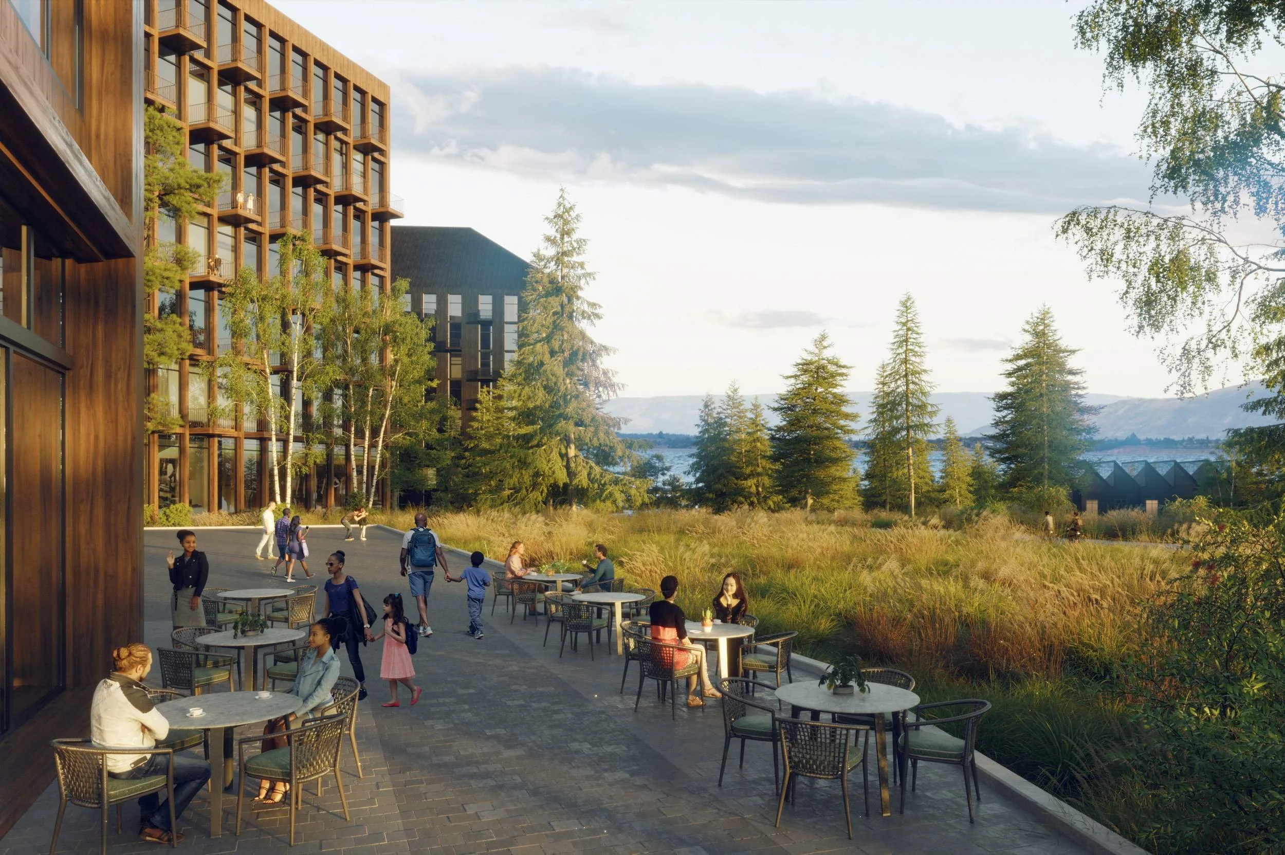
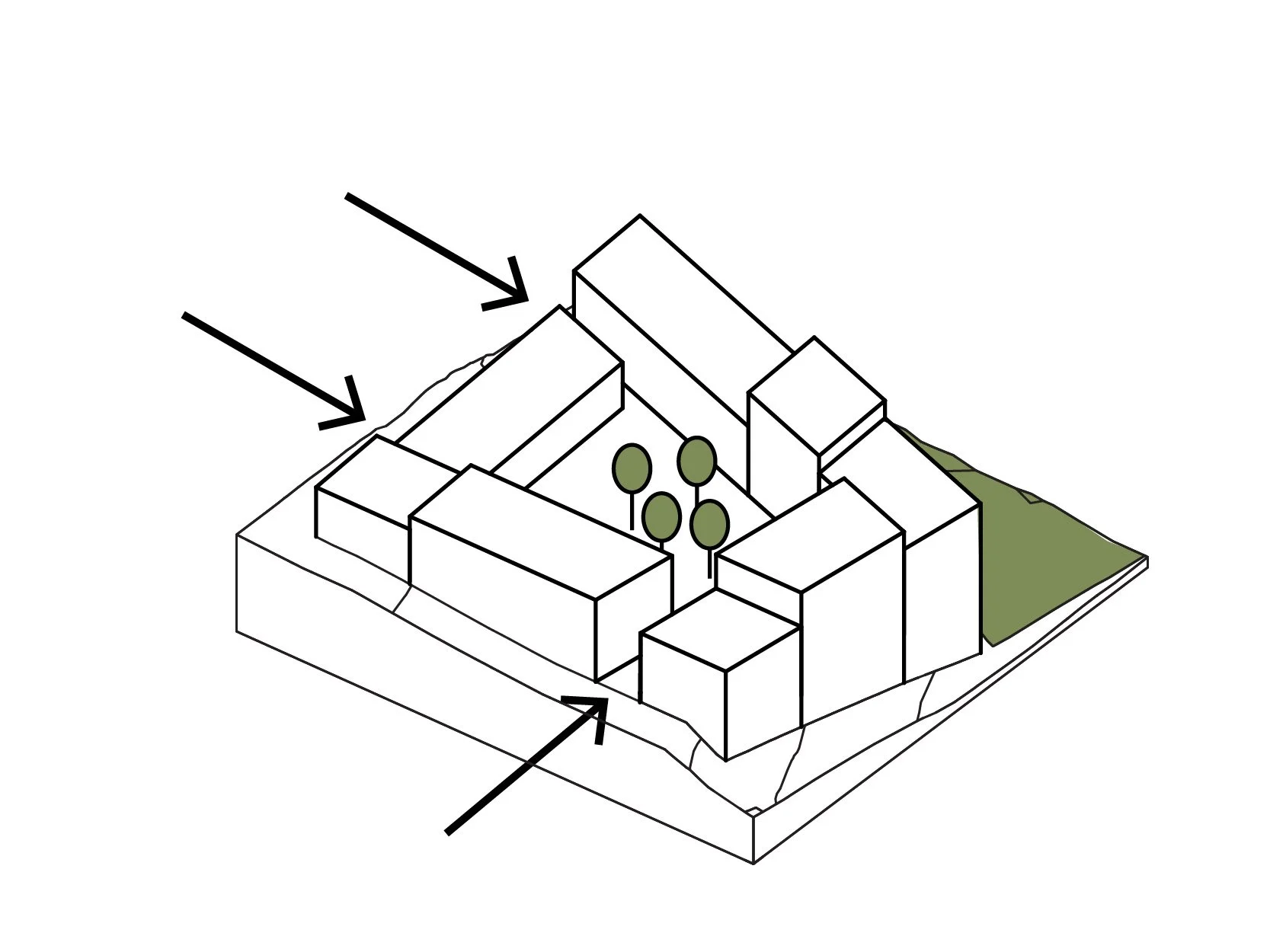
Across the Neighbourhood, semi-private courtyards offer space for a range of activities and shared experiences. Native plantings carefully integrated with social amenities and play spaces provide a range of new park types that expand public-space offerings in IR 10 and shape diverse spaces that can be accessed through a series of clear and nuanced connections that negotiate from the surrounding streets and urban squares into spaces for rest, gathering, play, and other rituals of daily experience. These new shared spaces highlight the diverse programming, plant forms, and landscape types of the expanded community, demonstrating a broader landscape language for urban ecologies and environmental relationships in the city.
Extending the emphasis on regional native plants, the street and trail networks offer chances to “shake hands with plants” in gracious, spacious, and educational opportunities within the Neighbourhood. In combination with the stormwater management strategy, the plant strategy uses a mix of recognizable regional natives and some plants that may be extending the limits of their native zones, in anticipation of changing climates and increased heat tolerance.
Base land plan
Prioritize views and experience
Shape new landscape and windows
Enhance ecological links
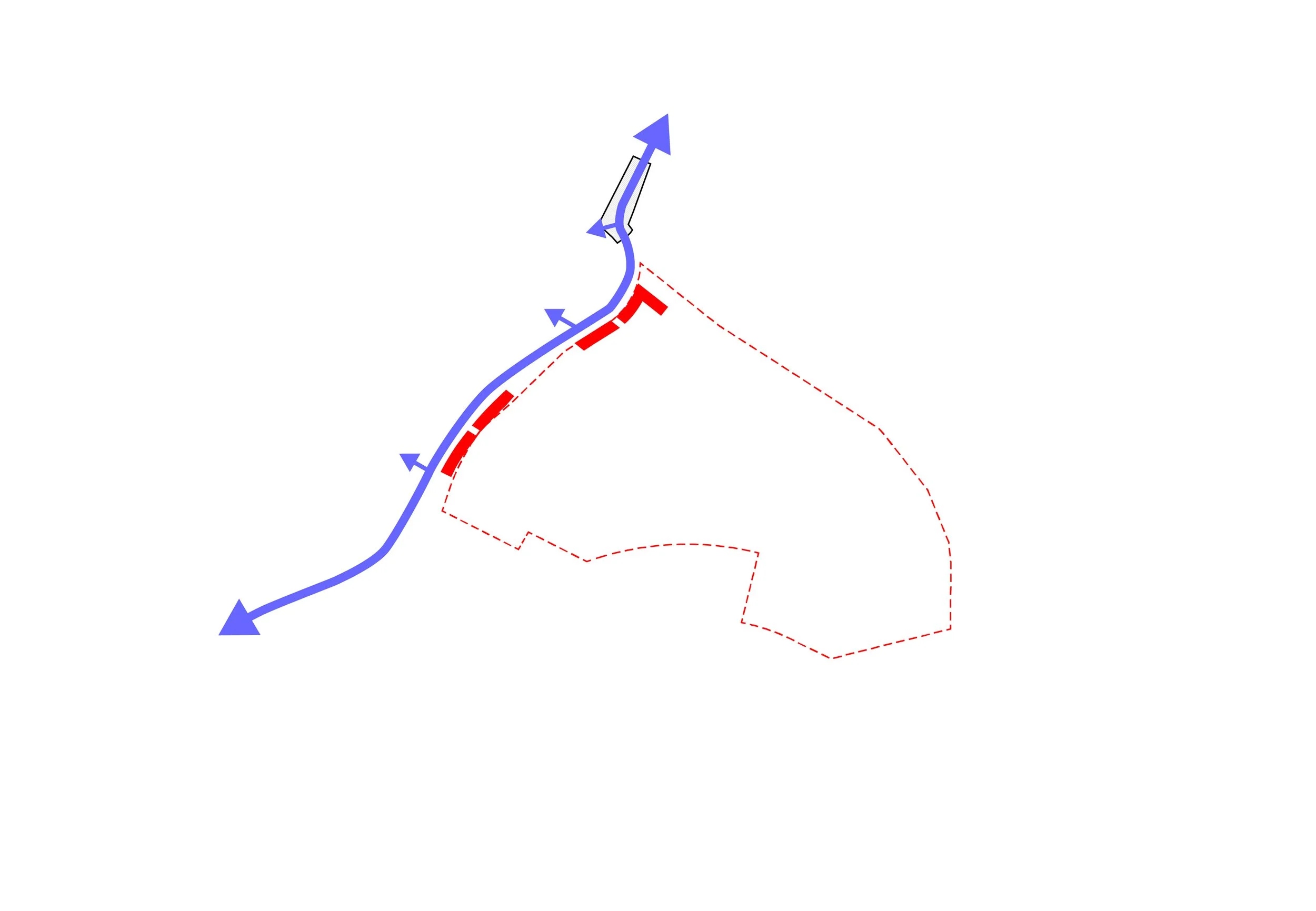
Regional Green Network
Regional Transportation Network
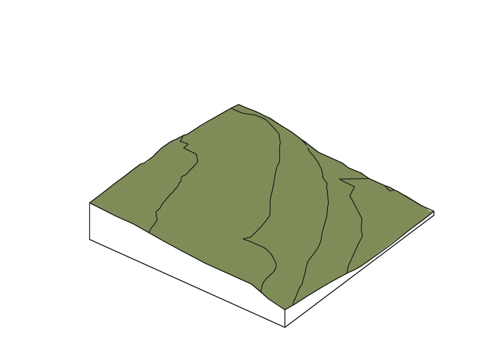
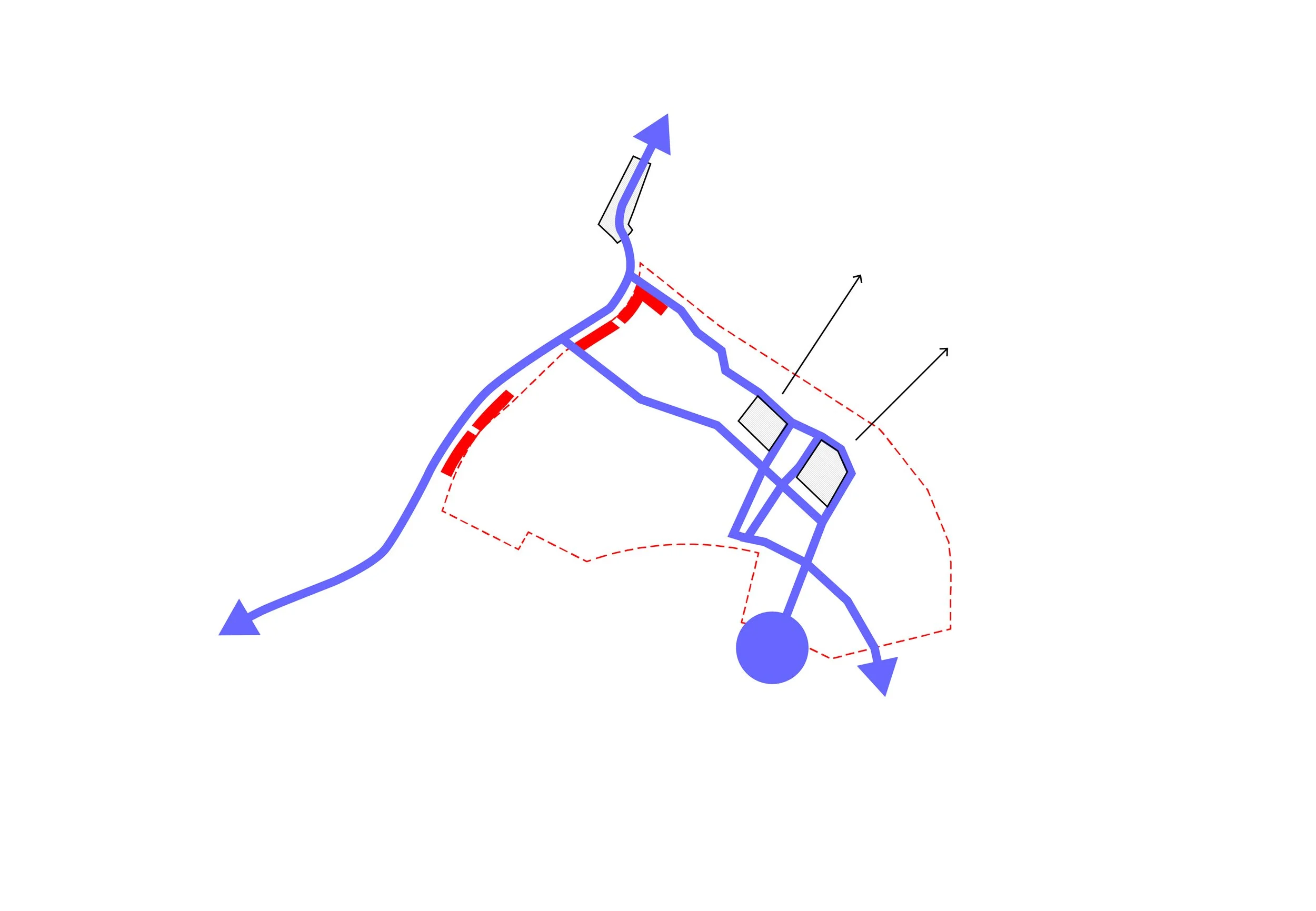
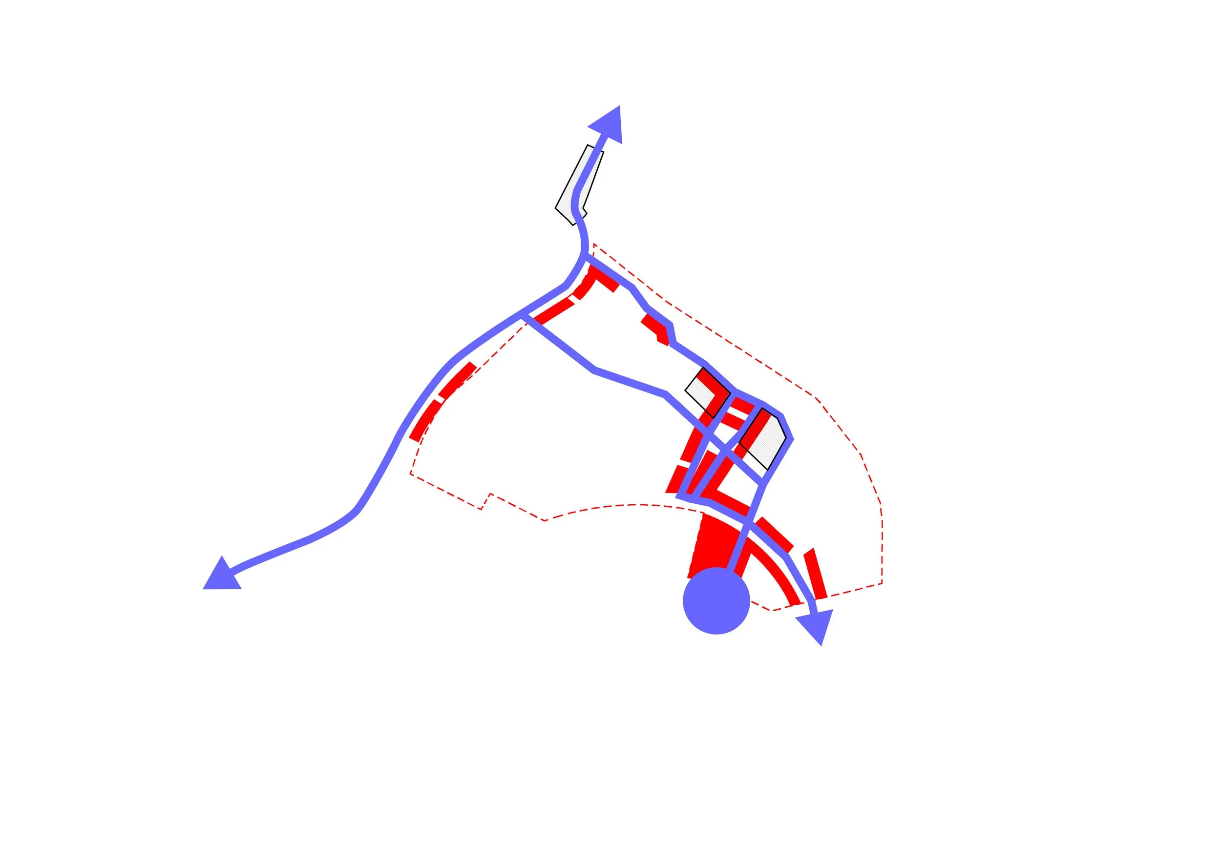
Existing Terrain

Establish limits
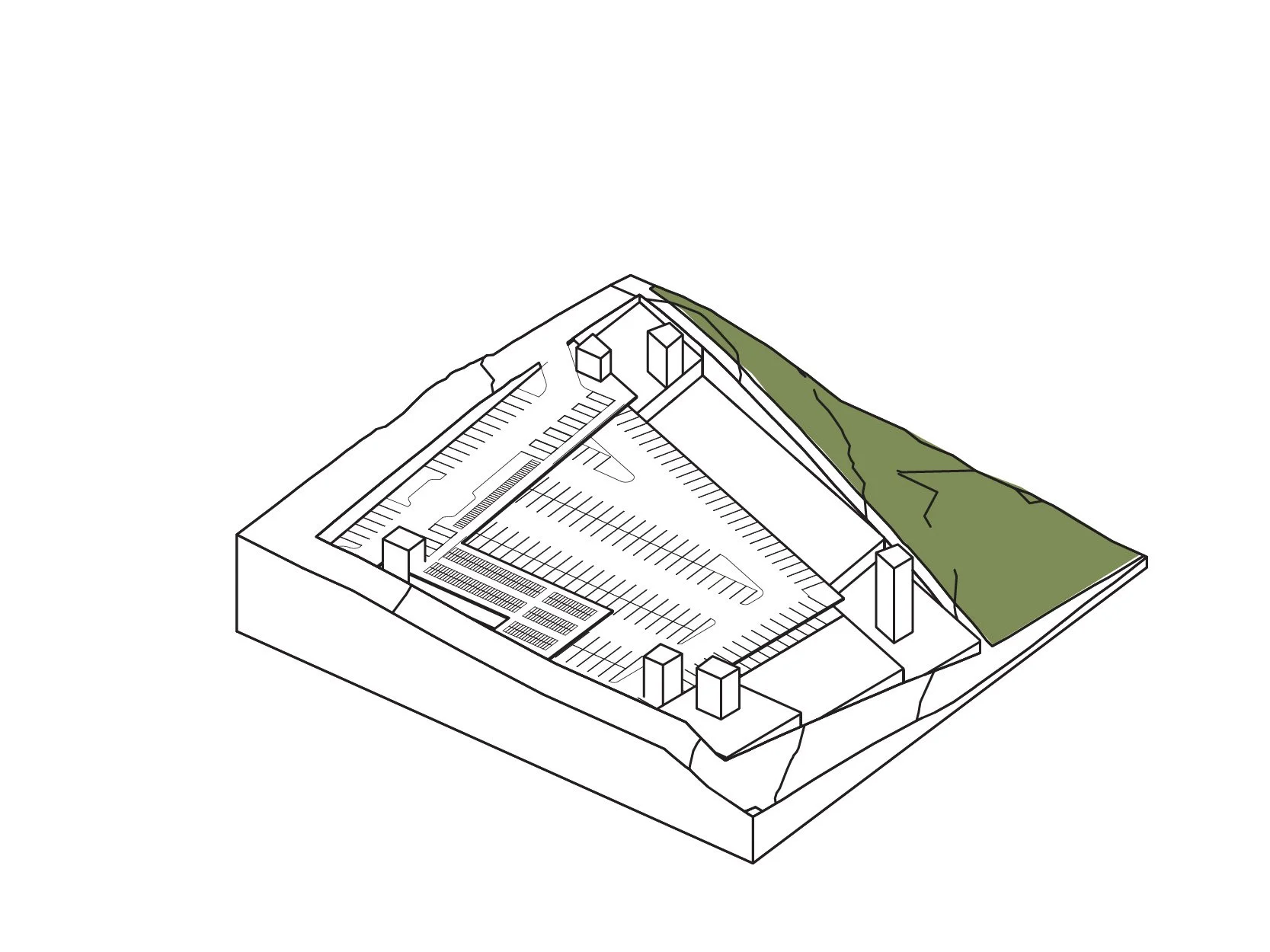
Excavate + construct parkade
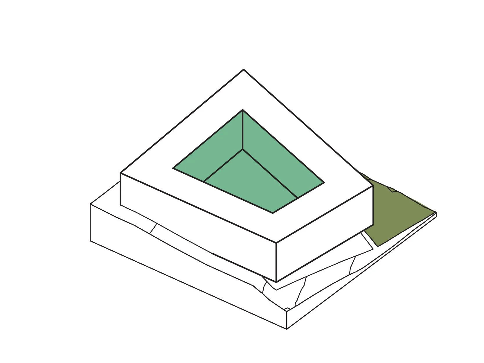
Establish primary massing
Adjust to environment
...and terrain
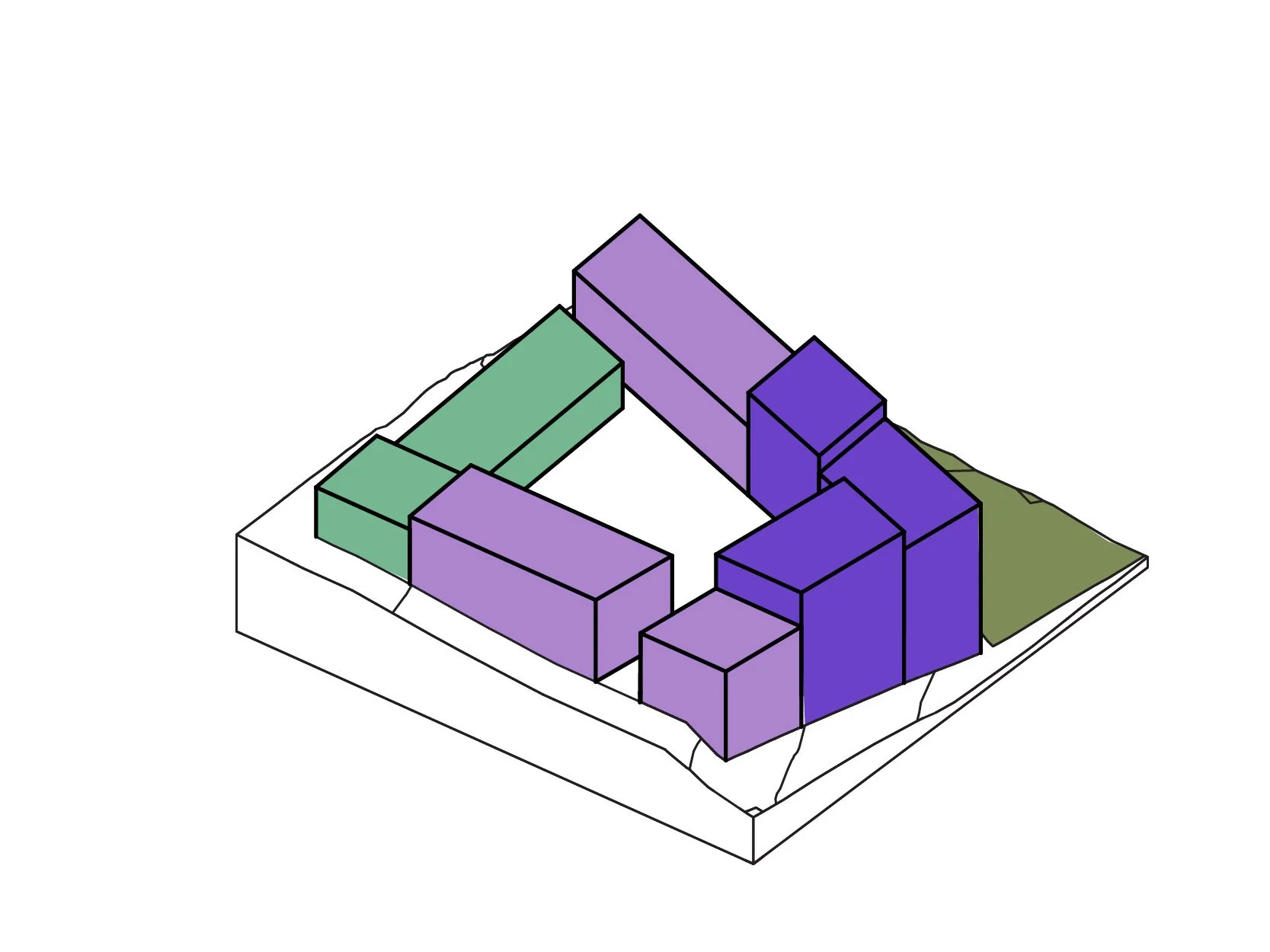
Perforate passages people
Connect to landscape
Responsible Density
To ensure a well-designed, high-performing public space, JIM revised the development's planning methodology. Rather than FAR and site coverage requirements, the plan consolidates open space into public parks and courtyards. The smaller lots are allowed 100% site coverage, with floor-height limitations to control solar access and scale.
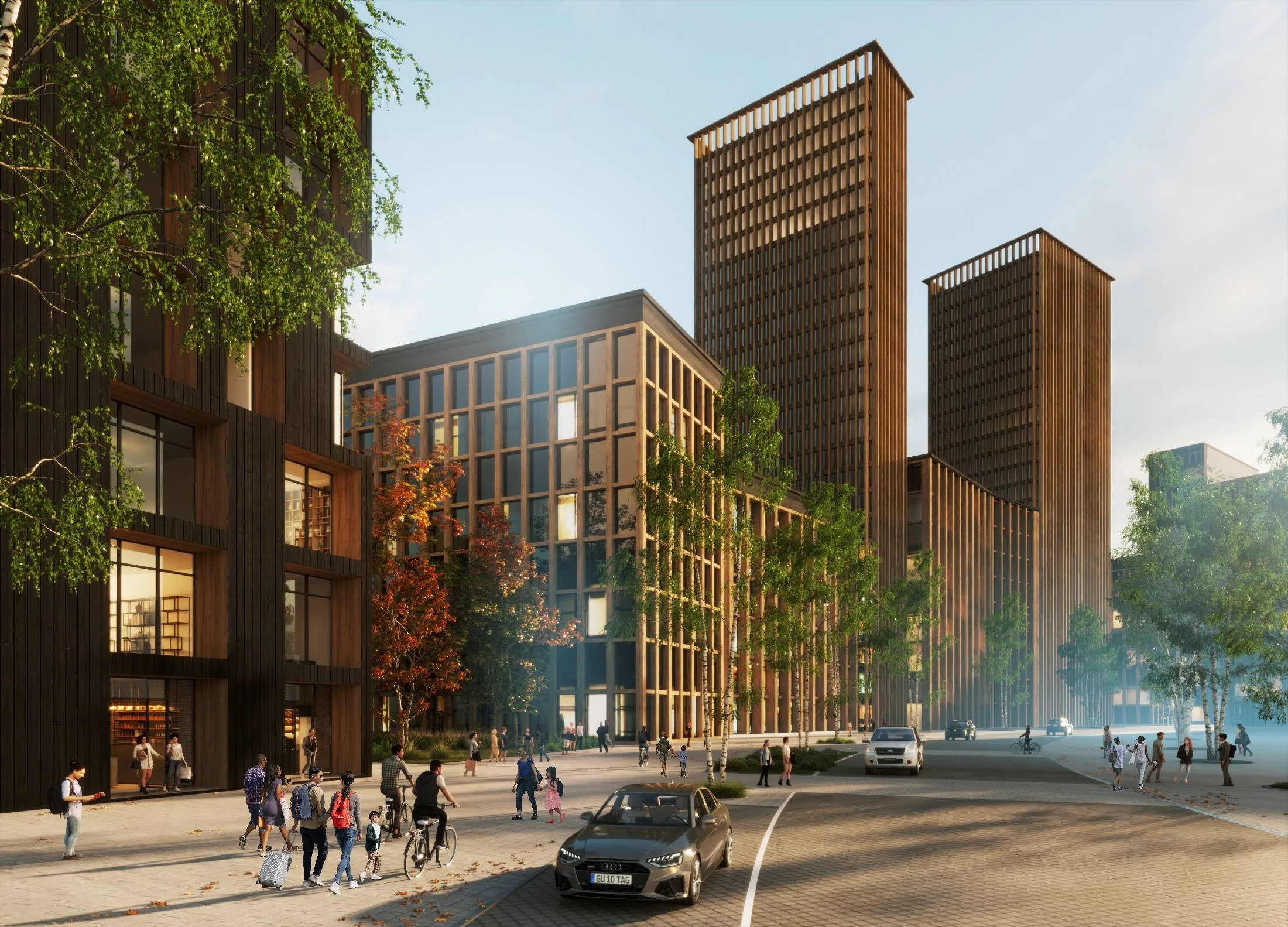
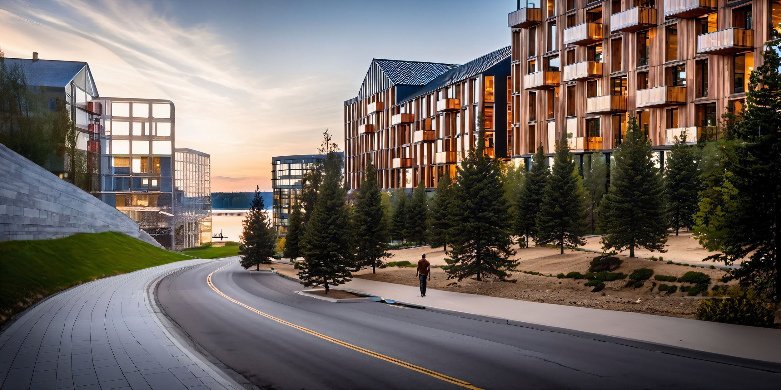
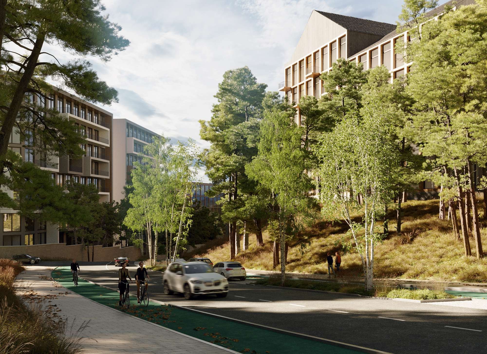
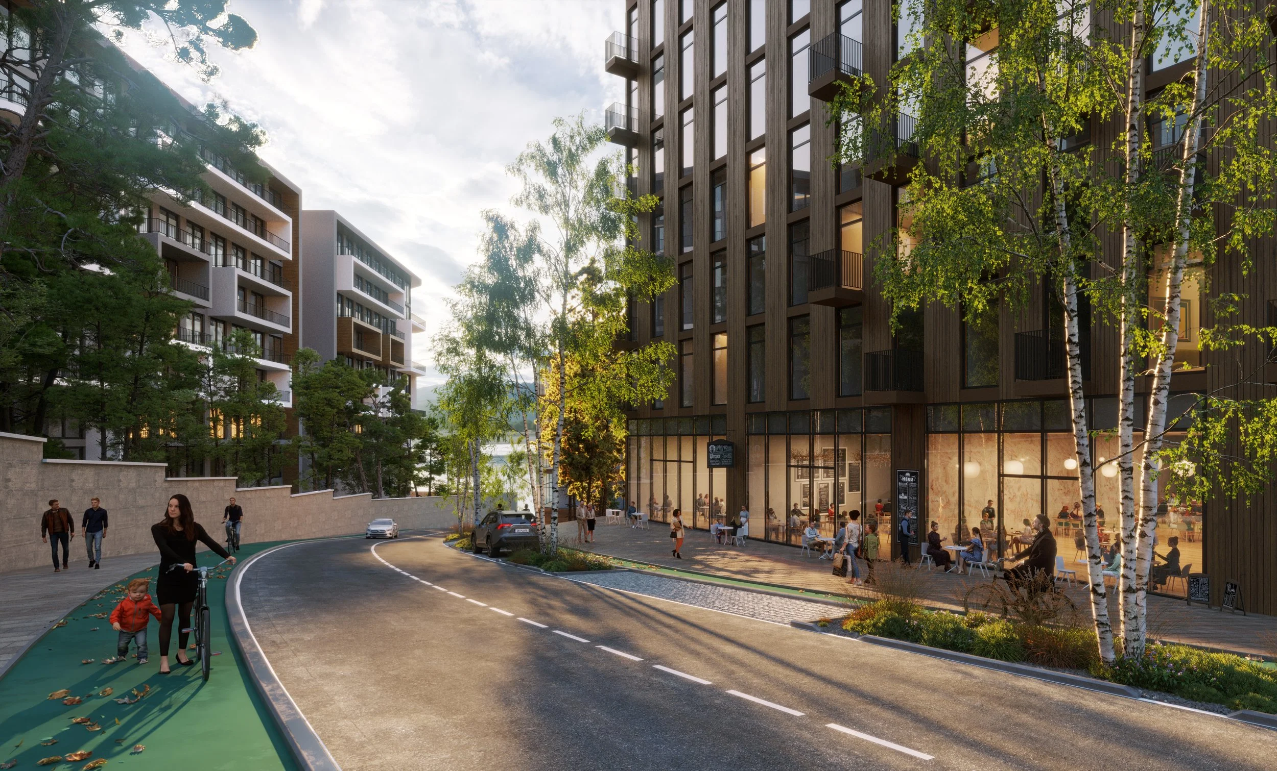
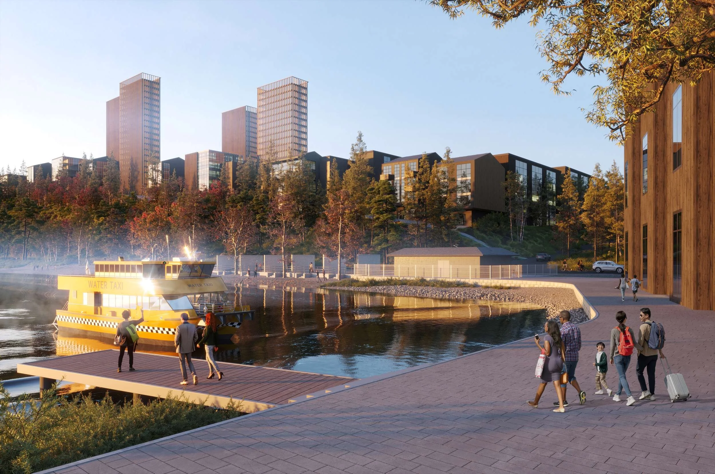
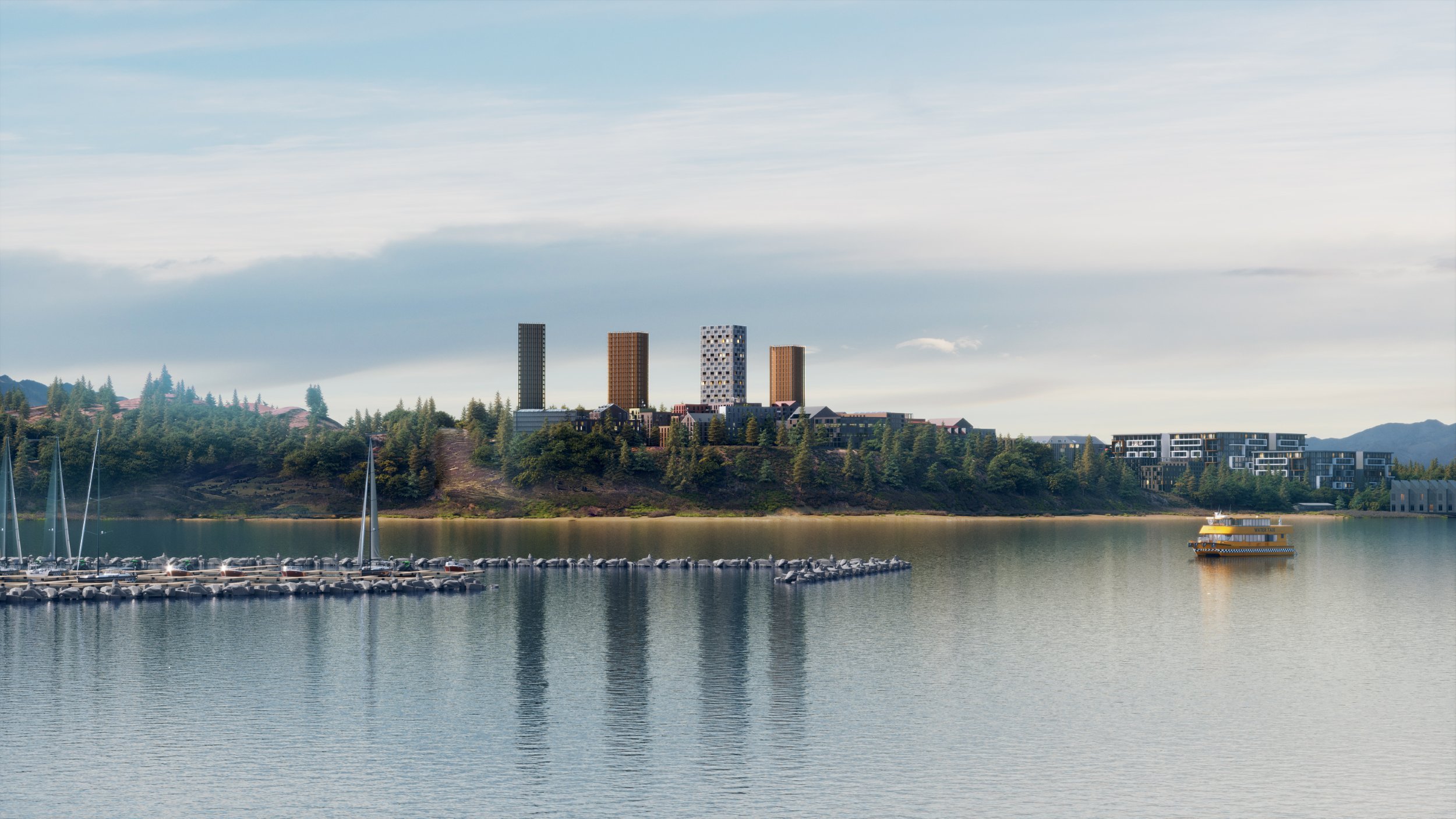
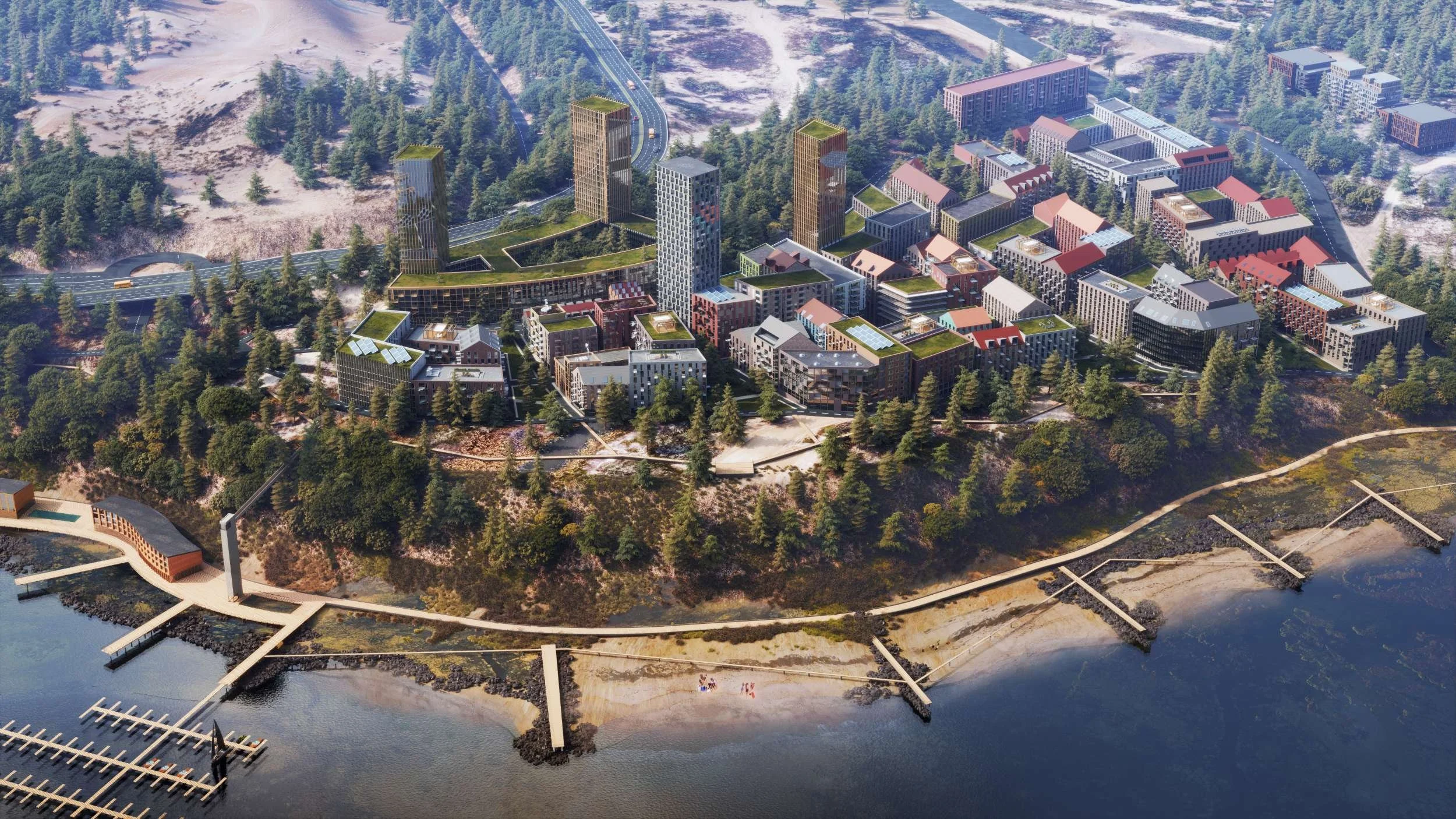
A new 16-hectare development with a comparable-sized park along the water on Westbank First Nation land, the Bluffs represents a new model for urban living in British Columbia—over four million square feet of mixed-use development, including a new community centre and park space. The dense buildings range from 3-story units to 28-story towers spread across the steeply sloping site. The buildings surround internal courts, while the dense blocks are separated by landscape corridors that connect the water to the forest. The development will include district energy and buildings designed using low-cost, passive technologies to achieve the highest sustainability standards while ensuring durability.
The Vision
Proposed land uses in the Bluffs Neighbourhood
Old Ferry Warf road
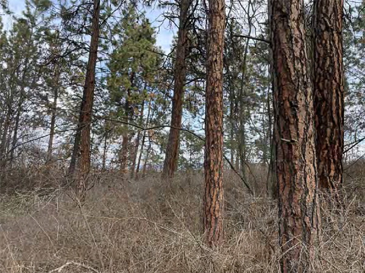
View within Polygon 10 (ESA-2 along Old Ferry Wharf Road) looking northeast
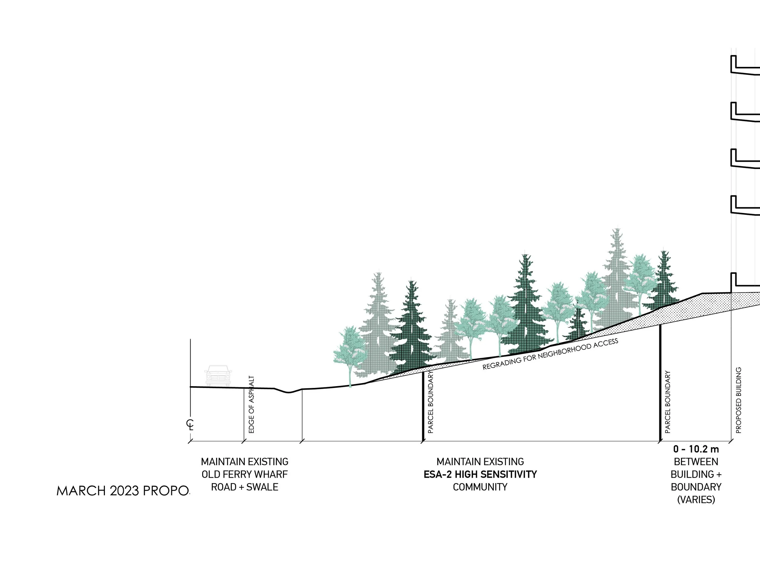
SCENARIO 1: landscape buffer Minimize impact on existing hillside and enhance as landscape buffer
SCENARIO 1: landscape buffer Minimize impact on existing hillside and enhance as landscape buffer
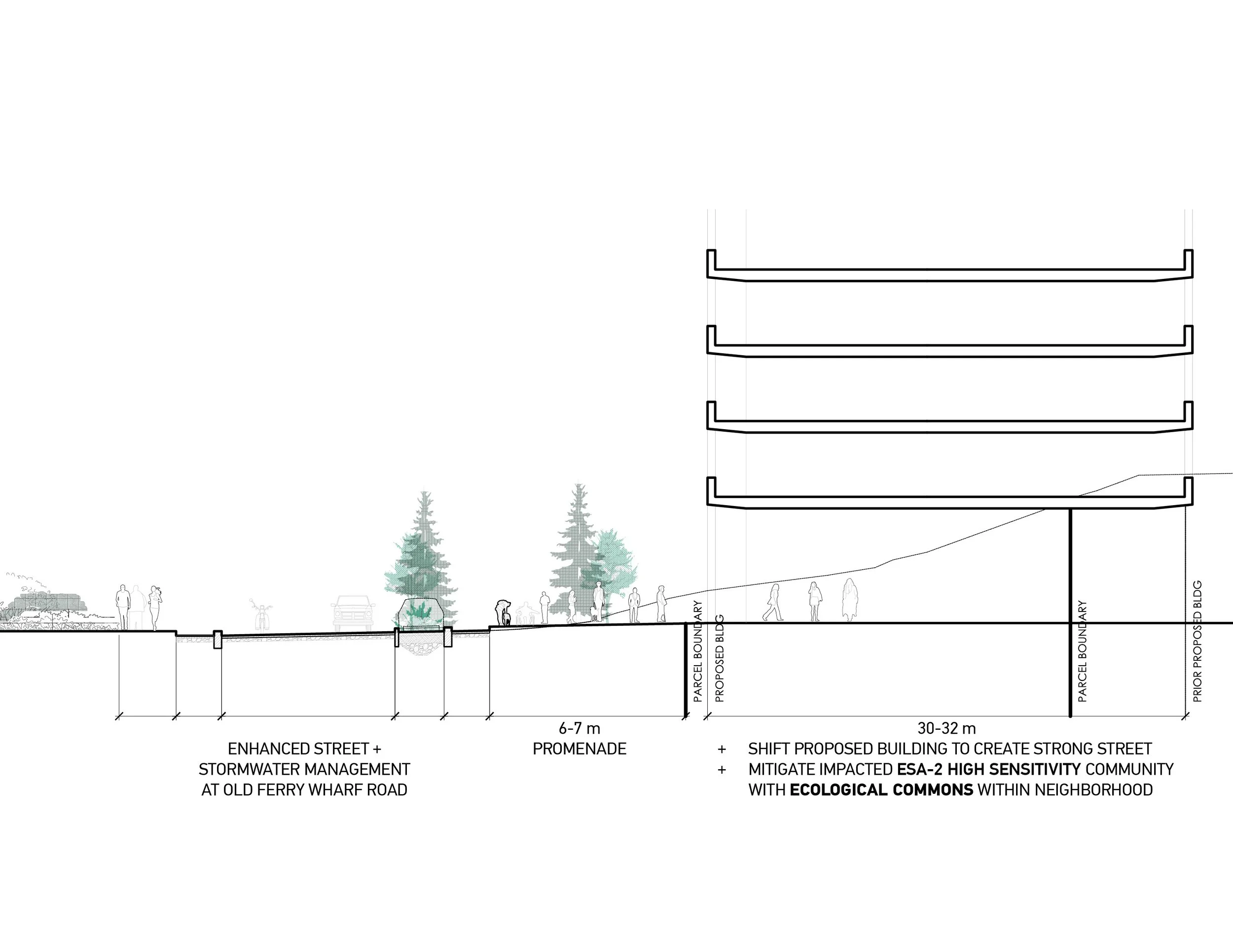
SCENARIO 2: Enhanced Street Add stormwater management and retail frontage promenade
SCENARIO 2: Enhanced Street Add stormwater management and retail frontage promenade
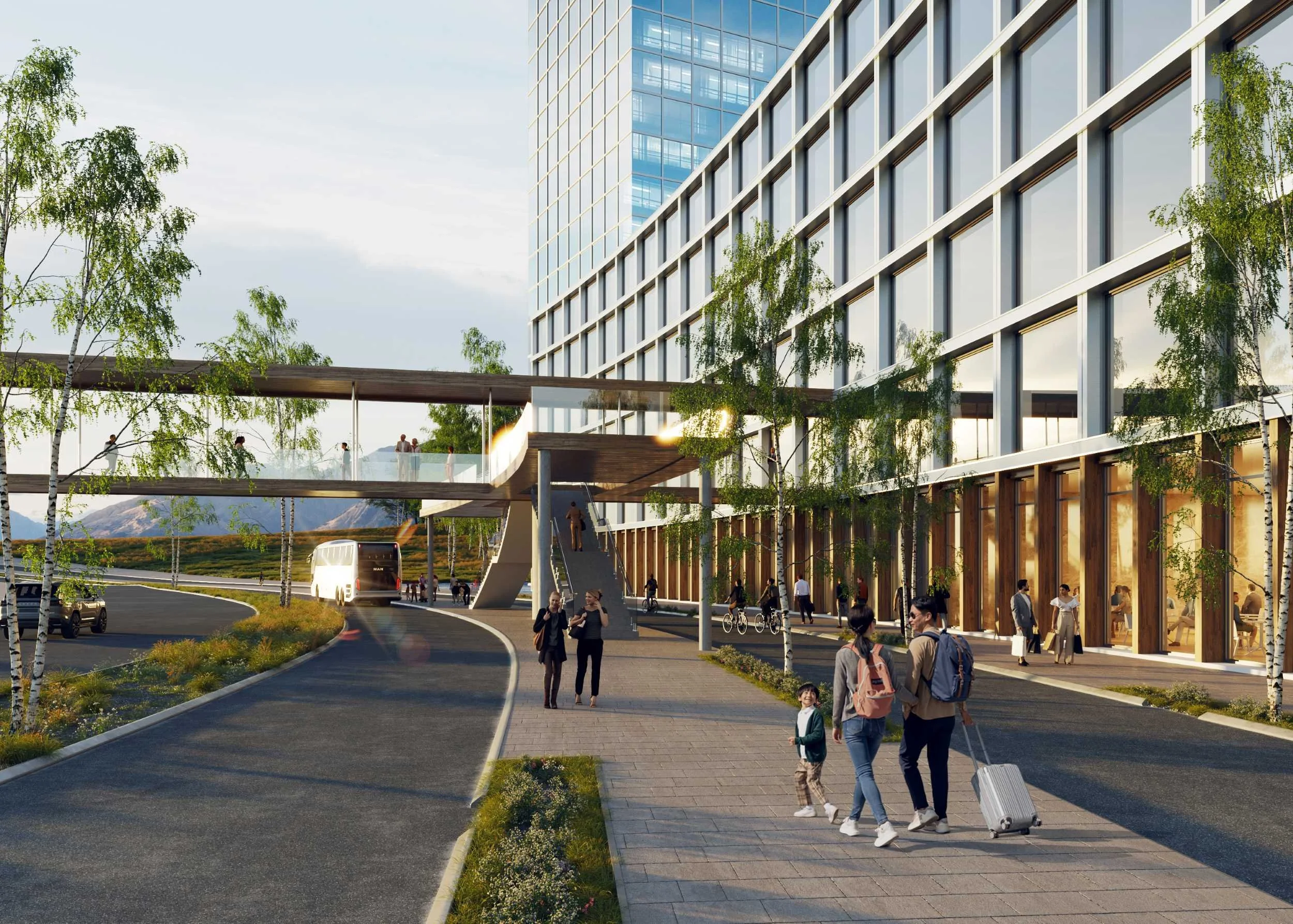
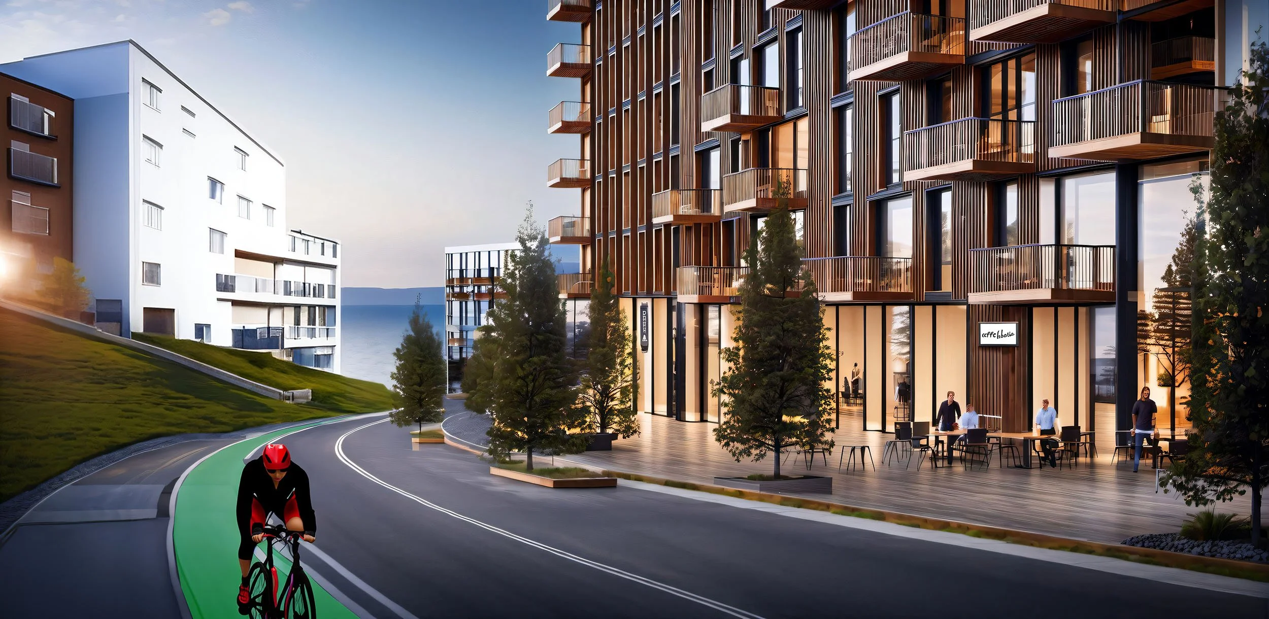
With increased density, JIM proposed several new transportation improvements, including a new express bus lane along the highway and a regional ferry. These public amenities reduce reliance on cars in the development and create a pedestrian-focused community.
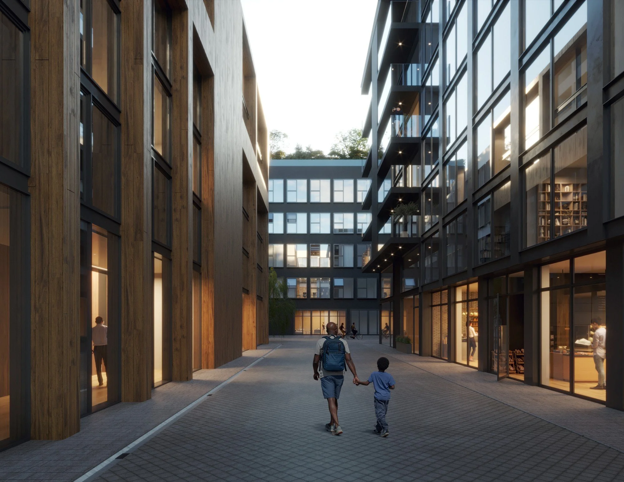
Intimate streets shape active public and private experiences
Betweenness
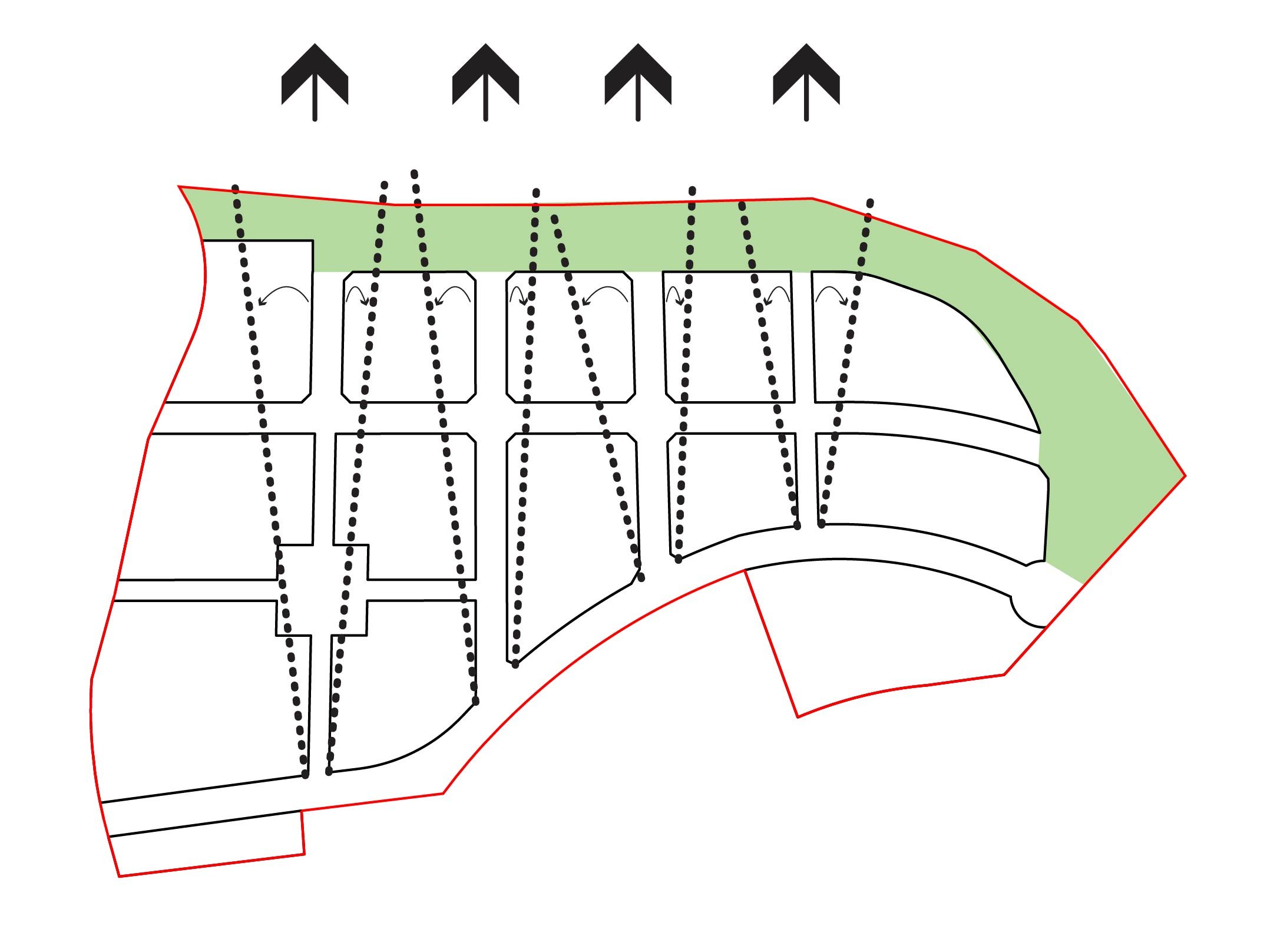
In a pedestrian-oriented, mixed-use neighbourhood, understanding how people move in a street network helps optimize retail positions. Betweenness examines the weighted values of destinations around the site and their impact on people’s movement. Placing retail along these movement paths allows them to reach a larger customer base. For The Bluffs, these patterns will shift as the development transitions from a vehicular-dependent to a transit-oriented site and as amenities are added.
With Phase 1 the initial retail offerings along Old Ferry Wharf Road will serve people as the move to and from the lakeshore and the adjacent developments.
As part of Phase 3 a new transit center, plus new destinations atop the Bluff embankment, will shift pedestrian flows through the development.
Attention will focus on building the primary retail components around these lines of pedestrian movement
Potential development of the foreshore’s non-Community Lands for visitors will add an additional destination to draw visitors and residents alike.
Success entices new retail opportunities as ground floor residential units are intended to be flexible and support growth.
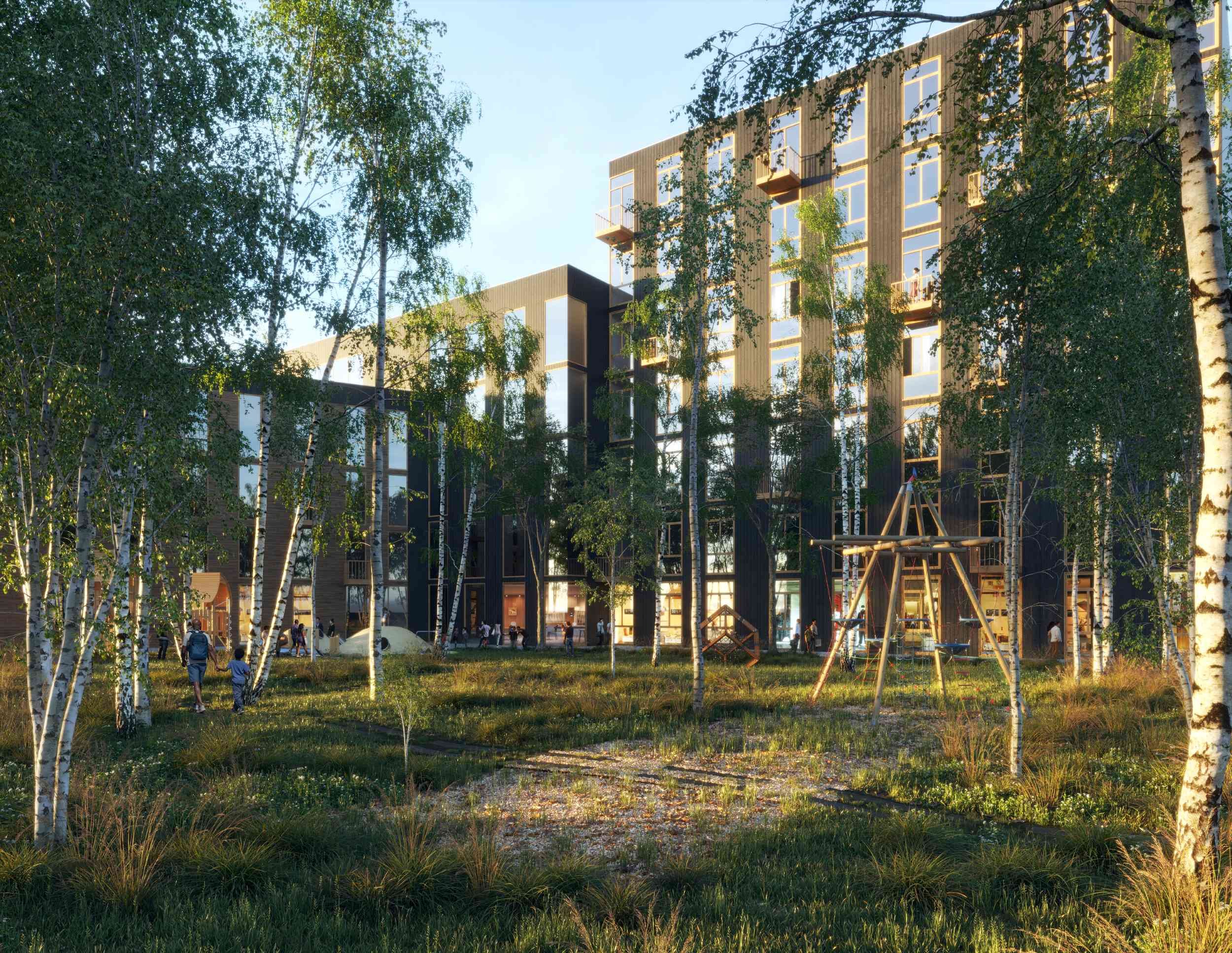
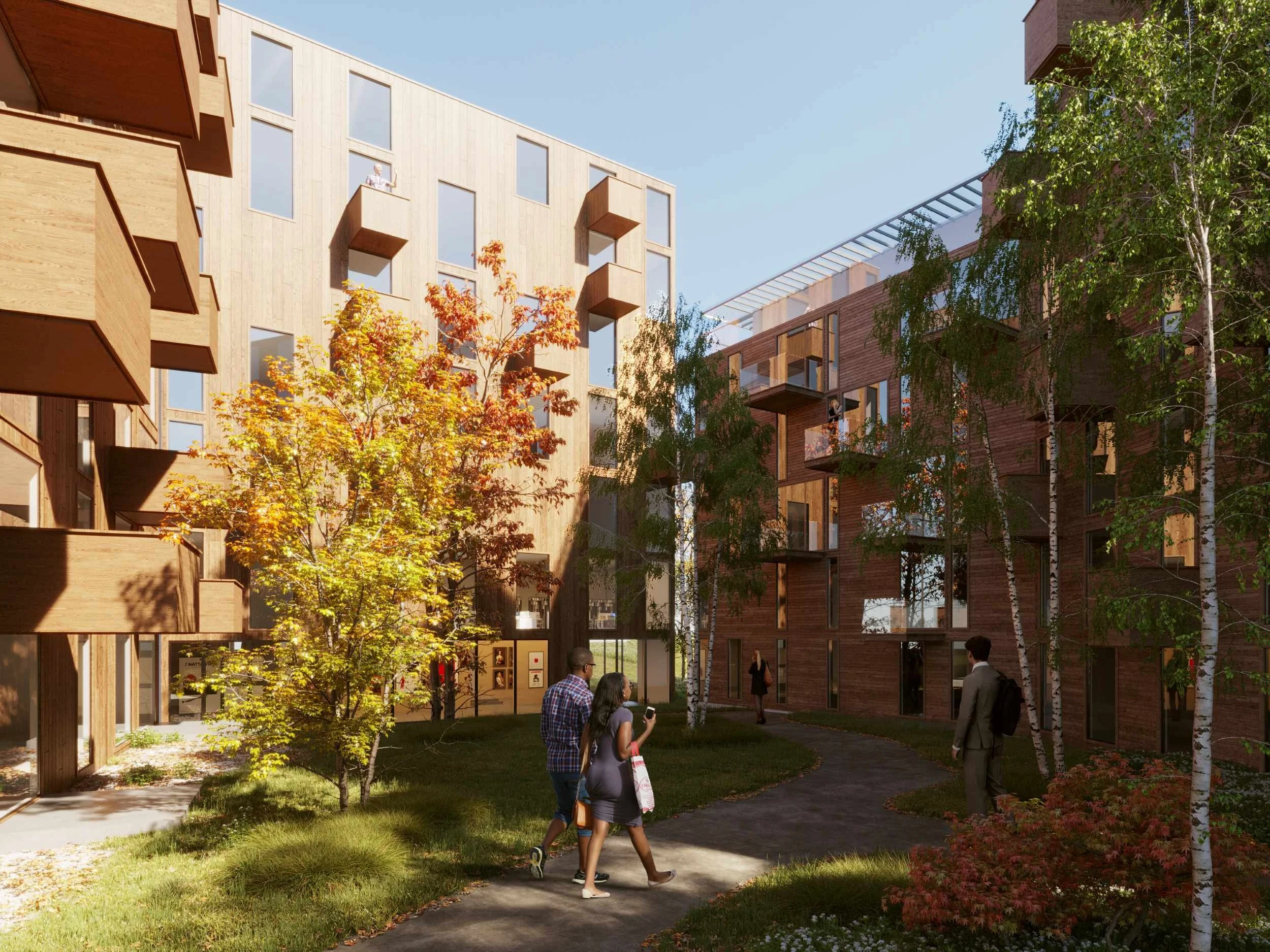
Courtyards offer pockets of wild Okanagan landscapes in managed settings at the Bluffs Neighbourhood.
Restoring Wetlands
JIM initially provided consultation to integrate a more sustainable approach into a prior development plan. As the project developed, JIM expanded the scope to address a need for more public park space around the site and the inconsistent relationships between the separate developments in the area. The proposed lakeside park would restore the natural wetlands around the lake, 85% of which have been lost in the Okanagan Valley. JIM also designed proposals for rapid public transportation connections and began investigations for district energy opportunities.
Related Workings
-
JIM
James Huemoeller
-
Landscape Design
OTHER LANDS STUDIO
-
Engagement, Planning and Civil Engineer
Aplin Martin
-
Geotechnical
Interior Testing Services Lts
-
Environmental
Ecospace Environmental Consultants Ltd.
-
Transportation
HDR
-
Archaeologist
Ursus Heritage Consulting
-
Surveyor
Ferguson Land Surveying & Geomatics Ltd.