
A Field Guide for the District of Stewart
The Prompt
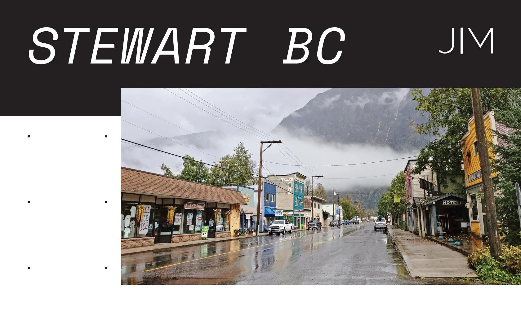
On January 23, 2018 at 12:31 a.m. local time a magnitude 7.9 earthquake rocked Alaskans, with an epicentre in the Gulf of Alaska about 175 miles southeast of Kodiak Island. The quake sent Tsunami warnings across the Pacific and many communities within British Columbia were under mandatory evacuation including the town of Stewart. For most towns that meant going to higher ground, hopefully at an emergency reception centre, but Stewart it presents a unique dilemma. The only access to, and from, the town is on Highway 37a through a long canyon with heavy avalanche activity. In the middle of the winter, therefore, the District’s choice was between staying put in a town well below the surge elevation or driving north to an avalanche zone during a period of earthquake activity. For most people this would be a problem, for the residents of Stewart, it is a way of life. In Stewart, everything is shifting.
Take the sociodemographic situation. Stewart, once a booming mining town of 10,000 people, today, according to the census, it scraps by with 400 residents. However, the picture is more complicated. In its 120-day tourism season, one of two remaining viable industries, the town averages 40,000 visitors a year, over 300 people per day. Throw into the mix another 200-300 people for mining exploration, a few snowbirds, and you have an undocumented “shadow population” of 800 part-time occupants for four months a year. 800 people using toilets, electricity, and roads. 800 people eating and sleeping. 800 people whom the Province fails to count when providing funding for emergency planning, infrastructure, and recreation facilities. On top of that at the moment the district council is hearing three different proposals for major projects including an LNG terminal at the port, a biomass plant, and a potential terminus of the BC pipeline to the adjacent town of Hyder, Alaska all of which would at least double the population of the small town.
In short, Stewart is a town built for 10,000 people, with only 400 permanent residence, next to an ever-shifting river, in a tsunami corridor under mountains of sliding snow, on a seismic fault with high volcanic activity…and their biggest municipal investment in the last 30 years has been a new bar in the ice rink. Bottoms up. (from introduction to Fall 2019 UBC Design Studio)
The Background
The objective of this project is to develop a coherent methodology for designing in our rural communities with a focus on resource-dependent settlements (as opposed to manufacturing, university or other non-commodity single industry towns). In developing that methodology, the work also seeks to build on an extensive body of research on the current state of our rural communities as well as contemporary design thinking to reinvigorate our approach to rural design. In particular the project engages scholarship that concentrates on the impact of both social-economic and environmental volatility on these communities, which most characterizes the state of our present rural landscape.
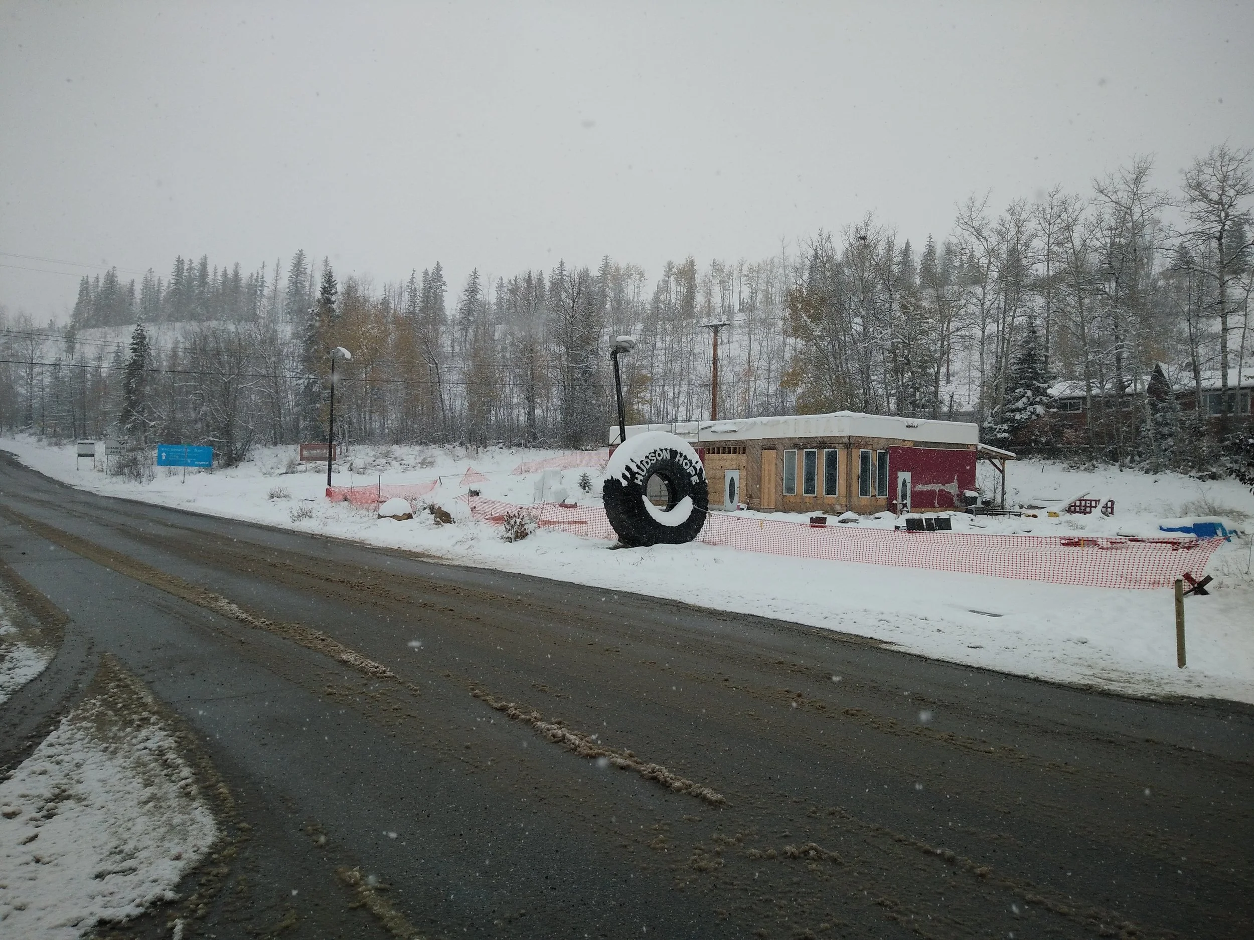
This project developed from two graduate research design studios at the University of British Columbia’s School of Architecture and Landscape Architecture as well as work performed by JIM for several rural communities throughout BC. The first studio, conducted in 2016, looked at designing in resource-dependent rural communities in BC and the impact of volatile commodity markets on the built environment. The class used Hudsons Hope in the Peace Valley, and the growing oil industry in the area as the case study. The town also lies along a portion of the Peace River that was flooded just two years later as part of the Site C dam construction. The studio served as the first attempt to develop a more productive theory on how to operate as designers within rural contexts within our currently global society. Extensive research into the current scholarship on the built environment in these communities informed the structure and content of the studio, a summary of which follows.
Much of the research relied on related fields such as rural sociology and cultural geography that have long investigated many of the issue’s rural communities face in our globalized world. Work in these disciplines specific to resource-dependent communities originated in the 1970’s after major booms throughout North America challenged many existing local communities to manage the intensive growth (Kassover and McKeown, 1978). Unlike the rushes of the turn of the century, most booms today occur in existing communities, often ones previously dependent on a different industry entirely. Particularly important was the work of William Fruedenburg who published a series of articles looking at different aspects of social conditions in resource dependent communities (Gramling and Fruendenberg, 1990; Fruedenburg, 1991; Fruedenberg 1992; Gramling, Frickel and Frudenberg, 1995; Krannich, 2012). More recent scholars are building on that early work looking at the impacts of shale gas development in the US (Besser et al, 2008; Jacquet, 2009; Weber, Geigle, and Barkdull, 2014; Stedman et al, 2012, Anderson, 2014). William Carahar, an archaeologist, brought together a team of scholars, artists, and writers to document the informal built environment that developed with the Baaken Oil Boom and later bust on the late 00’s and early 10’s (Weber, 2014; Caraher and Conway, 2016; Caraher and Weber, 2017). These works provide a useful glimpse into the spatial environment that develops from the fly in fly out (or drive in drive out) culture of today’s resource-dependent communities.
Canadian specific research on in the impact of resource dependency is perhaps even more extensive, again starting in the 1970’s (Lucas, 1971; Bradbury, 1979; Kassover, 1981; Besser, 2008) with much of the literature focusing on Alberta and Ft. McMurray further amplified by the devastating fires two years ago (Power et al, 1980; Shields, 2012; Keough, 2015; Beckley, 2017)). Scholars are also now looking more closely at the impacts on specific demographic groups giving greater depth to our understanding of the effect of volatility on rural communities (England and Albrecht, 1984; Stedman et al., 2004; Nelson et. Al, 2010; Stedman et al., 2012; Taylor and Carson, 2013; O’Conner, 2015). Studies include looking at the role of gender in these communities or the impact on First Nations. Taken as a whole this research gave an overview of life in towns with a resource-dependency.
Design specific research on rural communities alone is far more limited. Several journals have recent special issues on rural topics that either examine narrow subjects such as farming (White and Przybylski, 2010), or concentrate on the rural through the lens of urbanization (Upmeyer, 2012; Bolchover et al., 2016). While the importance of urbanization is unquestionable in the 21st century, reducing rural issues solely to an issue of hinterland fails to answer a question which has been brought to the fore with our current political situation, what is the future of our rural communities in an increasing globalized world? Furthermore, there is a certain conceit to assume those most detached from the landscape on which they depend for their lifestyle can meet the challenge of understanding how to best manage those landscape for our future (Brenner, 2014; Schumacher, 2016). Reducing the problems of the rural to an engineering problem as Schumacher argues ignores the value of these landscapes as venues for living cultures.
A hinterland centric thinking about the rural is largely in debt to the seminal work of William Cronon (Cronon, 1991), and later more specifically in relation to design, with the work of the landscape architect, James Corner (Corner et al., 2000). Corner’s collaboration in particular with the photographer Alex Mclean and his aerial photographs of the globalized American Landscape at the end of the 20th century has proved to be hugely influential. Since that publication a proliferation of books have been published mapping and documenting the same industrial-age rural (and formerly rural) landscapes (Mathur and Cunha, 2001; Mathur and Cunha, 2006; Bhatia and Casper, 2013; Ibanez et al., 2017; Robinson; 2018). These publications illustrate the impact of our industrialized society on our greater landscape and expanded our understanding of our rural landscapes, however, with a few exceptions (Wolfe, 2003; Sheppard and White, 2017) they rarely explore the social impact of the dynamics they document on the rural communities that live and work in these landscapes.
Attempting to move beyond scholarship framing the study of rural communities relative to urbanization leaves even fewer work available and largely with a New-Urbanist focus on methods for preservation and/or conservation of rural communities and their landscapes (Ardent, 1994; Daniels et al., 2007, Thorbeck, 2012). This thinking sets up a binary relationship within the design focused scholarship with one side that seeks to preserve a trademarked way of life, against another with an understanding of rural as exclusively contingent on urbanization, globalization and other contemporary undercurrents. These two means for viewing the rural condition are captured by their use of scale to highlight their primary spatial views. In the former, much of the conversation on building within rural communities comes down to an identification of the proper scale of any future project, usually a village. In the latter the ideas are embodied by aerial images ala Mclean, depicting the vast impact of contemporary society, exemplified by large mines that make toys of two-storey dump trucks. Two exceptions to the previous examples are focused on European contexts that differ considerably with North American (Cattaneo, 2014; Carlow, 2016). Therefore still today the most useful guide to thinking about operating in the built environment of North American rural communities is still the work of J.B Jackson (Jackson, 1986) who provides a pertinent outline of the systems shaping rural communities, and embraces rural features distinctive to the 20th century such as the mobile home. A way of conceptualizing the rural embedded in its contemporary reality.
Building on that scholarship, the studio conducted field research around the Peace Valley, visiting several communities and industrial facilities and holding meetings with local government officials and industry (led by the BC Oil and Gas Commission). The studio overlaid the field research with a review of the various systems (energy, environmental) in the Peace Valley that would impact Hudson’s Hope. Students then developed variety of design proposals for the community of 1000 with a focus on ideas that instilled the communities with greater resiliency. Projects ranged from housing for seniors, to industrial parks, to proposals for building better infrastructure networks branching out from the oil pads and dams in the area, all chiefly derived from issues mentioned by the Hudson’s Hope administration.
Overall the studio was successful in engaging the dynamics, however it was clear at the end that the projects were more reactive, rather the proactive, a problem recognized by JIM in their public projects for similar communities. Although meeting with the local administration provided valuable insight into the communities, it is also clear that the lack of planning expertise within the government means that they rarely engage issues outside their immediate vista such as climate change. Nor do they have the expertise available to develop innovative projects the challenge the status quo. Instead they turn to traditional approaches to expediently address their pressing tasks while limiting consulting fees. Will housing for seniors, better industrial parks, and more environmentally friendly pipelines and transmission lines truly provide a path towards a new rural future or merely bandaide a 20th century version? The studio infused these projects with greater resiliency by overlaying additional programming, improving adaptability and taking a more holistic approach, but we also began to understand the questions we were asking needed to go deeper.
This is a similar issue to what was seen by JIM in practice. By the time designers are brought into a project much of the scope is defined, using conventional terms usually no different that which we see in urban or suburban contexts. A project in Wamsutter, Wyoming serves as an example. There the oil town saw a boom in the early 2000’s and sought to improve their small community. Given most communities of that size typically only see a couple projects a decade, it was critical that the project maximized the influx of resources as much a possible. Instead the town installed a blocks length of sidewalk complete with curb and gutter and an accessible ramp from the street. While in most contexts this would be completely ordinary, in Wamsutter the project stands out surrounded by rutted out dirt roads with no visible stormwater system to connect to the newly installed gutter. Certainly, a good designer will challenge these norms, but often the problem is not that the project scope should be tweaked, but that the project should never happen in the first place.
It was clear that the next studio needed to develop a tool that provided a more useful starting point for project planning with a deeper understanding of the specific dynamics of the community and without a preconceived idea of outcome. Therefore, the second studio began with a research report structure employed by JIM Architecture for public projects. For the firm the report structure, adopted from the architecture firm KieranTimberlake and their research group (Riz, 2015), serves as a checklist for research questions that connect the given project to its larger context. The firm begins each project by investigating relevant issues to the project in question with the goal of understanding the intersection of the project with the different social and environmental dynamics at play in the larger site. The report is broken down into six topics that combines site specific research with precedent studies. This research allows the firm to identify opportunities for the project that lie outside the given scope. For example, research in one community’s water system highlighted that community’s susceptibility to power loss and in tern pump failure leaving the town without water. By incorporating water storage, the proposed building could provide additional resiliency for the community without needing to construct an additional reservoir as was being demanded by the local Regional District.
Whereas the previous studio used research into the various systems as a compliment to other research, in the second studio, that research needed to be that starting point for generating projects. With support from the Centre for Community Engaged Learning (CCEL) and Irving K Barber Learning Centre (IKBLC) and their BC Rural Grant program the second studio used Stewart, BC at the case study, a community where JIM Architecture has completed several feasibly studies and therefore could provide an extensive body of research to serve as the foundation. Additionally, a landscape architect with experience in mining geology, Beryl Allen, was brought on to co-teach the studio along with several specialists in areas of research specific to Stewart help the students translate their research in the operative ideas for the community including a glaciologist Gary Clark, professor emeritus at UBC, hydrologist Steven Weijs, professor at UBC, and Matthew Ramsay a restoration ecologist from Stantec to name a few. Lastly the field research included valuable meetings with various community members rather than just administrators or industry representatives to enlarge the reach of input. Later the mayor was brought to Vancouver mid-semester, after the design projects were initiated, to respond to the students work.
For Stewart the available sources for data extended back over 100 years. The vast majority of the documentation centred around the mining industry (Carmichael, 1906; Carmichael, 1909; Buddington, 1929; Grove, n.d.; Grove, 1985; Alldrick, 1993; Rescan, 2010; Canadian Environmental Assessment Agency, 2015). As mining waned in the middle of the century, government organizations began to look at other economic opportunities to diversify the economy (Sverre, 1986; Anon, 2000). In the middle of the century there were several studies commissioned to develop infrastructure to better manage the volatile environmental context include avalanche and flooding risks (Williams, 1995b). More recently those environmental studies have expanded to look at the risks to local flora and fauna due to that same infrastructure (Cleugh, 1979; Williams, 1995; Williams and Langer, 2002; Dessouki, 2009). In total there are upwards of twenty different reports for the District of Stewart and its surrounding area that provide extensive information on the community and the context (Schaerer, 1994; Dunbar et al.; 1998; Evan and Clague, 1999; Fredrickson, 2001; Septer, 2006; Osborn and Spooner, 2013). Other data sources included climate data from Environmental Canada, well and flow data from the province, and similar government sources. Most climate change data was derived from NGO’s and other organizations developing tools for designers and other researchers such as the IDF_CC Tool 4.0 (Intensity-Duration-Frequency (IDF) or rainfall events). The research report simply brings those studies together into one document.
The second meeting with the mayor proved useful in validating our approach as the mayor, whose initial ambition for the studio focused on designing recreation opportunities for the town, recognized the potential in beginning with a holistic study of the town rather then with a specific program. If the first studio developed a series of projects that directly engaged ideas of adaptability, the outcome of the second studio better embedded those ideas into the specifics of the local context. Returning to the need for recreational opportunities for Stewart as expressed by the mayor, the first studio would have looked at ways for cross programming a new recreation facility with a variety of other functions as, say, the commodity markets change. The second studio, however, began with a close reading of the existing context to build a project where the specific programs were secondary to exploiting existing assets even as those assets may transform as a result of global issues such as changes in the commodity markets or climate change. In other words, a project may begin with a question of how to better capitalize on Stewart’s waterfront, or mining industry, always considering that the complexion of those assets will change in the future. Identifying those opportunities for the town could only be realized through a deeper understand of the community thought a focused research process.
The further development of the Research Report for the town of Stewart building on the work completed by the second studio is therefore the focus of this project. While the work in the studio assembled a useful draft there is still considerable refinements needed for the content of the report, its communication of content, and in ensuring that the report adequality connects scholarship to practice methodology. For smaller communities with fewer resources, a guide is needed to help our rural communities generate innovative approaches that fully acknowledge the volatility rural communities face in the 21st century. Our hope is to provide the template for such a resource.
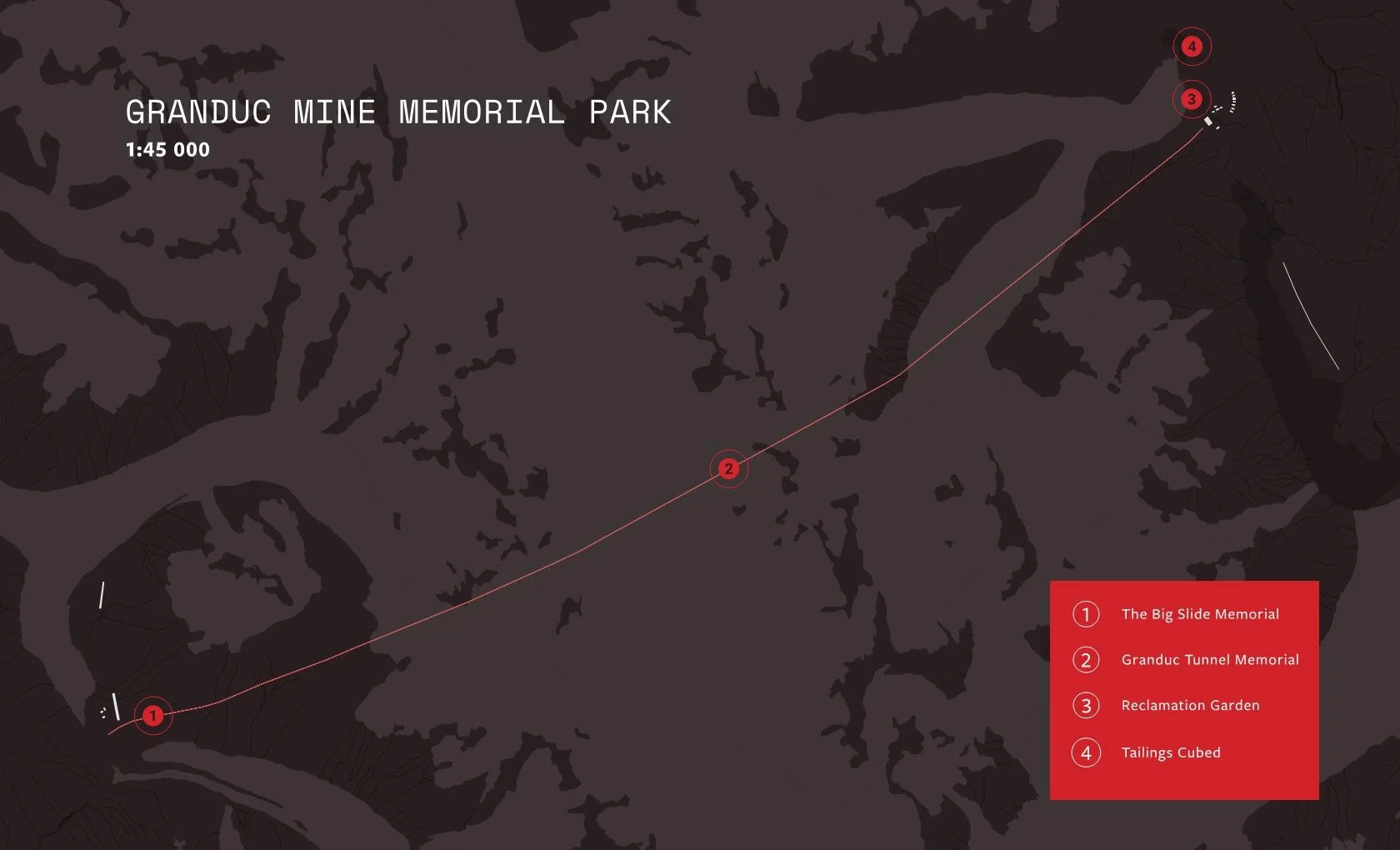
UBC SALA Open Studio - Stewart - Fall 2019
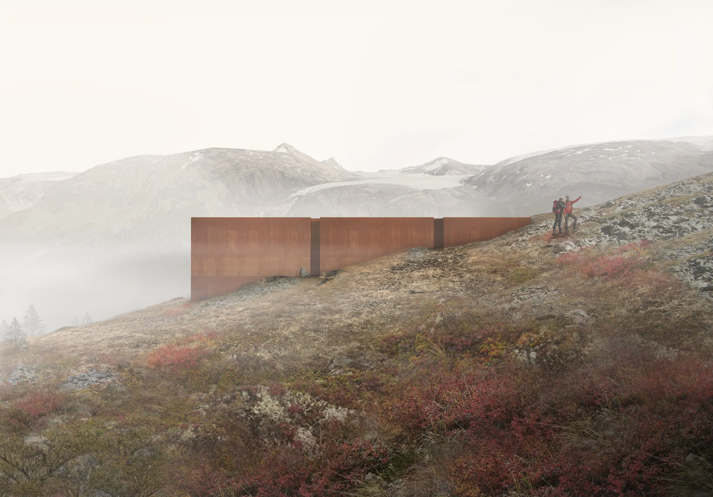

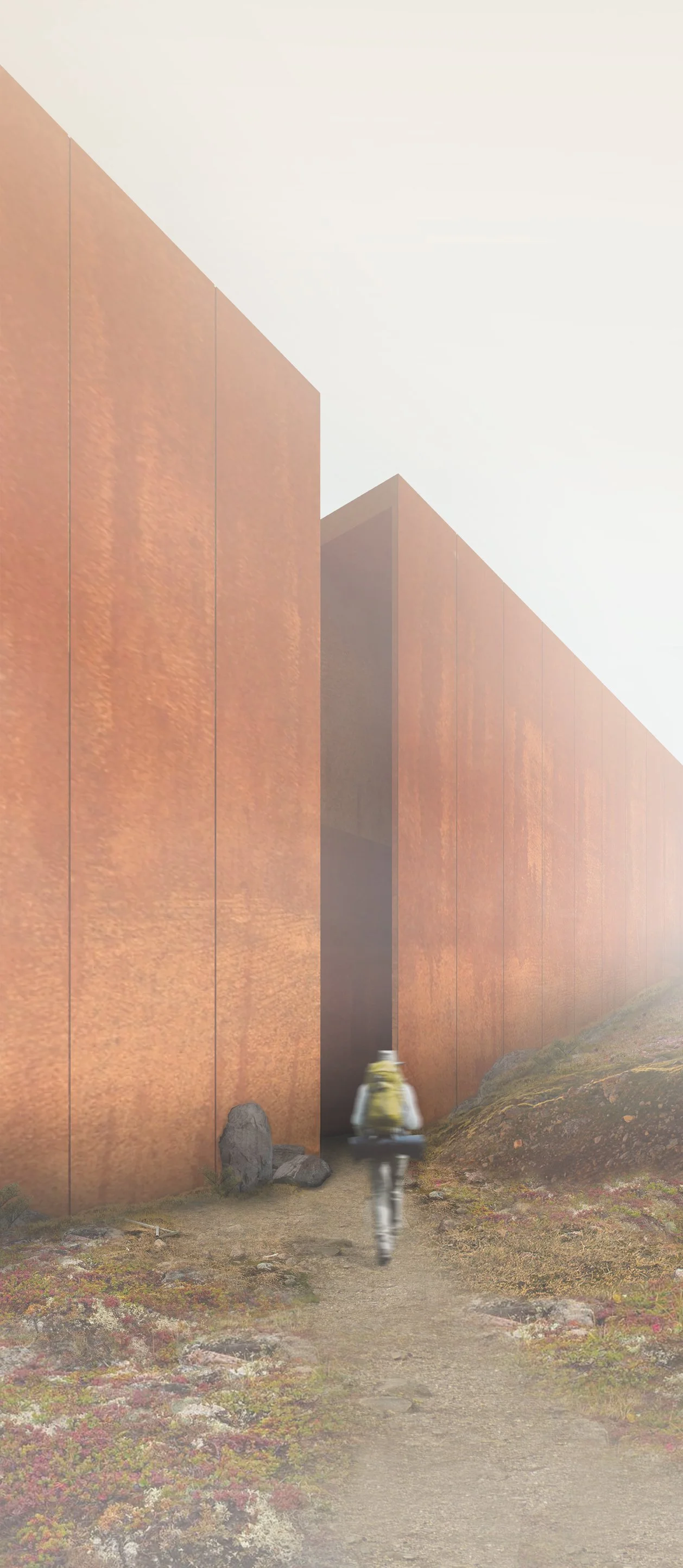
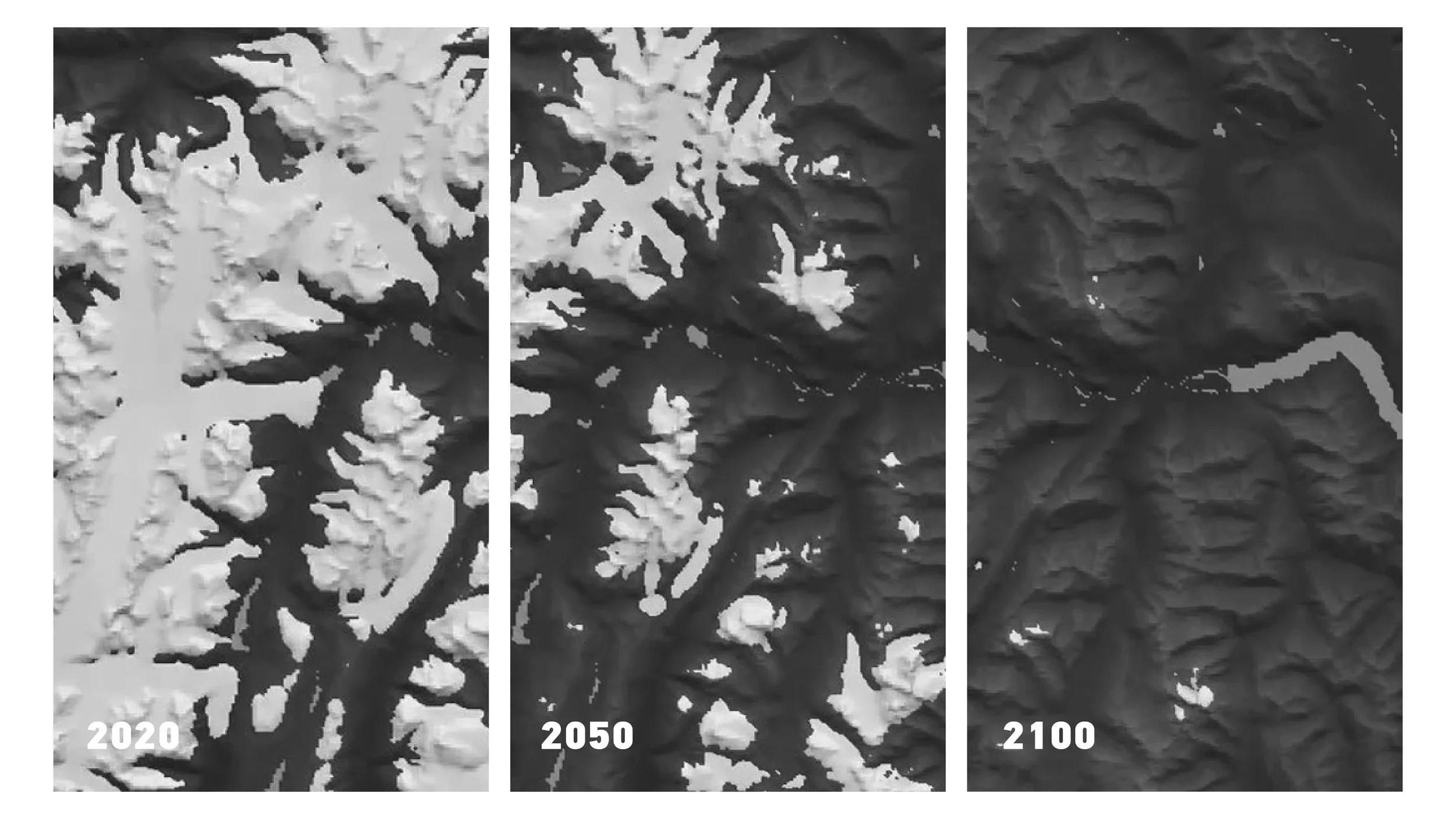
Josh Hall | Institute for Glacial Study | In 100 years the enormous glacial fields surrounding the town will be gone. This project creates a research lab and tourist hut that allows observation of the receding ice and connects people directly to the effects of climate change
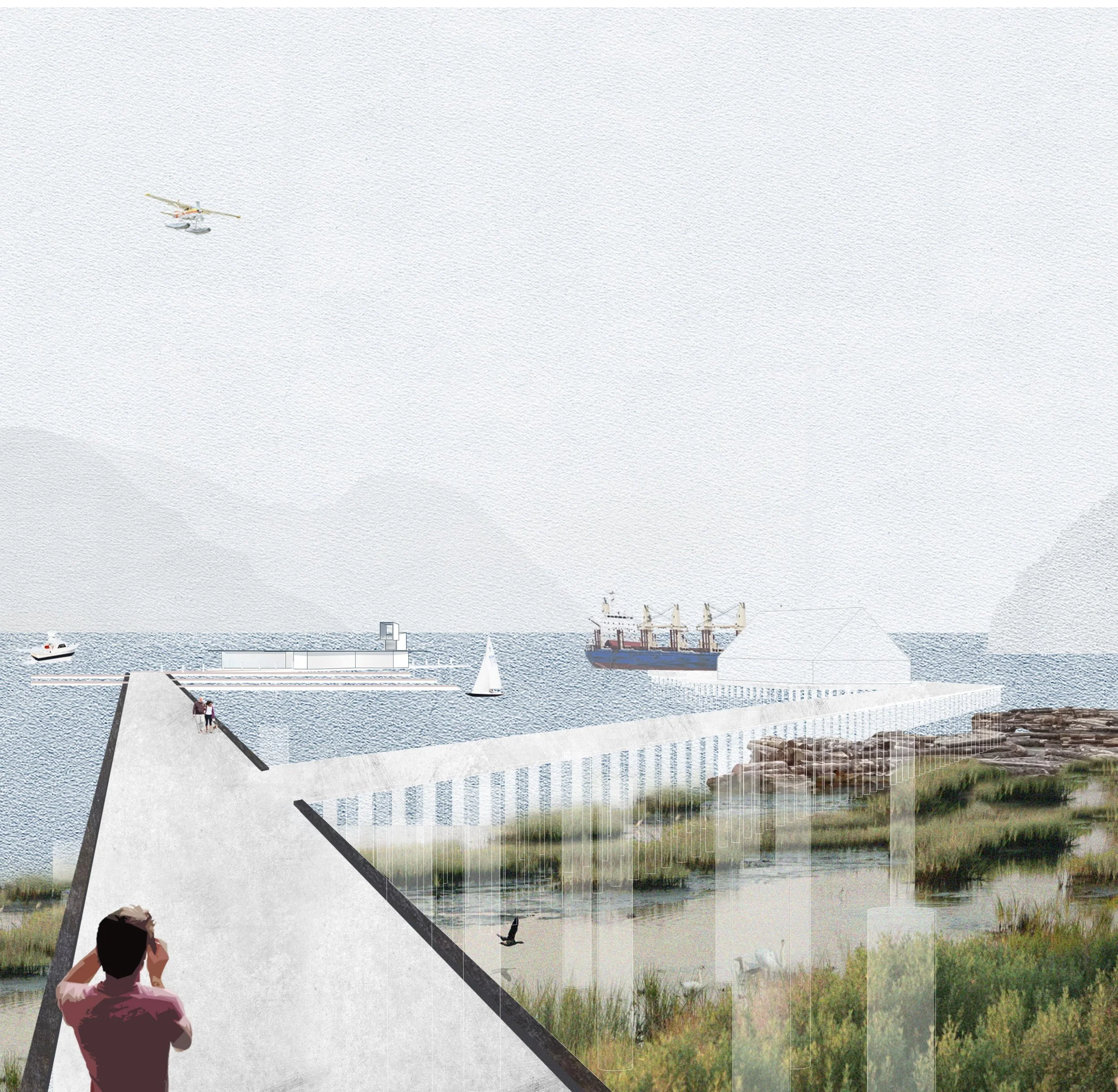
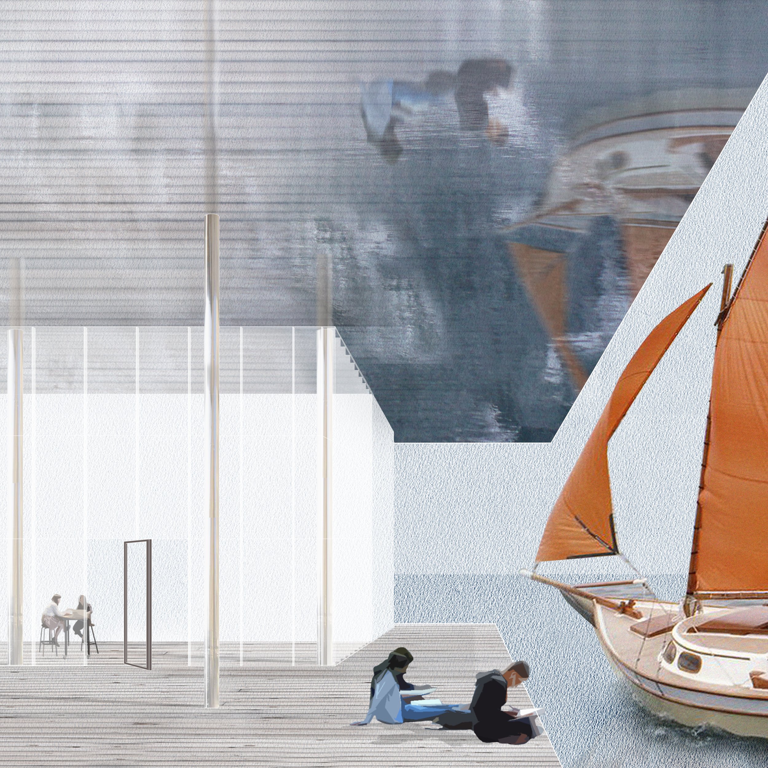
Amanda Nalli | A Dynamic Waterfront | Project weaves together industry, recreation, and ecology to revitalize the waterfront of Stewart by reconstructing the existing port.
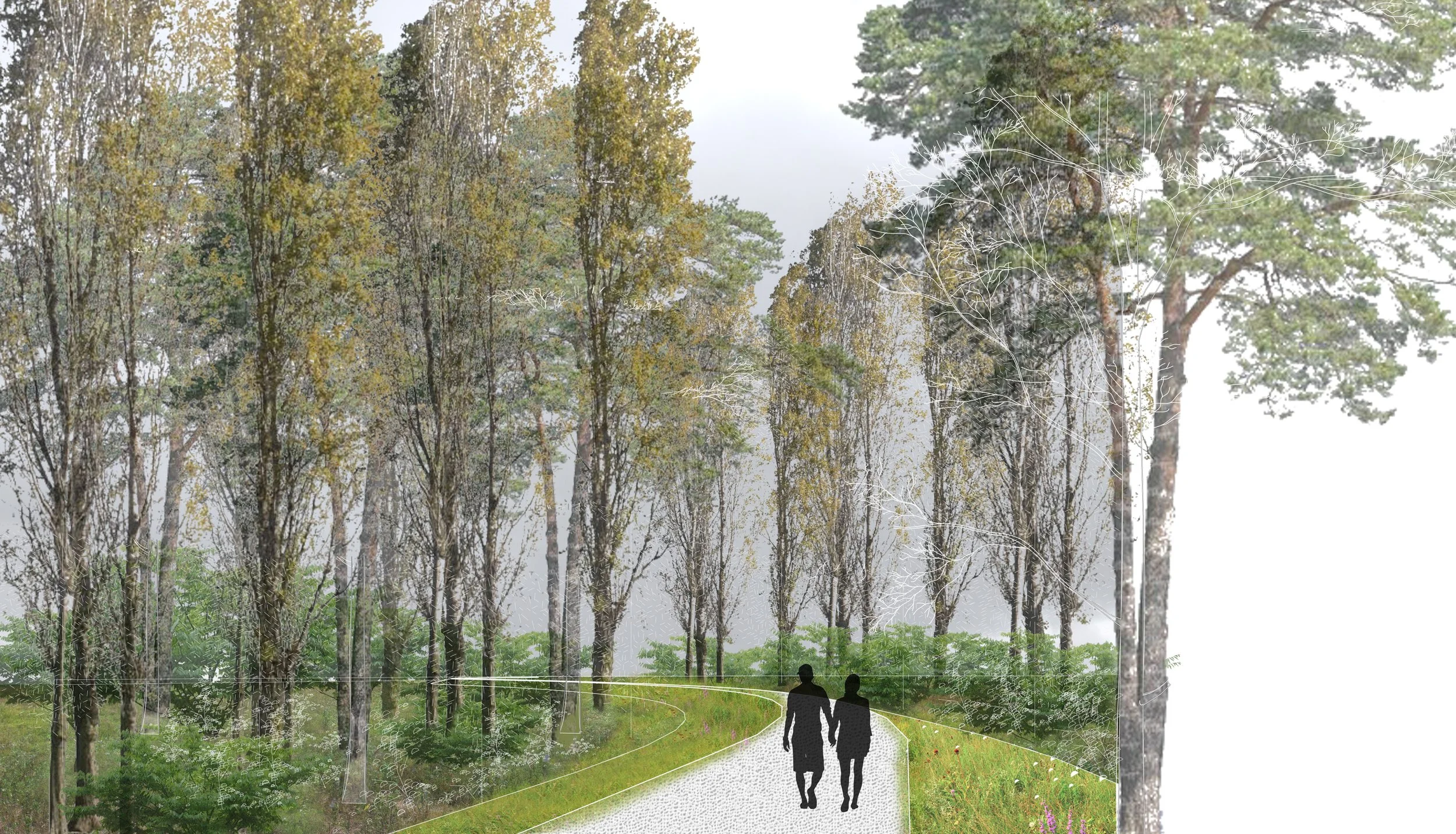
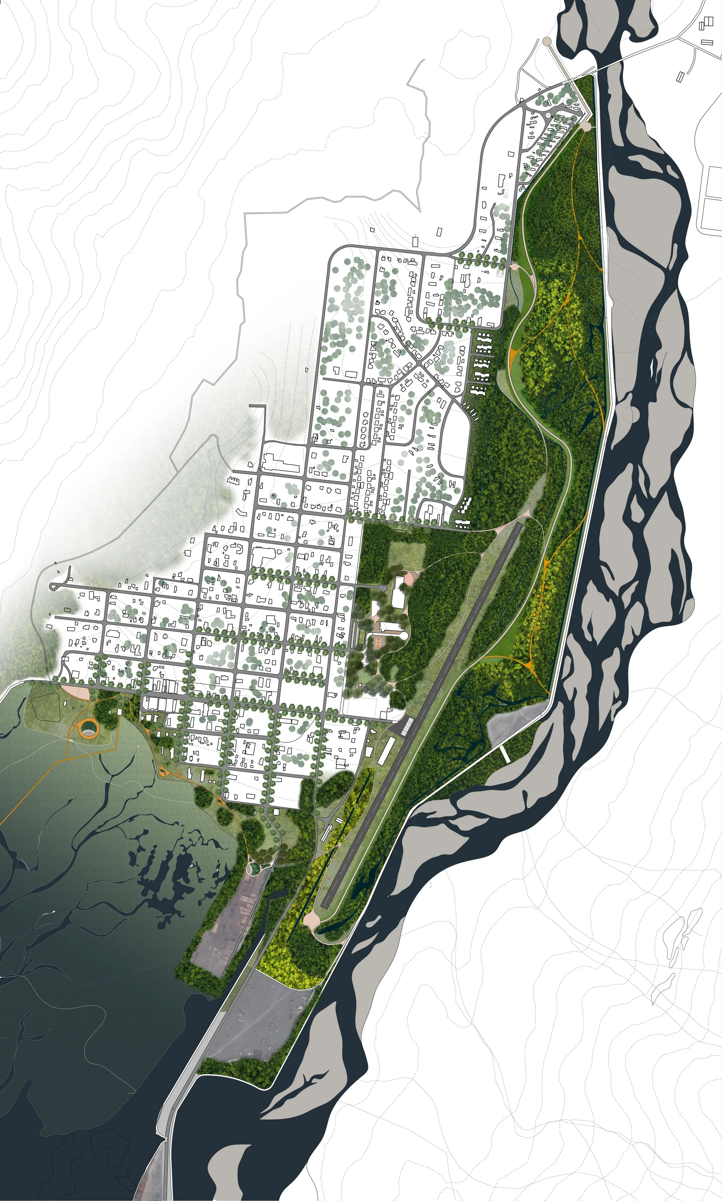
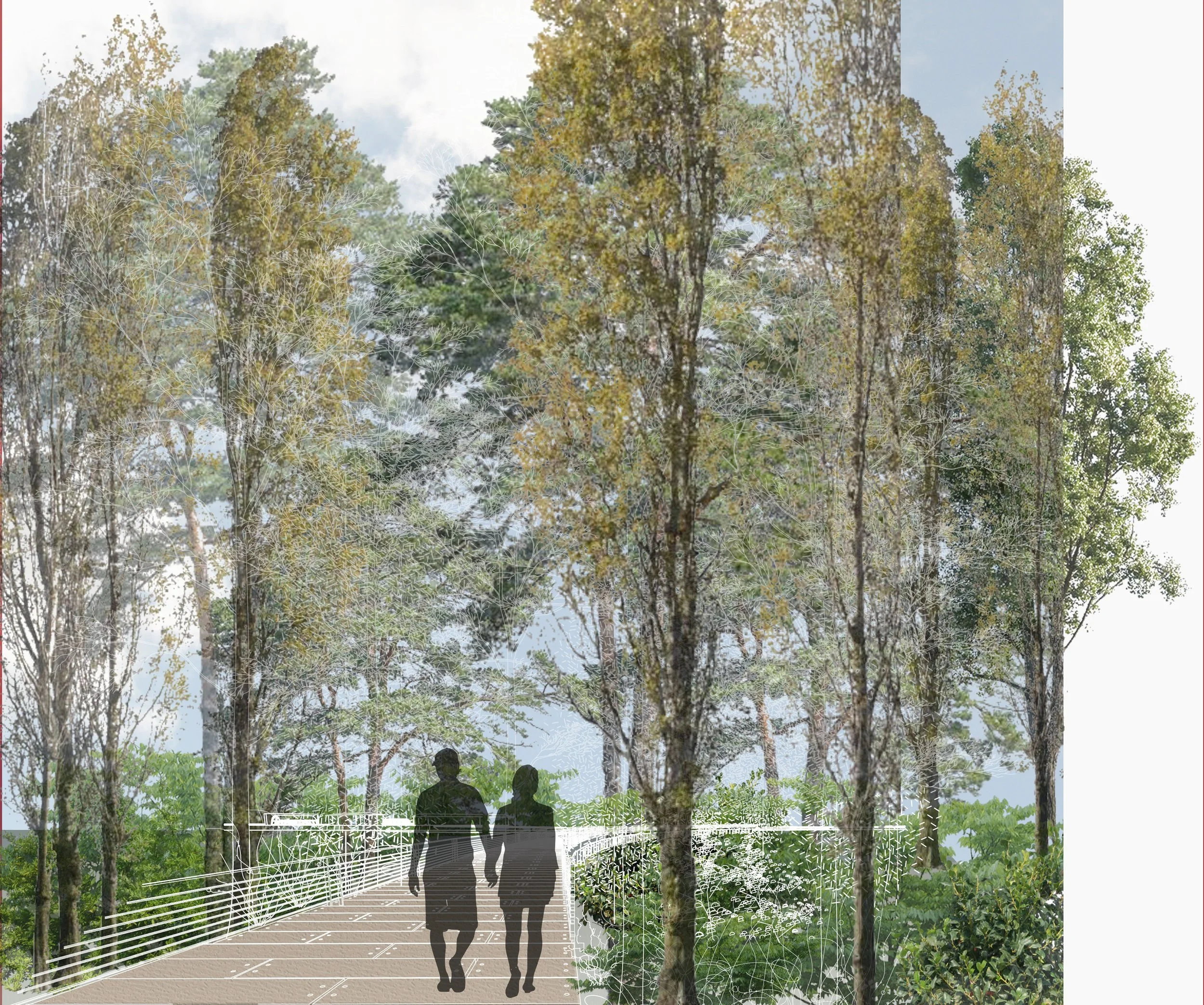
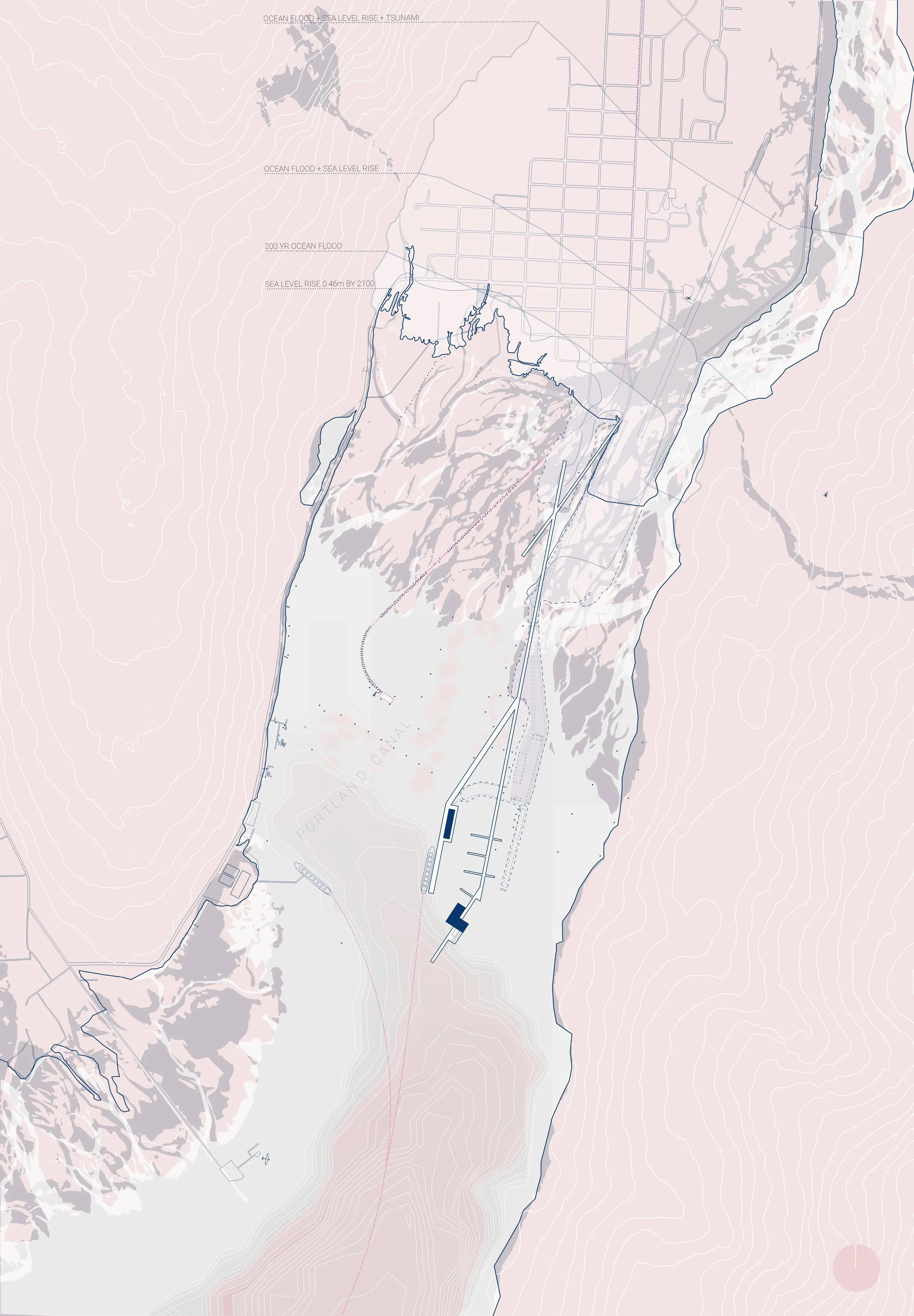
Grace Morazzani Diaz | The Shifting River | The existing dike for the river is undersized for the intensifying flooding occurring due to climate change. This proposal provides more room for the river while also giving the community & visitors recreation space.
Bibliography
Alldrick, Dani J. “Geology and Metallogeny of the Stewart Mining Camp, Northwestern British Columbia.” Bulletin. Geological Services Branch, March 1993.
Anderson, Peggy A. “Preserving Place: Williston, ND and the Use of the Community Capitals Framework for Boomtown Community Development.” Housing and Society 41, no. 2 (January 2014): 297–314.
Anon. “An Archaeology Overview of the North Coast Timber Supply Area.” Prince Rupert, BC: Prepared by Golder Associated Ltd. for teh Ministry of Forests, April 13, 2000.
Anon. District of Stewart Official Community Plan Bylaw 882, 2014, 882, 2014 Bylaw § (2014).
Anon. District of Stewart Zoning Bylaw 881, 2014, 881 Bylaw § (2014b).
Arendt, Randall, Elizabeth A. Brabec, Lincoln Institute of Land Policy, Environmental Law Foundation, and University of Massachusetts at Amherst Center for Rural Massachusetts. Rural by Design: Maintaining Small Town Character. Planners Press, American Planning Association, 1994.
Beckley, Thomas M. “Energy and the Rural Sociological Imagination.” Journal of Rural Social Sciences 32, no. 2 (2017): 29.
Besser, Terry L., Nicholas Recker, and Kerry Agnitsch. “The Impact of Economic Shocks on Quality of Life and Social Capital in Small Towns*.” Rural Sociology 73, no. 4 (2008): 580–604.
Bhatia, Neeraj, and Mary Casper, eds. The Petropolis of Tomorrow. English edition. New York, NY: Actar, 2013.
Bolchover, Joshua, John Lin, and Christiane Lange, eds. Designing the Rural: A Global Countryside in Flux. 1 edition. London: Academy Press, 2016.
Bradbury, John H. “Towards an Alternative Theory of Resource-Based Town Development in Canada.” Economic Geography 55, no. 2 (April 1979): 147.
Buddington, A.F. “Geology of Hyder and Vicinity, Southeastern Alaska, with a Reconnaissance of Chickamin River.” Bulletin. US Department of the Inteior, 1929.
Canadian Environmental Assessment Agency. Brucejack Gold Mine Project: Environmental Assessment Report., 2015.
Caraher, William, and Kyle Conway. The Bakken Goes Boom: Oil and the Changing Geographies of Western North Dakota. Grand Forks, North Dakota: Digital Press at The University of North Dakota, The, 2016.
Caraher, William R., and Bret A. Weber. The Bakken: An Archaeology of an Industrial Landscape. First Edition, Heritage Guide Series edition. Fargo, ND: North Dakota State University Press, 2017.
Carlow, Vanessa Miriam. Ruralism: The Future of Villages and Small Towns in an Urbanizing World. Jovis, 2016.
Carmichael, Herbert. “Mineral Locations, Portland Canal District, in the Skeena Mining Division.” Bulletin. British Columbia Bureau of Mines, 1906.
———. “Mineral Locations, Portland Canal District, in the Skeena Mining Division.” Bulletin. British Columbia Bureau of Mines, 1909.
Cattaneo, Tiziano De Lotto, Roberto. Rural-Urbanism-Architecture. Design Strategies for Small Towns Development. Firenze: Alinea Editrice, 2014.
Cleugh, T R. “Status of Environmental Knowledge of the Stewart Estuary.” Memorandum Report. Habitat Pretection Division Fisheries and Oceans, November 1979.
Corner, James, Alex S. MacLean, and Denis Cosgrove. Taking Measures Across the American Landscape. New Haven, Conn.: Yale University Press, 2000.
Cronon, William. Nature’s Metropolis: Chicago and the Great West. Reprint edition. W. W. Norton & Company, 2009.
Daniels, Thomas L., John W. Keller, Mark B. Lapping, Katherine Daniels, and James Segedy. Small Town Planning Handbook, 3rd Ed. 1 edition. Chicago, Ill: Routledge, 2007.
Dessouki, Tarik. “Water Quality Assessment of the Salmon River near Hyder, Alaska.” BC Ministry of Envrionment, March 2009.
Dunbar, Donald S., Paul H. LeBlond, and Donald O. Hodgins. “Evaluation of Tsunami Level Along the British Columiba Coast.” Sidney, BC: Department of Fisheries and Oceans Institute of Ocean Sciences, March 1998.
England, J. Lynn, and Stan L. Albrecht. “Boomtowns and Social Disruption.” Rural Sociology 49, no. 2 (1984): 230.
Evans, Stephen G, and John J Clague. “Rock Avalanches on Glaciers in the Coast and St. Elias Mountains, British Columbia,” Proceedings of the 13th Annual Geotechnical Society Symposium, January 1999, 10.
Fredrickson, Reg, and Jack Bennetto. “District of Stewart Mount Rainey Avalanche Program.” Snow Avalanche Programs; Avalanche Safety Recommendations. Ministry of Transportation, December 2001.
Freudenburg, William R. “Addictive Economies: Extractive Industries and Vulnerable Localities in a Changing World Economy.” Rural Sociology 57, no. 3 (1992): 305–332.
———. “Rural-Urban Differences in Environmental Concern: A Closer Look.” Sociological Inquiry 61, no. 2 (April 1, 1991): 167–98.
Freudenburg, William R., Scott Frickel, and Robert Gramling. “Beyond the Nature/Society Divide: Learning to Think about a Mountain.” In Sociological Forum, 10:361–392. Springer, 1995.
Gramling, Robert, and William R. Freudenburg. “A Closer Look at ‘Local Control’: Communities, Commodities, and the Collapse of the Coast.” Rural Sociology 55, no. 4 (December 1, 1990): 541–58.
Grove, Edward W. “Geology and Mineral Deposits of the Stewart Area Northwestern British Columbia.” Bulletin. Department of Mines and Petroleum Resources, n.d.
———. “Geology and Mineral Deposits of the Unuk River-Salmon River-Anyox Area.” Bulletin. Ministry of Energy, Mines and Pertoleum, December 1986.
Ibanez, Daniel, Clare Lyster, Charles Waldheim, and Mason White, eds. Third Coast Atlas: Prelude to a Plan. English edition. New York: Actar, 2017.
Jackson, John Brinckerhoff. Discovering the Vernacular Landscape. Revised ed. edition. New Haven: Yale University Press, 1986.
Jacquet, Jefrey. “Energy Boomtowns & Natural Gas: Implications for Marcellus Shale Local Governments & Rural Communities.” NERCRD Rural Development Paper. University Park, Pa: The Northeast Regional Center for Rural Development, January 2009.
Kassover, Jodi, and Robert McKeown. “Resource Development, Rural Communities and Rapid Growth: Managing Social Change in the Modern Boomtown.” Minerals and the Environment 3 (1981): 47–54.
Keough, Sara Beth. “Planning for Growth in a Natural Resource Boomtown: Challenges for Urban Planners in Fort McMurray, Alberta.” Urban Geography, June 5, 2015, 1–28.
Krannich, Richard S. “Social Change in Natural Resource-Based Rural Communities: The Evolution of Sociological Research and Knowledge as Influenced by William R. Freudenburg.” Journal of Environmental Studies and Sciences 2, no. 1 (March 2012): 18–27.
Lefebvre, Henri, David Harvey, Christian Schmid, and Matthew Gandy. Implosions/Explosions: Towards a Study of Planetary Urbanization. Edited by Neil Brenner. Berlin: Jovis, 2014.
Lucas, Rex A. Minetown, Milltown, Railtown: Life in Canadian Communities of Single Industry. University of Toronto Press, 1971.
Mathur, Anuradha, and Dilip da Cunha. Deccan Traverses: The Making of Bangalore’s Terrain. New Delhi: Rupa, 2006.
———. Mississippi Floods: Designing a Shifting Landscape. Yale University Press, 2001.
Misrach, Richard, and Kate Orff. Petrochemical America. Aperture, 2014.
Nelsen, Jacqueline L., Malcolm Scoble, and Aleck Ostry. “Sustainable Socio-Economic Development in Mining Communities: North-Central British Columbia Perspectives.” International Journal of Mining, Reclamation and Environment 24, no. 2 (June 2010): 163–79.
O’Connor, Christopher D. “Classed, Raced, and Gendered Biographies: Young People’s Understandings of Social Structures in a Boomtown.” Journal of Youth Studies 18, no. 7 (August 9, 2015): 867–83.
Osborn, G, R Haspel, and I Spooner. “Late-Holocene Fluctuations of the Bear River Glacier, Northern Coast Ranges of British Columbia, Canada.” The Holocene 23, no. 3 (March 2013): 330–38.
Power, G., W. Gillespie, D. Wittkowski, and R. Rink. “Computer Modelling of Boomtown Housing: The Fort McMurray Study.” Canadian Journal of Regional Science 3, no. 1 (1980): 29–48.
Rescan. “KSM Project 2009 Wildlife Characterization Baseline Report.” Vancouver, BC: Prepared by Rescan Envrionmental Services Lts for Seabridge Gold Ltd, August 2010.
Riz, David. “Form vs Function.” Presentation presented at the BEST4 Conference, Kansas City, Missouri, April 13, 2015. https://www.brikbase.org/content/form-follows-function-kierantimberlake-architects.
Robinson, Alexander. The Spoils of Dust: Reinventing the Lake That Made Los Angeles. ORO Editions, 2018.
Schaerer, Peter. “Snow Avalanche Hazard Lines District of Stewart.” BC Ministry of Transportation and Highways, November 1994.
Schumacher, Patrik. “Don’t Waste Your Time in the Countryside.” Architectural Design 86, no. 4 (2016): 128–33.
Septer, D. “Flooding and Landslide Events Northern British Columbia 1820-2006.” BC Ministry of Envrionment, 2006.
Sheppard, Lola, and Mason White, eds. Many Norths: Spacial Practice in a Polar Territory. English edition. New York: Actar, 2017.
Shields, Rob. “Feral Suburbs: Cultural Topologies of Social Reproduction, Fort McMurray, Canada.” International Journal of Cultural Studies, 2012.
Stedman, Richard C., Jeffrey B. Jacquet, Matthew R. Filteau, Fern K. Willits, Kathryn J. Brasier, and Diane K. McLaughlin. “Environmental Reviews and Case Studies: Marcellus Shale Gas Development and New Boomtown Research: Views of New York and Pennsylvania Residents.” Environmental Practice 14, no. 4 (December 2012): 382–93.
Stedman, Richard C., John R. Parkins, and Thomas M. Beckley. “Resource Dependence and Community Well-Being in Rural Canada*.” Rural Sociology 69, no. 2 (2004): 213–34.
Sullivan, Edward J., and Jennifer Bragar. “Recent Developments in Comprehensive Planning.” The Urban Lawyer 46, no. 3 (2014): 685–702.
Sverre, S.F. “Portland and Pearse Canal Aquaculture Study.” Victoria, BC: Prepared by Envrionmental Consultants LTD for the Ministries of Agriculture and Food, and Environment, August 6, 1986.
Taylor, Andrew J, and Dean B Carson. “It’s Raining Men in Darwin: Gendered Effects from the Construction of Major Oil and Gas Projects,” 2013, 19.
Thorbeck, Dewey. Rural Design: A New Design Discipline. 1 edition. Milton Park, Abingdon, Oxon ; New York: Routledge, 2012.
Upmeyer, Bernd. Non-Urbanism. Vol. 16. MONU: Magazine on Urbanism. Rotterdam, the Netherlands: BOARD Publishers, 2012.
Wallwork, R.J. “Bear River at Stewart Design Brief.” Floodplain Mapping Program. Prepared by Hay & Compnay Consultants Inc for the BC Ministry of Environment Water Management Branch, January 1993.
Weber, B. A., J. Geigle, and C. Barkdull. “Rural North Dakota’s Oil Boom and Its Impact on Social Services.” Social Work 59, no. 1 (January 1, 2014): 62–72.
White, Mason, and Maya Przybylski, eds. On Farming. Bracket. ACTAR Publishing, 2010.
Williams, G L. “Bear River Estuary Shoreline Habitat Classification Final Report.” Smithers: Prepared by G.L. Williams & Associates Ltd. for the District of Stewart and Department of Fisheries and Oceans, 1995.
———. “Port of Stewart Environmental Management Plan.” Smithers, BC: Prepared by G.L. Williams & Associates Ltd. for the District of Stewart and Department of Fisheries and Oceans, 1995b.
Williams, G L, and O E Langer. “Review of Estuary Management Plans in British Columbia.” Fisheries and Oceans Canada, 2002.
Wolff, Jane. Delta Primer: A Field Guide to the California Delta. William Stout Publishers, 2003.